Intense pre Monsoon rains in Dehradun, Nainital, Manali, Mukhteshwar today

March 21, 2018 4:01 PM|

Three digit rain of 150 mm lashes Dehradun, more showers expected

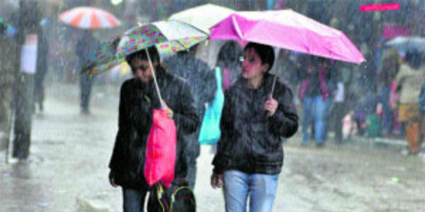
Pre Monsoon showers have tightened a grip over the hilly states of North. On and off rain and snow activities were witnessed over Jammu and Kashmir, Himachal Pradesh and Uttarakhand. In fact, due to the prevalent Western Disturbances over Jammu and Kashmir rain and snowfall activity is being recorded.

[yuzo_related]

During last 24 hours, fairly widespread rains were reported in Gulmarg, Banihal, Qazigund, Dharamsala, Manali, and Dehradun.

As per weathermen, the Western Disturbances over Jammu and Kashmir is gradually moving along the foothills of Himalayas. Therefore, light to moderate rain with isolated heavy showers and thundershower activity will continue over all the three hilly states during the next 24 hours. However, the intensity of showers would reduce over Jammu and Kashmir.

Click the image below to see the live lightning and thunderstorm across the Western HimalayasHills

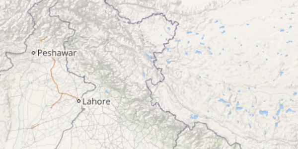
As per forecasters, Uttarakhand is likely to record maximum amount of rains. Along with rain, the upper reaches may also receive snowfall activity. Stations such asShimla,Manali, Dharamsala,Nainital, Mussoorie, Mukhteshwar, andDehradunwill be the most rain affected regions.

Activities such as landslides, flash floods, and waterlogging cannot be avoided as the spells are expected to be intense.

The rainfall activity over Himachal Pradesh and Uttarakhand are also anticipated to witness a decreasing trend by tomorrow afternoon or evening. However, scattered activities will continue until March 23. Thereafter, the weather is likely to be almost dry as this weather system is anticipated to the last active system.

IMAGE CREDIT: Wikipedia.org

Any information taken from here should be credited to skymetweather.com


Similar Articles

thumbnail image
March 20, Today Marks The Spring Equinox: Day-Night Duration Nearly Equal

The official transition from winter to spring, known as the SPRING EQUINOX, occurs today! It’s time when the Sun crosses the celestial equator precisely at 2:31 PM, delivering warmer, longer days to the Northern HemiSphere. As autumn arrives, the South enjoys colder evenings.

posted on:
thumbnail image
आज सूर्य करेगा भूमध्य रेखा पार, बसंत ऋतु की शुरुआत, दिन-रात की अवधि लगभग बराबर

आज, 20 मार्च 2025, बसंत विषुव (Spring Equinox 2025) का दिन है। सूर्य भूमध्य रेखा को पार करेगा, दिन बड़े और गर्म होंगे। उत्तर गोलार्ध में बसंत ऋतु की शुरुआत होगी, दक्षिण गोलार्ध में शरद ऋतु का आगमन होगा। वहीं, सितंबर में यह खगोलीय घटना फिर से होगी।

posted on:
thumbnail image
गर्मी का दायरा बढ़ा! ओडिशा, महाराष्ट्र, तेलंगाना और रायलसीमा में 40°C के पार तापमान, राहत की उम्मीद

देश में समय से पहले गर्मी असर बढ़ रहा है। ओडिशा, महाराष्ट्र, तेलंगाना, आंध्र प्रदेश में अभी तापमान से 40°C से ऊपर पहुंच गया है, जिस कारण इन राज्यों में भीषण गर्मी हो रही है। फरवरी 2025, पिछले 125 वर्षों में सबसे गर्म महीना रहा है। कई जगहों पर सामान्य से 6.4°C तक ज्यादा तापमान रिकॉर्ड हुआ है।

posted on:
thumbnail image
दिल्ली में बढ़ेगी गर्मी! शुष्क और तपता रहेगा वीकेंड, बारिश की संभावना हुई कम

दिल्ली में गर्मी बढ़ रही है, पिछले 3 दिनों में तापमान 4°C बढ़ा है। आज अधिकतम 34-35°C, न्यूनतम 17°C तक रह सकता है। मार्च अब तक लगभग शुष्क बना हुआ है, सिर्फ 2mm बारिश दर्ज हुई है। 26-28 मार्च को तापमान 40°C के करीब पहुंचने की संभावना है। वहीं,पश्चिमी विक्षोभ से मैदानी इलाकों में बारिश की संभावना नहीं है।

posted on: