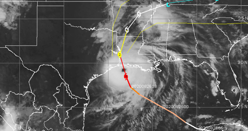
Hurricane Laura has strengthened to a Cat-4 storm before making landfall. The violent storm is packed with a wind speed of about 240kmh which is just short by about 14km to be a Cat-5 Hurricane, the top most category. Laura has become an extremely dangerous storm with catastrophic potential and resulting unsurvivable storm surge in excess of 15feet. The Hurricane is speeding towards the coast, aiming Louisiana-Texas border and is likely to make landfall shortly.
The well defined and sharp eye of the storm is the show of its strength and power. This region was last struck by such powerful storm Andrey way back in 1957. Laura will have a devastating swath of more than 100km which will cause power outages, disrupting communication & connectivity, felling/uprooting trees, and demolishing weak structures. Nothing will be safe on roads in the vicinity of the storm when making landfall.

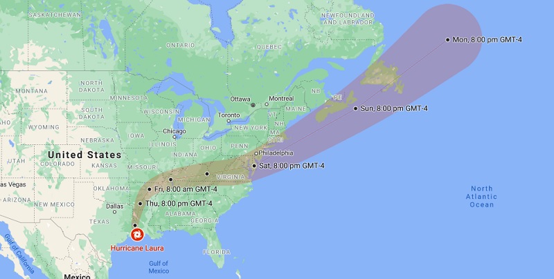
Hurricane Laura Track
There is a flood risk for inland pockets of Arkansas, Ohio, and Tennessee. Houston will be on the left of the track and may get spared from its severe impact. However heavy rains and strong winds are inevitable. Mandatory evacuations have been ordered numbering over 400,000 in Texas and 200,000 in Louisiana. The hurricane will weaken to a tropical storm within 24-hours after making landfall.


