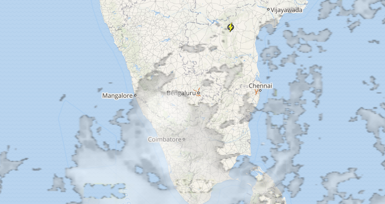
 Pre-Monsoon rains and thundershowers have gained momentum over Peninsular India, resulting in significant increase in the weather activity over the region.
During the last 24 hours, Kerala and Karnataka have recorded moderate to heavy showers, while Interior Tamil Nadu has received light to moderate showers.
 Click here to check the live status of lightning, rain and thundershowers across India
All thanks to the trough, which has been running from Coastal Odisha up to Comorin region across Karnataka for the last few days. The trough has been infusing moisture across these three neighbouring states.
Further, weather conditions will remain conducive for rain and thundershowers to continue over Kerala, Karnataka and Interior Tamil Nadu for another 24 hours, predict Skymet Weather.
Thereafter, weather models are indicating towards the weakening of the trough. With this, rains will reduce after the next 24 hours but light showers will continue over the region.
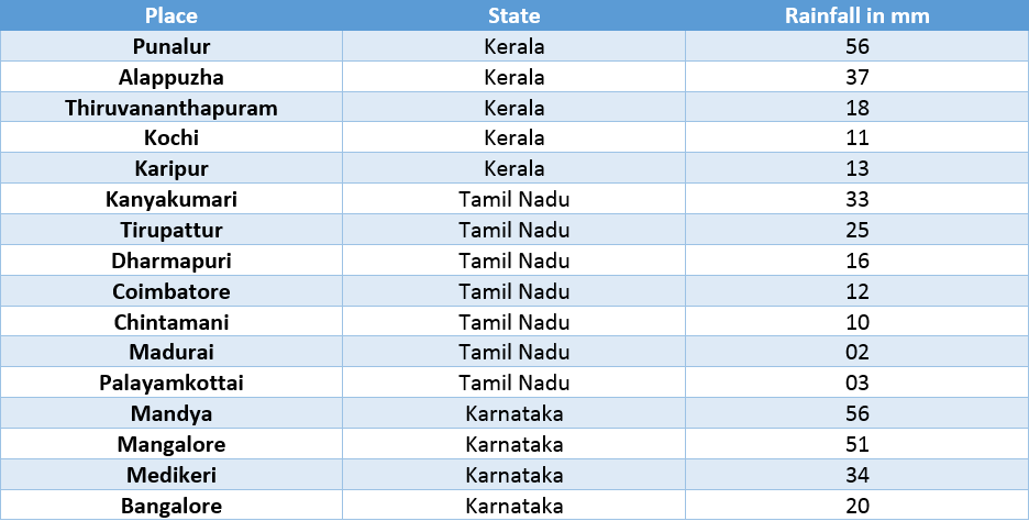
Let us have a look at the rainfall figures recorded in span of 24 hours from 8:30 am on Thursday.

The region is witnessing pre-Monsoon season, which keeps on increasing and decreasing from time to time. The journey for the Southwest Monsoon 2017 has already begun. According to Skymet Weather, we expect Monsoon to make onset over Kerala by May 29, with the error margin of + /- three days.
Image credit: The Hindu
Any information taken from here should be credited to skymetweather.com


