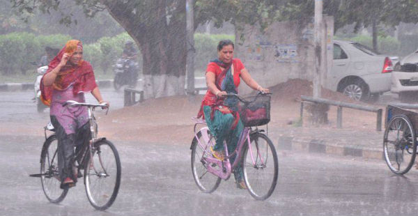
Haryana has been receiving moderate to heavy showers since many days. Pre-Monsoon period has been very good for the state. In the last 24 hours, Haryana recorded moderate to heavy showers at many places. Narnaul recorded extremely heavy rains of 68 mm and Karnal witnessed 140 mm.
As per Skymet Weather, these rainfall activities can be attributed to the trough which was extending from North Rajasthan and adjoining Haryana to Bay of Bengal across North Madhya Pradesh and an active Western Disturbance which was over Western Himalayas.
These two weather systems induced the formation of convective clouds over Haryana that gave thunderclouds and lightning over the state which resulted in these heavy showers. Monsoon has not yet reached the state, but it is round the corner. It can soon make an onset in the next 24-48 hours.
Click the image below to see the live lightning and thunderstorm across Haryana
There are chances of good rains to continue over many parts of Haryana in the next 24-48 hours and the intensity of rains may increase in the first week of July. At present, Haryana is rain surplus by 76%. It means that this year rainfall in the month of June is better than of the previous years.
[yuzo_related]
Temperatures across the state were in lower 30’s, Weather conditions were warm till now but due to good rain activities, we expect relief from the hot weather conditions.
IMAGE CREDIT: hindustantimes.com
Any information taken from here should be credited to skymetweather.com


