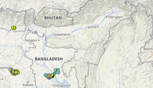
Monsoon has made a timely arrival over parts of northeastern states. In fact, heavy Monsoon rains had triggered massive floods over Assam and Mizoram. However, Monsoon rains took a back seat during the last two days but light to moderate rains continued over the region.
Now, Monsoon rains are likely to pick up pace once again over region, due to which moderate to heavy rains are all set to revisit Assam, Meghalaya and Arunachal Pradesh during the next 24 hours.
These rains can be attributed to the low pressure area over Northwest Bay of Bengal that has shifted towards northeastward and is presently sited over Bangladesh. Also, a trough is extending from Punjab to Arunachal Pradesh embedded with a cyclonic circulation over West Assam. Besides this, the moisture feed is also available from the humid winds coming from the Bay of Bengal up to the region.
[yuzo_related]
During the last 24 hours from 8:30 am on Thursday,Guwahatiand Cherrapunji recorded 54 mm of rainfall, Aizawl 39 mm, Agartala 26 mm, Kailashahar 18 mm,Mangan15 mm, Golaghat and Itanagar 13 mm and Lengpui 12 mm of rains. There were other districts too that witnessed light to moderate rains such as Dhubri, Dibrugarh, North Lakhimpur,Silcharand Passighat.
Skymet Weather predicts rain and thundershowers to intensify over most parts of northeastern states, particularly over Assam, Meghalaya and Arunachal Pradesh during the next 24 hours. Moderate to heavy rains with squally winds will lash these states. Meanwhile, Nagaland, Manipur, Mizoram and Tripura will receive light to moderate rains at many places.
Click the image above to see the live lightning and thunderstorm across Northeast India
There has been severe flooding reported in most areas of Assam including Guwahati, caused mostly due to a poor network of clogged and unscientifically constructed drains. Five persons have been reported dead due to the flooding in the city.
Image Credit: the wire
Any information taken from here should be credited to skymetweather.com


