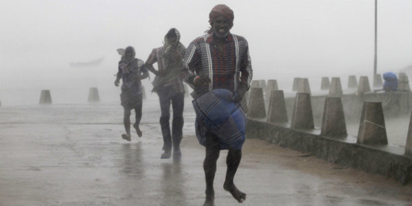
After giving almost a month long dry spell and uneasy days to several districts of Andhra Pradesh, finally, the weather took a u-turn and offered some good rains to many districts of the state. Though the interior regions of Andhra Pradesh likeVijayawadaand Rentachintala did observe some rains last week, but rains had escaped the coastal regions.
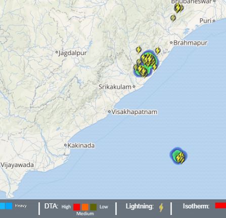
Click the image above to see the live lightning and thunderstorm across Andhra Pradesh
However, in the last 24 hours, moderate to heavy spells showed up in most parts of Andhra Pradesh thereby making the weather conditions pleasant. Not only this, these rains were also responsible for the further advancement of Monsoon into parts of Coastal Andhra Pradesh. The Northern Limit of Monsoon is now passing through Nellore.
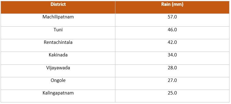
The table below depicts the rainfall recorded in parts of Andhra Pradesh within a span of 24 hours from 08:30 am on Wednesday:
[yuzo_related]
Skymet Weather reiterates that these showers occurred over Andhra Pradesh due to a cyclonic circulation that persisted over the Andhra Pradesh coast. However, now this weather system is likely to move further north-northwestwards towardsOdisha.
Furthermore, it will strengthen and hence on account of this, coastal regions ofAndhra Pradeshare expected to continue with light to moderate spells for the next 48 hours. The possibility of a few isolated heavy showers cannot be ruled out as well.
With the effect of these rains, the temperatures are likely to drop further. Already most of the regions have seen a significant drop in the day temperature. The maximums that were settling close to the 45-degree mark almost a week ago are already in mid-30. Though due to the close proximity of these regions to the Bay, humid conditions will prevail.
Image Credit: dnaindia
Any information taken from here should be credited to skymetweather.com