Heavy Monsoon rains in Kerala, more during next 3-4 days

June 28, 2017 3:17 PM|

keralaarticle

Southwest Monsoon has finally picked up the pace along the West Coast, particularly over Konkan region and Kerala during the last 24 hours.

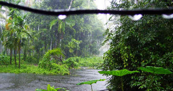
Vigorous Monsoon conditions have battered many parts ofKeralawith heavy rains and thundershowers. In a span of 24 hours from 8:30 am on Tuesday, Punalur recorded 66 mm of rain, Karipur 61 mm, Cannur 54 mm, Kozhikode 52 mm, Alappuzha 48 mm, Thiruvananthapuram 41 mm and Kochi 37 mm.

lightning in kerala

Click the image above to see the live lightning and thunderstorm across Kerala

According to Skymet Weather, a cyclonic circulation has developed over SouthGujarat. An off-shore trough has also been extending from this system along the West Coast up to Kerala. Both the systems have revived the Monsoon surge, resulting in moderate to heavy rains and thundershowers.

[yuzo_related]

Further, both the systems will continue to sustain the strength and thus, more moderate to heavy spells are likely over Kerala during the next 2-3 days. Though cyclonic circulation is likely to move westwards gradually, it will be capable enough of giving good rains.

Known for heavy Monsoon showers during June, Kerala has been battling rain deficiency this season. As on June 27, the cumulative rainfall deficiency for Kerala stands at 12%.

However, with good rains in offing during the next 2-3 days, we expect rain deficiency to improve and Kerala may end the month with normal rains.

ImageCredit: livemint

Any information taken from here should be credited to skymetweather.com  

Similar Articles

thumbnail image
March 20, Today Marks The Spring Equinox: Day-Night Duration Nearly Equal

The official transition from winter to spring, known as the SPRING EQUINOX, occurs today! It’s time when the Sun crosses the celestial equator precisely at 2:31 PM, delivering warmer, longer days to the Northern HemiSphere. As autumn arrives, the South enjoys colder evenings.

posted on:
thumbnail image
आज सूर्य करेगा भूमध्य रेखा पार, बसंत ऋतु की शुरुआत, दिन-रात की अवधि लगभग बराबर

आज, 20 मार्च 2025, बसंत विषुव (Spring Equinox 2025) का दिन है। सूर्य भूमध्य रेखा को पार करेगा, दिन बड़े और गर्म होंगे। उत्तर गोलार्ध में बसंत ऋतु की शुरुआत होगी, दक्षिण गोलार्ध में शरद ऋतु का आगमन होगा। वहीं, सितंबर में यह खगोलीय घटना फिर से होगी।

posted on:
thumbnail image
गर्मी का दायरा बढ़ा! ओडिशा, महाराष्ट्र, तेलंगाना और रायलसीमा में 40°C के पार तापमान, राहत की उम्मीद

देश में समय से पहले गर्मी असर बढ़ रहा है। ओडिशा, महाराष्ट्र, तेलंगाना, आंध्र प्रदेश में अभी तापमान से 40°C से ऊपर पहुंच गया है, जिस कारण इन राज्यों में भीषण गर्मी हो रही है। फरवरी 2025, पिछले 125 वर्षों में सबसे गर्म महीना रहा है। कई जगहों पर सामान्य से 6.4°C तक ज्यादा तापमान रिकॉर्ड हुआ है।

posted on:
thumbnail image
दिल्ली में बढ़ेगी गर्मी! शुष्क और तपता रहेगा वीकेंड, बारिश की संभावना हुई कम

दिल्ली में गर्मी बढ़ रही है, पिछले 3 दिनों में तापमान 4°C बढ़ा है। आज अधिकतम 34-35°C, न्यूनतम 17°C तक रह सकता है। मार्च अब तक लगभग शुष्क बना हुआ है, सिर्फ 2mm बारिश दर्ज हुई है। 26-28 मार्च को तापमान 40°C के करीब पहुंचने की संभावना है। वहीं,पश्चिमी विक्षोभ से मैदानी इलाकों में बारिश की संभावना नहीं है।

posted on: