Updated on July 21 at 2:30 PM: The well-marked low-pressure area which was persisting over Northwest Bay of Bengal off West Bengal and Odisha coast has intensified into a depression. We expect heavy to very rains over the state during the next 24 to 48 hours.
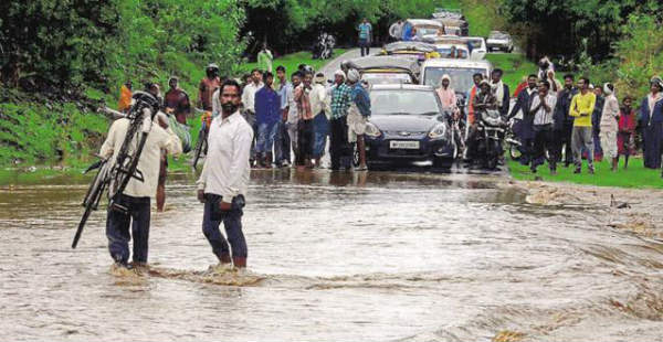
Updated on July 21 at 12:00 PM: As predicted Skymet Weather, Odisha witnessed extremely heavy rainfall activity. In fact, several districts have recorded three digit rains during the past day. In wake of these rains flood like conditions are experienced by many places.
[yuzo_related]
In the last 24 hours from 8:30 am on Friday,Purirecorded heavy rain to the tune of 269 mm,Cuttack211.2 mm, Bhubaneswar 195 mm, Koraput 185 mm, Bhawanipatna 126 mm and Titlagarh 109 mm of rains.
In the same time frame, Gopalpur witnessed 80.4 mm of rain, Paradip 81 mm, Balasore 52.5 mm and Chnadbali 28.3 mm of rains.
As per weathermen at Skymet Weather, the well-marked low-pressure area lies over Northwest Bay of Bengal off West Bengal and Odisha coast. This system is likely to intensify more during the next 24 hours. Due to the presence of this system very heavy to heavy rain is likely to continue over most parts of South Odisha. While north Odisha is expected to receive moderate to heavy rains.
Places like Rajgarh, Malkangiri, Bhawanipatna, Koraput, and Ganjam districts are likely to witness heavy to very heavy Monsoon rains. In fact, flood situation may arise during the next 24 to 36 hours.
Meanwhile, districts such as Bhubaneshwar, Puri, Jharsuguda, Bhadrak, Phulbani, and Cuttack would witness moderate to heavy Monsoon rainfall during the same period. Along with rains, moderate lightning strikes and strong winds will also accompany.
It is anticipated that after 36 hours, rainfall intensity is likely to decrease as the above system is expected to move in west northwestward direction.
IMAGE CREDIT: Wikipedia.org
Any information taken from here should be credited to skymetweather.com


