During the last 24 hours, many parts of Himachal Pradesh as well as Uttarakhand received moderate to heavy Monsoon rains. In fact, one or two places recorded very heavy spells. Parts of Jammu and Kashmir also recorded some spells.
In a span of 24 hours form 08:30 am on Thursday, Dehradun recorded a mammoth 150 mm of rainfall, followed by Haridwar 79 mm, Tehri 72 mm, Dharamsala 58 mm, Uttarkashi 45 mm,Katra44 mm, Nainital 34 mm, Nahan 29 mm,Shimla29 mm, Pithoragarh 24 mm, Pantnagar 22 mm, Manali 20 mm, Mukteshwar 17 mm andJammu12 mm.
[yuzo_related]
Now a fresh Western Disturbance is seen over Jammu and Kashmir. Along with this, the axis of Monsoon trough is running close to foothills of Himalayas. Thus, together these weather systems will pour moderate to heavy showers over many parts Uttarakhand. Places likeDehradun, Nainital, Mukteshwar and Pithoragarh are likely to witness some good rain and thundershowers.
In fact, weathermen at Skymet Weather expect some parts of Himachal Pradesh will also record moderate intensity of rains. Isolated heavy spells also cannot be ruled out. Places such as Dharamsala and Mandi may receive good rains. And these showers over both Himachal Pradesh and Uttarakhand are anticipated to stay for at least the next 24 to 36 hours.
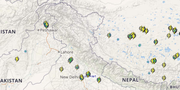
Click the image above to see the live lightning and thunderstorm across India
During the same time frame, Jammu and Kashmir will continue with scattered light rain activity.
By September 3, the intensity of rains will decrease but till then the chances of landslides and flash floods are very protuberant. Hence, we advise people who are planning their weekends to head towards these famous North Indian hills to kindly skip their visits to avoid massive traffic and road obstructions caused by landslides and water logging.
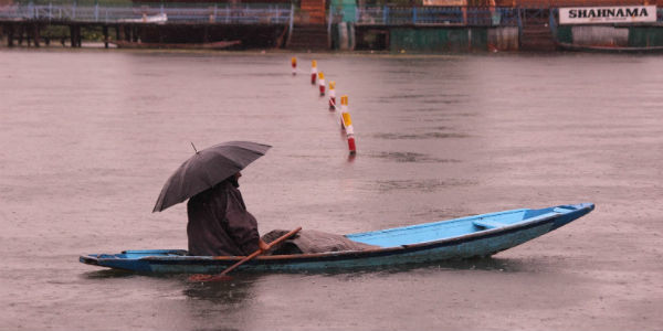
IMAGE CREDIT: pixelsorcery.in
Any information taken from here should be credited to skymetweather.com