Good rains to continue over Northern Hills of India

May 21, 2017 11:59 AM|

jammupost

Yesterday’s Western Disturbance has moved away. Another fresh Western Disturbance is over North Pakistan and adjoining Jammu and Kashmir. It's induced cyclonic circulation is seen over Punjab and adjoining Pakistan followed by another cyclonic circulation prevailing over parts of Rajasthan and adjoining Pakistan.

During the last 24 to 48 hours, scattered rains have occurred over some parts. Now, we are likely to expect the intensity of rainfall to increase in this region.

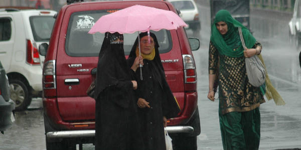
Meanwhile, in Himachal Pradesh and few parts of Uttarakhand andJammuand Kashmir, scattered rains along with squally winds may continue to occur over these regions during the next 24 to 48 hours. In places like Tehri,Qazi Gund, Mandi, Srinagar,Manali, andShimlahave been already witnessing few spell of rain during the last two to three days.

CHECK OUT THE LIVE LIGHTENING AND THUNDERSTORM STATUS ACROSS INDIA 

Jammu and kashmir lightening strikes

Within a span of 24 hours from 08:30 am on Saturday, Bhuntar witnessed the maximum amount of rainfall of 8.0 mm, Banihal 2.0 mm and Gulmarg 2.0 mm.

According to Skymet Weather, rainfall along with squally winds may continue to occur at many places in  Jammu and Kashmir, Himachal Pradesh and Uttarakhand during the next two days.

However, in parts of southern Himachal Pradesh and Uttarakhand may receive hailstorm activities in the next 24-48 hours.

Furthermore, with these systems, the sky is expected to become partly cloudy and gradually the cloud cover will increase over many parts of northern hills.

Image credit:  FT Photo Diary

Any information taken from here should be credited to skymetweather.com


Similar Articles

thumbnail image
March 20, Today Marks The Spring Equinox: Day-Night Duration Nearly Equal

The official transition from winter to spring, known as the SPRING EQUINOX, occurs today! It’s time when the Sun crosses the celestial equator precisely at 2:31 PM, delivering warmer, longer days to the Northern HemiSphere. As autumn arrives, the South enjoys colder evenings.

posted on:
thumbnail image
आज सूर्य करेगा भूमध्य रेखा पार, बसंत ऋतु की शुरुआत, दिन-रात की अवधि लगभग बराबर

आज, 20 मार्च 2025, बसंत विषुव (Spring Equinox 2025) का दिन है। सूर्य भूमध्य रेखा को पार करेगा, दिन बड़े और गर्म होंगे। उत्तर गोलार्ध में बसंत ऋतु की शुरुआत होगी, दक्षिण गोलार्ध में शरद ऋतु का आगमन होगा। वहीं, सितंबर में यह खगोलीय घटना फिर से होगी।

posted on:
thumbnail image
गर्मी का दायरा बढ़ा! ओडिशा, महाराष्ट्र, तेलंगाना और रायलसीमा में 40°C के पार तापमान, राहत की उम्मीद

देश में समय से पहले गर्मी असर बढ़ रहा है। ओडिशा, महाराष्ट्र, तेलंगाना, आंध्र प्रदेश में अभी तापमान से 40°C से ऊपर पहुंच गया है, जिस कारण इन राज्यों में भीषण गर्मी हो रही है। फरवरी 2025, पिछले 125 वर्षों में सबसे गर्म महीना रहा है। कई जगहों पर सामान्य से 6.4°C तक ज्यादा तापमान रिकॉर्ड हुआ है।

posted on:
thumbnail image
दिल्ली में बढ़ेगी गर्मी! शुष्क और तपता रहेगा वीकेंड, बारिश की संभावना हुई कम

दिल्ली में गर्मी बढ़ रही है, पिछले 3 दिनों में तापमान 4°C बढ़ा है। आज अधिकतम 34-35°C, न्यूनतम 17°C तक रह सकता है। मार्च अब तक लगभग शुष्क बना हुआ है, सिर्फ 2mm बारिश दर्ज हुई है। 26-28 मार्च को तापमान 40°C के करीब पहुंचने की संभावना है। वहीं,पश्चिमी विक्षोभ से मैदानी इलाकों में बारिश की संभावना नहीं है।

posted on: