The incidents of landslides and flash flooding have become quite common for the hilly states of North India that has been witnessing heavy to extremely heavy rains from last many days. Though in contrast with Jammu & Kashmir, these hefty showers are primarily lashing Himachal Pradesh and Uttarakhand.
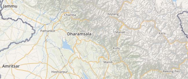
In the last 24 hours also, heavy with isolated extremely heavy rains have lashed Himachal Pradesh with Dharamsala recording heavy rains of 118 mm. While the other districts of Himachal Pradesh and Uttarakhand that have recorded light to moderate spells includeDehradun50.6 mm, Una 38 mm,Shimla15.6 mm, and Tehri 13.5 mm.
On the other hand, rains over Jammu & Kashmir were comparatively on a lesser side. Mainly Jammu and Katra have recorded few good spells while other regions of the state mainly received light to very light rains. Within the similar time frame, Jammu recorded 12.8 mm of rains whileKatrawitnessed 6 mm of spells only.
As of now, charismatic Jammu & Kashmir is likely to continue with scattered rains that too mainly over the southern parts of the state. However, the intensity will be on a lower side. Thereafter, few good spells are once again expected around August 12 due to the approach of a fresh Western Disturbance.
[yuzo_related]
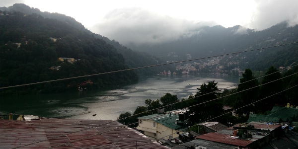
On the other hand, the scenic Himachal Pradesh and mesmerizing Uttarakhand to continue with moderate to heavy rains. These rains are likely to continue for the next 24 hours. Henceforth, there will be a slight reduction in rains over both the state but on and off good showers will continue till August 13.
Click above to see the live lightning and thunderstorm across Northern Hills
These rains as per Skymet Weather were a result of the axis of Monsoon trough which was running along the foothills of Himalayas. Moreover, the Western Disturbance as an upper air cyclonic circulation also persisted over North Pakistan and adjoining Jammu & Kashmir.
On account of more moderate to heavy rainfall, landslide and flash flood threat still remains in some parts of Uttarakhand and Himachal Pradesh. But the famous tourist spots of Jammu & Kashmir such asSrinagar, Pahalgam, andGulmargare much safer options for touring.
Image Credit: Facebook
Any information taken from here should be credited to skymetweather.com


