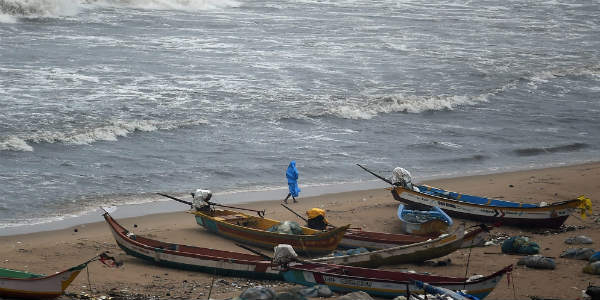
In the past day, the rainfall activity reduced significantly over the state of Tamil Nadu. Since many days rain and thundershowers had been splashing the residents of Tamil Nadu includingChennai. In the last 24 hours from 8.30 am on Monday, the Observatories of Chennai, Meenambakkam, and Nungambakkam failed to record any rainfall activity.
[yuzo_related]
However, other districts of the state such as Tondi witnessed rain to the tune of 4.5 mm and Kodaikanal 1.6 mm. At present, multiple weather systems such are hovering above the state of Tamil Nadu. A cyclonic circulation is seen prevailing over Southwest Bay of Bengal off Sri Lanka Coast.
Another cyclonic circulation is persisting over the southeast Arabian Sea close to North Kerala. A trough has formed between the above mentioned cyclonic circulations. Another trough is seen extending from South Chhattisgarh to Coastal Arabian Sea across South Karnataka and Telangana.
Click the image below to see the live lightning and thunderstorm across Tamil Nadu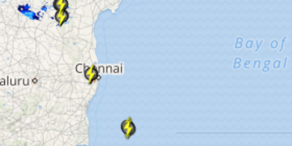
In wake of these weather systems, the coastal stations will receive light to moderate rain and thundershower activities. Meanwhile, the interior parts will mainly witness light rainfall. As per weathermen at Skymet Weather, it is anticipated that after 24 hours rainfall activity is likely to increase over Chennai and the extreme southern parts of the state.
The temperatures may drop marginally over the state. These rain showers are likely to continue for a few days. The weather across Tamil Nadu including the capital city will remain humid and warm and the sky conditions will be cloudy to overcast.
IMAGE CREDIT: rediff.com
Any information taken from here should be credited to skymetweather.com