Fresh Low Pressure Area to give moderate rains in Bhopal, Jabalpur, Sagar, Satna August 30 onward

August 27, 2019 11:46 AM|

Rain in Madhya Pradesh

Many parts of Madhya Pradesh are witnessing moderate rains with occasional heavy to very heavy spells since the second half of July. These rains are beneficial for restoring groundwater and the reservoirs have also reached their mark. Since these rains are continuing without any extended break, therefore these rains are also damaging the crops.

The reason for such continuous rains can be attributed to the successive weather systems such as aLow-Pressure Area, Cyclonic Circulation and Depression. These systems originate over west-central and north Bay of Bengal and then travel further towards the West impacting Madhya Pradesh.

Now, the current Low-Pressure Area has weakened, and rains will be now fewer. We can seescattered rain and thundershowersover West Madhya Pradesh. However, there will be a significant drop in rainfall activities on August 28 and 29 with solely isolated activities in sight.

Another spell of good rains is expected over East Madhya Pradesh on August 30 in wake of a new Low-Pressure Area which is likely to form in the next 24 to 48 hours.

Gradually,many more parts of Madhya Pradeshwill start experiencing rains and these rain spell may last up to September 2 or September 3. The new Low-Pressure Area will give light to moderate rains with few heavy spells, but very heavy rains are ruled out. So, the threat of flooding seems to be out of sight for now.

Places like Jabalpur, Damoh, Sagar, Satna, Bhopal, Dewas, Betul, Guna, and Mandla are very likely to witness moderate rains with isolated heavy spells between August 30 to September 2.

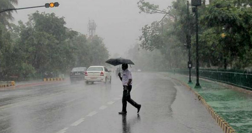
Image Credits – The Hindu Business Line

Any information taken from here should be credited to Skymet Weather

Similar Articles

thumbnail image
March 20, Today Marks The Spring Equinox: Day-Night Duration Nearly Equal

The official transition from winter to spring, known as the SPRING EQUINOX, occurs today! It’s time when the Sun crosses the celestial equator precisely at 2:31 PM, delivering warmer, longer days to the Northern HemiSphere. As autumn arrives, the South enjoys colder evenings.

posted on:
thumbnail image
आज सूर्य करेगा भूमध्य रेखा पार, बसंत ऋतु की शुरुआत, दिन-रात की अवधि लगभग बराबर

आज, 20 मार्च 2025, बसंत विषुव (Spring Equinox 2025) का दिन है। सूर्य भूमध्य रेखा को पार करेगा, दिन बड़े और गर्म होंगे। उत्तर गोलार्ध में बसंत ऋतु की शुरुआत होगी, दक्षिण गोलार्ध में शरद ऋतु का आगमन होगा। वहीं, सितंबर में यह खगोलीय घटना फिर से होगी।

posted on:
thumbnail image
गर्मी का दायरा बढ़ा! ओडिशा, महाराष्ट्र, तेलंगाना और रायलसीमा में 40°C के पार तापमान, राहत की उम्मीद

देश में समय से पहले गर्मी असर बढ़ रहा है। ओडिशा, महाराष्ट्र, तेलंगाना, आंध्र प्रदेश में अभी तापमान से 40°C से ऊपर पहुंच गया है, जिस कारण इन राज्यों में भीषण गर्मी हो रही है। फरवरी 2025, पिछले 125 वर्षों में सबसे गर्म महीना रहा है। कई जगहों पर सामान्य से 6.4°C तक ज्यादा तापमान रिकॉर्ड हुआ है।

posted on:
thumbnail image
दिल्ली में बढ़ेगी गर्मी! शुष्क और तपता रहेगा वीकेंड, बारिश की संभावना हुई कम

दिल्ली में गर्मी बढ़ रही है, पिछले 3 दिनों में तापमान 4°C बढ़ा है। आज अधिकतम 34-35°C, न्यूनतम 17°C तक रह सकता है। मार्च अब तक लगभग शुष्क बना हुआ है, सिर्फ 2mm बारिश दर्ज हुई है। 26-28 मार्च को तापमान 40°C के करीब पहुंचने की संभावना है। वहीं,पश्चिमी विक्षोभ से मैदानी इलाकों में बारिश की संभावना नहीं है।

posted on: