Fresh low in Bay to give hefty rains over Andaman and Nicobar islands

November 29, 2017 6:44 PM|

Fresh low in Bay to give hefty rains over Andaman and Nicobar islands

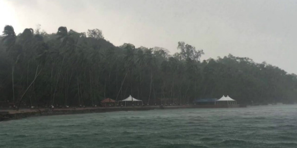
The Andaman and Nicobar Islands have been witnessing good rains for the last few days. In fact, a few hefty spells of rainfall were also recorded over the southern areas. All thanks to the persisting low pressure area which had been causing heavy rains in the region.

However, the system has now moved towards Sri Lanka coast and intensified into a depression and is likely to intensify into a deep depression. In fact, the possibility of its further intensification into a cyclone cannot be ruled out as well.

[yuzo_related]

However, the system has no effect on the weather of the Andaman and Nicobar Islands which is why during the last 24 hours, almost no rainfall activity has been observed over the region except trace of rainfall over Port Blair.

Check out the live lightning and thunderstorm status across Andaman and Nicobar Islands

lightning in andaman

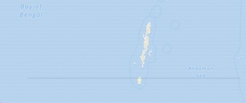
Now, another low pressure is expected to appear in the Andaman Sea and under its influence, a depression is expected to form over in the Bay off Andaman and Nicobar Islands and adjoining areas.

Due to this weather system, moderate to heavy rain and thundershowers are expected to occur over Andaman and Nicobar Islands. In fact, the possibility of a few very heavy spells of rains cannot be ruled out over the region.

These showers will occur between November 30 and December 2. During this period, sea will remain rough and winds will gust up to 60 kmph along the coast. Thereafter, the weather system may intensify further and move towards North Tamil Nadu coast and give hefty showers over Chennai December 3 night onward.

Image Credit: YouTube

Please Note: Any information picked from here must be attributed to skymetweather.com

Similar Articles

thumbnail image
March 20, Today Marks The Spring Equinox: Day-Night Duration Nearly Equal

The official transition from winter to spring, known as the SPRING EQUINOX, occurs today! It’s time when the Sun crosses the celestial equator precisely at 2:31 PM, delivering warmer, longer days to the Northern HemiSphere. As autumn arrives, the South enjoys colder evenings.

posted on:
thumbnail image
आज सूर्य करेगा भूमध्य रेखा पार, बसंत ऋतु की शुरुआत, दिन-रात की अवधि लगभग बराबर

आज, 20 मार्च 2025, बसंत विषुव (Spring Equinox 2025) का दिन है। सूर्य भूमध्य रेखा को पार करेगा, दिन बड़े और गर्म होंगे। उत्तर गोलार्ध में बसंत ऋतु की शुरुआत होगी, दक्षिण गोलार्ध में शरद ऋतु का आगमन होगा। वहीं, सितंबर में यह खगोलीय घटना फिर से होगी।

posted on:
thumbnail image
गर्मी का दायरा बढ़ा! ओडिशा, महाराष्ट्र, तेलंगाना और रायलसीमा में 40°C के पार तापमान, राहत की उम्मीद

देश में समय से पहले गर्मी असर बढ़ रहा है। ओडिशा, महाराष्ट्र, तेलंगाना, आंध्र प्रदेश में अभी तापमान से 40°C से ऊपर पहुंच गया है, जिस कारण इन राज्यों में भीषण गर्मी हो रही है। फरवरी 2025, पिछले 125 वर्षों में सबसे गर्म महीना रहा है। कई जगहों पर सामान्य से 6.4°C तक ज्यादा तापमान रिकॉर्ड हुआ है।

posted on:
thumbnail image
दिल्ली में बढ़ेगी गर्मी! शुष्क और तपता रहेगा वीकेंड, बारिश की संभावना हुई कम

दिल्ली में गर्मी बढ़ रही है, पिछले 3 दिनों में तापमान 4°C बढ़ा है। आज अधिकतम 34-35°C, न्यूनतम 17°C तक रह सकता है। मार्च अब तक लगभग शुष्क बना हुआ है, सिर्फ 2mm बारिश दर्ज हुई है। 26-28 मार्च को तापमान 40°C के करीब पहुंचने की संभावना है। वहीं,पश्चिमी विक्षोभ से मैदानी इलाकों में बारिश की संभावना नहीं है।

posted on: