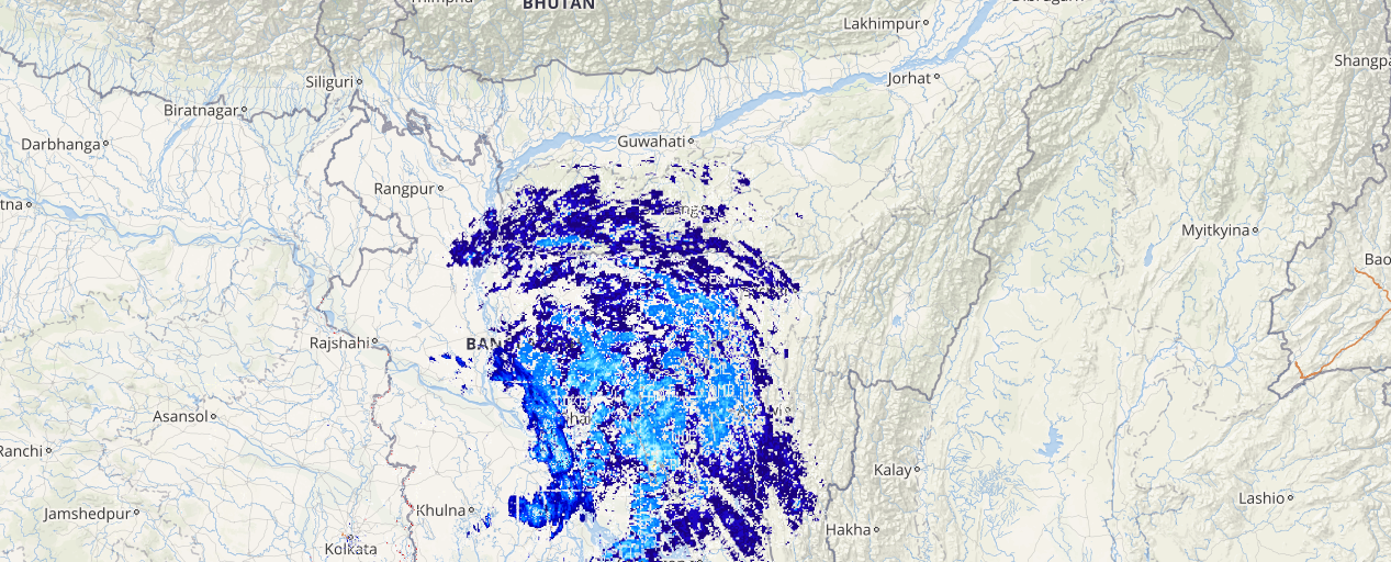
During the past 24 hours, several districts in Arunachal Pradesh, Tripura, Assam and Meghalaya have been witnessing moderate to heavy intensity of rains. While the remaining areas of Northeastern states have been observing moderate spells of rain.
Within the span of 24 hours from 8:30 am on Friday, Passighat recorded heavy rainfall of 60 mm, followed by Agartala at 54 mm, Cherrapunji 48 mm, Goalpara 39.4 mm, Mazbat 33.2 mm, Shillong 29.2 mm, Guwahati 25 mm, Tinsukia 24 mm, Jorhat 23 mm, Kohima 19 mm, Dhubri 17 mm, Golaghat 16 mm, Kailashahar 11.4 mm, Dibrugarh 7.2 mm, Silchar and Lengpui 5 mm and Imphal 4.5 mm.
The reason for such good rains can be attributed to a depression which has been recurved and is presently seen lying over Murshidabad and adjoining areas of Bangladesh. Also, this system is likely to move northeastwards and further is expected to weaken gradually.
[yuzo_related]
Due to the effect of the above-mentioned weather system, moderate to heavy rain and thundershowers along with squally winds are likely to occur in several districts of Meghalaya, Assam, and Tripura during the next 24 hours.
On the other hand, the remaining parts of northeastern states may also witness moderate rains with one or two heavy spells during the similar time frame. In addition, the winds in gust will reach up to 50-60 Kmph.
Moreover, moderate to strong lightning strikes are possible in some parts of the aforementioned regions for the next 24 hours.
Click here to check the Live Lightning and Thunderstorm status over Northeast India:
The districts of lower Assam such as Dhubri, Khasi, Darrang, Nagaon, Nalbari and Kokrajhar may observe very heavy showers and thus, may lead to chances of a flood-like situation over these areas.
However, after 24 hours, the intensity of these incessant rains is expected to reduce significantly from tomorrow afternoon or evening hours over the entire northeastern states of India.
Image Credit: indiatoday.in
Any information taken from here should be credited to skymetweather.com


