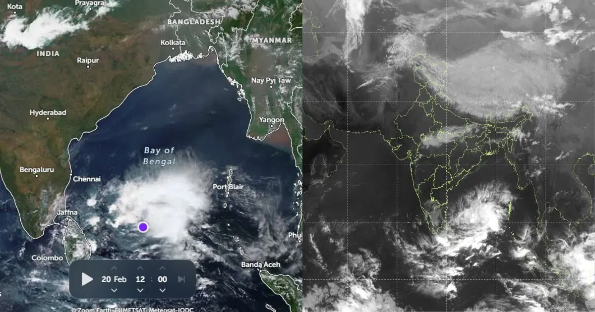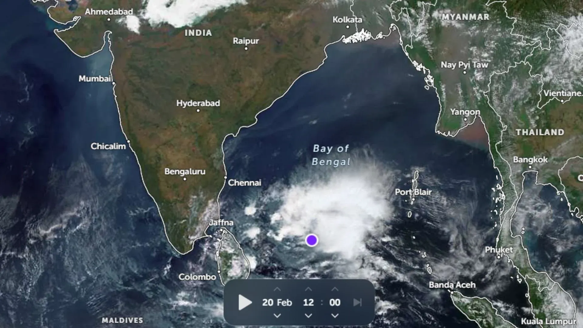
The global warming and climate change seems to be altering the characteristics of El Nino and La Nina. Because of the ocean warming, a ‘cool’ La Nina year is now hotter than an El Nino year of 25-30 years ago. As it is, the origin of El Nino or La Nina is least known, rise in the ocean temperatures have added to the complexity of the event. It is getting harder to predict the ENSO cycle, its onset, intensity and duration.
The Pacific Ocean is the largest and deepest body of water. It generates chaotic climate pattern across the globe. Degree of warming and cooling of Pacific Ocean is larger than others on account of El Nino and La Nina. Occasionally, even the Indian Ocean try to match this variability, during strongly positive IOD events.
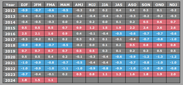
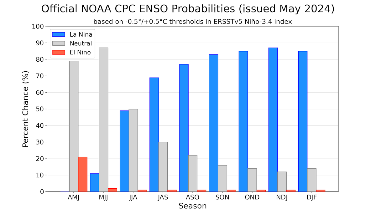
El Nino, the warm phase of the Pacific Ocean is now winding down and is slated to move in to counter phase La Nina. NOAA projects an 85% chance that ENSO cycle will shift to neutral between April-June 2024, and then 60% chance, a La Nina will develop between June-August 2024. Historically, strong El Nino like the last one, are followed by short neutral phase, before switching to La Nina. Emergence of La Nina is certain, but the question is, when will it establish and how strong will it be. Also, how long will it last.
ENSO: Sub-surface negative anomalies are extending from the Date Line to the eastern Pacific Ocean. The coupled ocean- atmosphere system reflected the continued weakening of El Nino and transition towards ENSO neutral.

The latest weekly Nino indices have dropped below the threshold, except in Nino 4. The ONI is based on SST departures from average in the Nino 3.4 region, and is a principal measure for monitoring, assessing and predicting ENSO. It has dropped below the threshold for the first time since 15May 2023. However, the three month running mean SST departure in the Nino 3.4 region for the quarter Feb-Mar-Apr is 1.1°C. At the current rate of cooling, the ONI for Mar-Apr-May is likely to be 0.8°C, still above the threshold mark. Continuation of this trend will have transition to ENSO neutral conditions, possibly by mid-June.
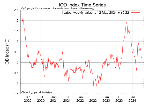
IOD: Positive Indian Ocean Dipole or Indian Nino, a climate pattern that results in irregular oscillations of sea surface temperatures in the Indian Ocean, may re-emerge for the 2nd consecutive year, in the latter half of 2024. A positive IOD can boost the performance of Indian monsoon, depending on when it develops. In 2019, a strong positive IOD event developed during late monsoon season compensated for a 33% rainfall deficit in June.
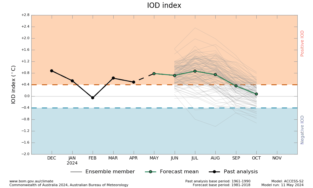
Development of positive or negative IOD for the second consecutive year is not very common. On an average, in a decade, the IOD remains neutral on 6 occasions, and positive or negative on 2 years each. The IOD is currently neutral. The most recent value of the IOD index (+0.22°C) is the second consecutive weekly value within the neutral threshold. Earlier, the IOD index had remained positive and above the threshold of +0.4°C, for seven weeks.
Typically, a positive event IOD event is considered underway, once the IOD index is sustained above +0.4°C for about 8 weeks. It may be construed that the potential development of positive IOD has stalled, for the time being. The latest forecasts are suggesting a weaker IOD than earlier forecast. However, historical skills of IOD forecasts at this time of the year, beyond spring is low.
MJO: Coherent pulse of MJO in April, weakened considerably in May. It also became disorganized. There is growing support now for renewed MJO activity, while it propagates eastward from Indian Ocean and cross over to the Maritime Continent, at a potentially moderate amplitude. Despite some uncertainties, this may enhance the chance of cyclogenesis over Bay of Bengal, during last week of May 2024.

Monsoon may arrive anytime soon over Bay Islands and Southeast Bay of Bengal. It is likely to reach the mainland Kerala as per scheduled date. It will be too early to comment on its further progress. However, two important aspects need pondering: La Nina is developing later than expected and IOD is likely to be weaker than the earlier forecast.


