The Eastern Equatorial Pacific Ocean is much warmer than the rest of it. During evolving stage of El Nino, warm water on the western boundary of the Pacific begins to drift eastward. This tiny perturbation decreases the temperature gradient which in turn dilutes the Walker's Circulation. As trade winds weaken and Walker's Circulation diminishes, the temperature gradient begins to disperse. The eastern and central Pacific becomes warm and rainy; the Western Pacific becomes cooler and drier. Shift in the warm temperature belt leads to El Nino which invariably lasts for 9-12 months.
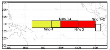
ENSO: The Pacific Ocean is currently ENSO-neutral. All 4 Nino indices cover an approximate sea surface of 17 million sq. km. El Nino forecasts are made utilising a blend of hydro and statistical techniques. The ocean and atmosphere need to respond in tandem to culminate full-blown El Nino. The equatorial belt of the eastern and central Pacific does not seem to be having equitable warming. South American coastline, next to Peru is much hotter than the rest of the region.
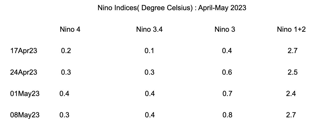
Nino 1+2 region has sustained a rise of temperature of 2 degrees or more for the last 6 weeks. The neighbouring region, Nino 3 has breached the threshold mark of 0.5 degrees for the last 3 consecutive weeks. However, the rest of the Nino regions ( Nino 4 & Nino 3.4) are below the threshold mark, albeit marginally. Though, it is too early to commit but the pattern so far looks synonymous with 'Canonic" El Nino. In the recent past, the year 2014, a drought year, observed Canonic El Nino when the Nino 1+2 region had warmed up earlier than the western Nino region of 3.4. However, the temperature of Nino 1+2 did not exceed 1 degree during the monsoon.
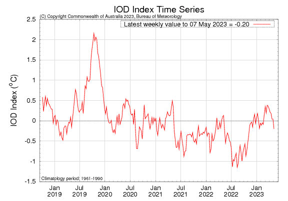
IOD: The Indian Ocean Dipole is currently neutral. The IOD index value for the week ending 07 May 2023 was -0.20 degrees, which is within neutral bounds ( +/- 0.4 degrees). The IOD index has dropped to its lowest value of -0.20 degrees since 06 Nov 2022. Earlier, IOD remained neutral positive from 26th Feb 2023 to 30 Apr 2023. The index has gradually declined over the last 8 weeks. As per model projection, positive IOD events may develop in the coming months. However, model accuracy is generally very low at this time of the year and so is to be viewed with caution.
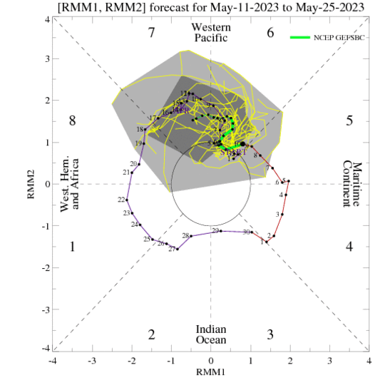
MJO: The Madden Julian Oscillation is the largest element of intra-seasonal variability in the tropical atmosphere. MJO has been very active in the respective regions since March 2023. It is likely to remain the dominant driver during the ongoing stormy season across the global oceans. MJO will be transiting from phase-5 ( Maritime Continent) to phase-6 (Western Pacific) which generally favours tropical storm formation for both the Western Pacific and South Pacific basins. There is an enhanced probability of cyclone formation in these basins between the period 17May-23May 2023.
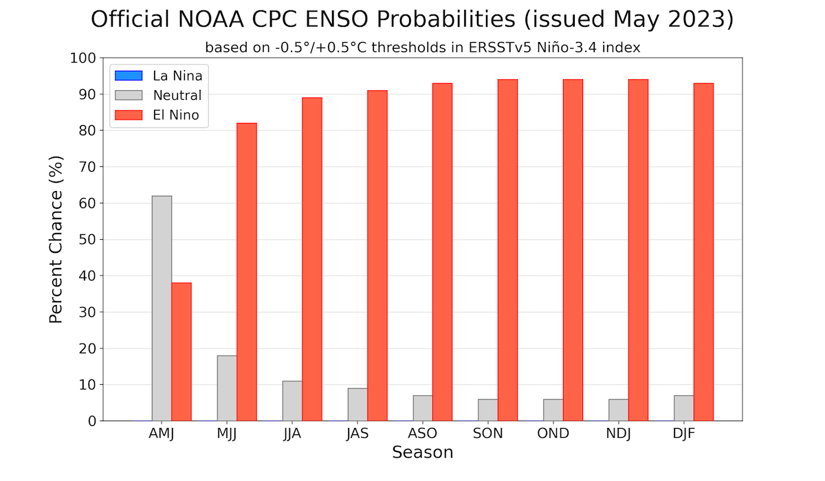
The most recent numerical models plume suggest a transformation to El Nino, beginning June-August 2023. While the lower accuracy of models at this time keeps the forecasters haunted, anticipatory warming of the Pacific Ocean favours, with conviction, the transition to El Nino. NOAA now gives as high as a 94% chance El Nino- known as the world's ultimate " master weather maker" could affect weather patterns, producing relentless floods and droughts and tinkering with the hurricane seasons in the Pacific and Atlantic oceans.


