Dry weather ahead over Manipur, Mizoram and Tripura

February 26, 2018 1:48 PM|

artttt

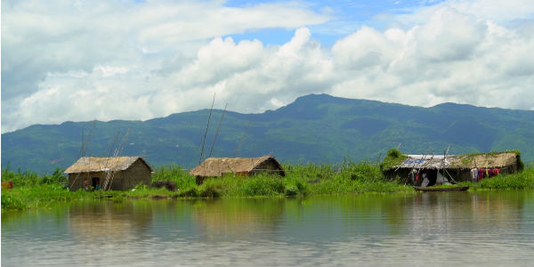
The northeastern region of the country has remained dry almost throughout the month of February. Despite witnessing some light spells during the second week of the month, the rains have remained on the lower side over this region.

[yuzo_related]

During last 24 hours, many areas of the northeastern states have witnessed light to moderate rain activities. This can be termed as first good spell of rain which has covered almost all the states of northeast India.

In a span of 24 hours from 8:30 am on Sunday, Cherrapunji witnessed 21 mm of rain, Halflong recorded 20 mm of rains, Kailashahar 26 mm, Golaghat 15 mm, Silchar 14 mm, Gangtok 10 mm, Agartala 6 mm, Aijal 5 mm, Goalpara 6 mm, Imphal 4 mm and North Lakhimpur 2 mm.

The reason for these rains can be attributed to the movement of the Western Disturbance towards east and a trough which was seen extending from east Bihar to Assam.

Now, the Western Disturbance is seen moving away further east and the trough will also soon become insignificant. Therefore, the weather will once again go dry over Manipur, Mizoram and Tripura.

Scattered rains will continue over East Assam and Arunachal Pradesh. Isolated rains are also possible over remaining parts of Assam, Meghalaya and parts of Nagaland.

Day temperatures have decreased due to the cloud cover and scattered rains, but now as the rains will be seen disappearing from the southern states i.e. Manipur, Mizoram and Tripura, temperatures will once again start increasing. Days will be warm and nights are likely to remain comfortable.

Image Credit: eastindia.com

Any information taken from here should be credited to skymetweather.com

Similar Articles

thumbnail image
March 20, Today Marks The Spring Equinox: Day-Night Duration Nearly Equal

The official transition from winter to spring, known as the SPRING EQUINOX, occurs today! It’s time when the Sun crosses the celestial equator precisely at 2:31 PM, delivering warmer, longer days to the Northern HemiSphere. As autumn arrives, the South enjoys colder evenings.

posted on:
thumbnail image
आज सूर्य करेगा भूमध्य रेखा पार, बसंत ऋतु की शुरुआत, दिन-रात की अवधि लगभग बराबर

आज, 20 मार्च 2025, बसंत विषुव (Spring Equinox 2025) का दिन है। सूर्य भूमध्य रेखा को पार करेगा, दिन बड़े और गर्म होंगे। उत्तर गोलार्ध में बसंत ऋतु की शुरुआत होगी, दक्षिण गोलार्ध में शरद ऋतु का आगमन होगा। वहीं, सितंबर में यह खगोलीय घटना फिर से होगी।

posted on:
thumbnail image
गर्मी का दायरा बढ़ा! ओडिशा, महाराष्ट्र, तेलंगाना और रायलसीमा में 40°C के पार तापमान, राहत की उम्मीद

देश में समय से पहले गर्मी असर बढ़ रहा है। ओडिशा, महाराष्ट्र, तेलंगाना, आंध्र प्रदेश में अभी तापमान से 40°C से ऊपर पहुंच गया है, जिस कारण इन राज्यों में भीषण गर्मी हो रही है। फरवरी 2025, पिछले 125 वर्षों में सबसे गर्म महीना रहा है। कई जगहों पर सामान्य से 6.4°C तक ज्यादा तापमान रिकॉर्ड हुआ है।

posted on:
thumbnail image
दिल्ली में बढ़ेगी गर्मी! शुष्क और तपता रहेगा वीकेंड, बारिश की संभावना हुई कम

दिल्ली में गर्मी बढ़ रही है, पिछले 3 दिनों में तापमान 4°C बढ़ा है। आज अधिकतम 34-35°C, न्यूनतम 17°C तक रह सकता है। मार्च अब तक लगभग शुष्क बना हुआ है, सिर्फ 2mm बारिश दर्ज हुई है। 26-28 मार्च को तापमान 40°C के करीब पहुंचने की संभावना है। वहीं,पश्चिमी विक्षोभ से मैदानी इलाकों में बारिश की संभावना नहीं है।

posted on: