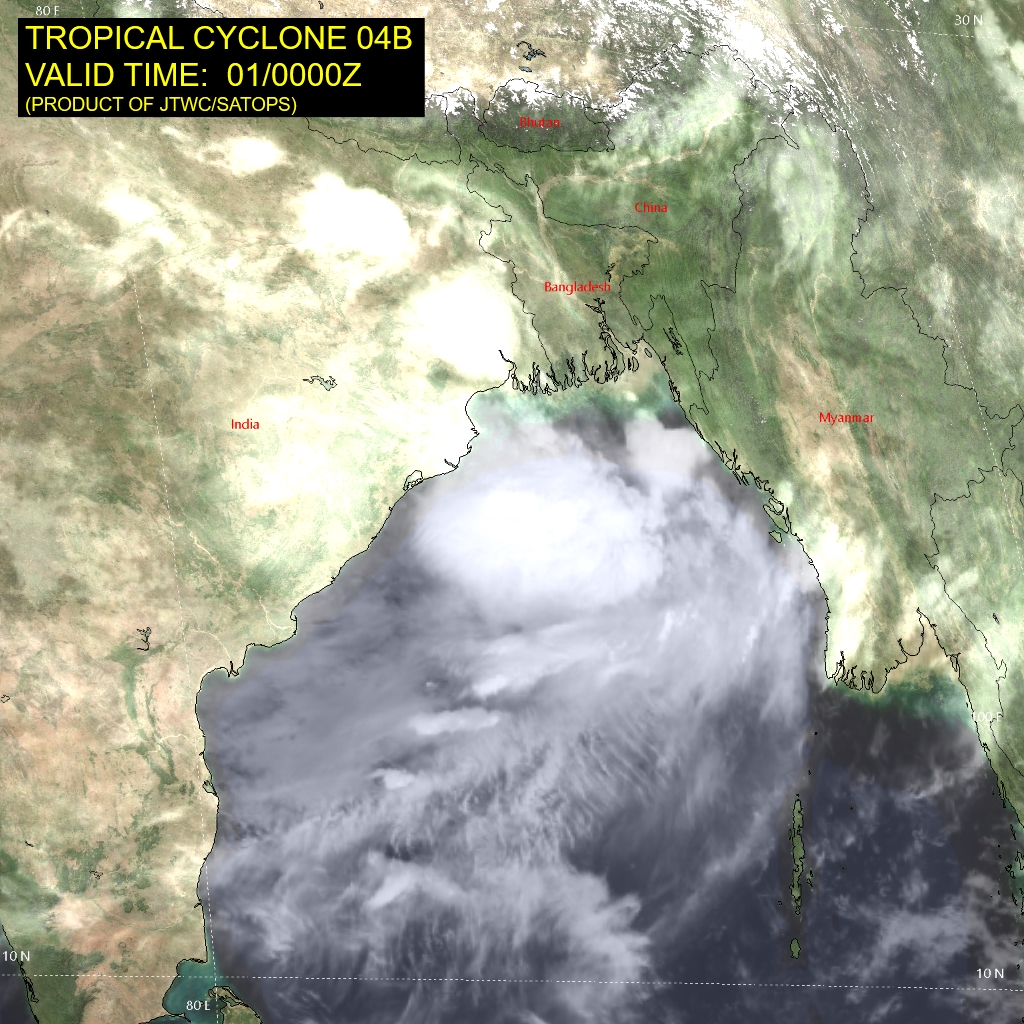
Yesterday’s well marked low pressure area over north Bay of Bengal (BoB) intensified in to a depression. Under favourable prevailing conditions, it strengthened further to deep depression, associated with winds in excess of 60 kmh. Deep depression is centered around 21°N and 91.5°E, about 150km south of Chittagong (Bangladesh). It is likely to move west-northwest and may pick up intensity for another few hours.
Joint Typhoon Warning Center ( Hawaii) has announced the system as tropical storm-4. Wind speed in association with tropical storm range between 34-47knots (62-88kmh). There is compact low level cyclonic circulation around the center and flaring convection to the south and west sector, as manifested in the satellite imagery. The weather system is in a supportive environment with warm sea surface temperatures and strong equatorward flow. However, the system is very close to the coastline and does not have room to concentrate further. Rather, interaction with the rugged terrain may lead to weakening without any further sharpening.

The deep depression is likely to move slowly and cross Bangladesh coast near beach town of Kaukata, sometime in the late evening, today itself. Thereafter, it will move across Gangetic West Bengal, with its peripheral reaching north Odisha. It is expected to weaken over land and move further stretching across Jharkhand, North Chhattisgarh, East Madhya Pradesh and neighbouring Uttar Pradesh.
The confluence zone ahead of the system has already deluged parts of Gangetic West Bengal and North Coastal Odisha. Coastal city of Bhubaneshwar was ravaged with exceptionally heavy rainfall. The city measured record 24hr rainfall of 259mm, ending 8.30 a.m today. Prior to this, the capital city had measured 173.8mm rainfall on 07thAug 2018. Normal rainfall of the city for the month of August is 374.6mm. Very heavy rainfall is expected over and around the city in the next 48 hours, likely to inch closer to the normal in the early days of August.
While over land, the weather system will give heavy to very heavy rains over Gangetic West Bengal, North Odisha, North Chhattisgarh, Jharkhand, Bihar, Madhya Pradesh and Uttar Pradesh in a staggered manner between 01st and 05th August. Eastern states of the country, namely West Bengal, Jharkhand and Bihar have accumulated large deficits during the first half of the season. This wet spell will lash all three states with heavy showers in their pockets and reduce the seasonal shortfall adequately.


