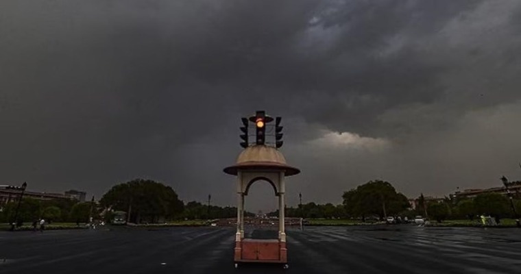
The national capital is a observing large fluctuations in winter weather conditions over the last couple of years. Last year, January 2023 received a normal rainfall of 20mm, but the rainy month of February recorded zero rainfall against the normal of 21.3mm. Contrasting conditions have been observed during this winter season. January 2024 had the distinction of remaining dry but February so far, in the first 5 days, turned wettest in the last 10 years by measuring 30.8mm rainfall. Though, weather conditions are expected to remain dry for the next one week, rains are likely to follow, a little later.
February is the rainiest winter month with an average of 21.3mm rainfall. However, it has a track record of being the most pulsating month, with rainfall as strong as 3 digits and as poor as zero, on more than one occasion in the recent past. The month of February also has the rare record of measuring zero rainfall on 3 occasions, in the last 5 years. It has overtaken the figure of average rainfall six times, in the last 15 years, including rainfall in excess of 100mm in 2013.

Base observatory Safdarjung had recorded more than the monthly average rainfall on the first day itself. Subsequent days measured light rainfall, including less than a millimetre in 24 hours. The wet spell was under the combined influence of a western disturbance over the mountains and induced circulation in the plains. The auxiliary system has moved away eastward, clearing the Delhi area, the western disturbance will last for one more day and the remnant affect tomorrow as well.
The sheet of persistent clouds will get smothered shortly, today itself. Tomorrow, Delhiites will see a fair amount of sunshine after the bout of thick fog in the morning hours. There is the likelihood of a drop in the minimum temperature, sliding to a single digit and further slipping to about 6-7°C, a day later. No rainfall is expected over and around Delhi for the next one week. The layer of high clouds may appear ‘off and on’ dimming the sunlight marginally. The fresh salvo of western disturbance will surely follow but not earlier than midweek next.
Image Credit: news24online


