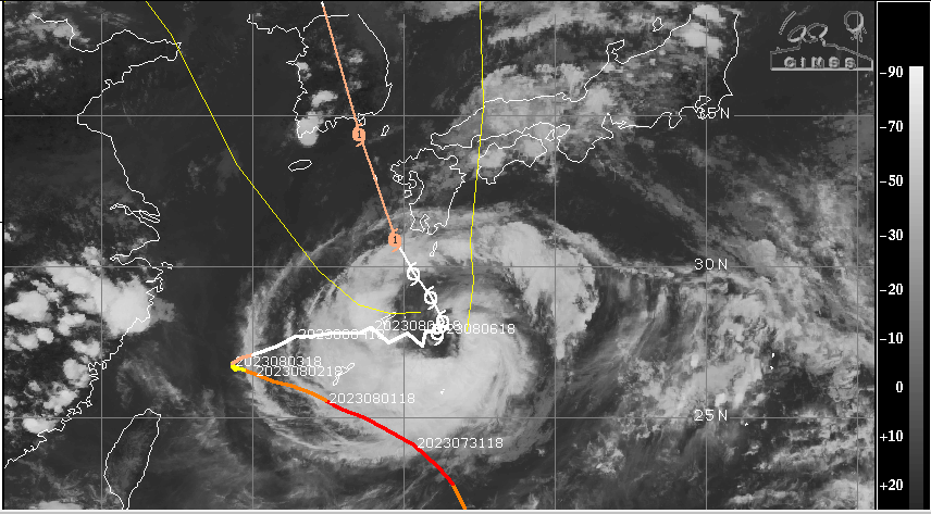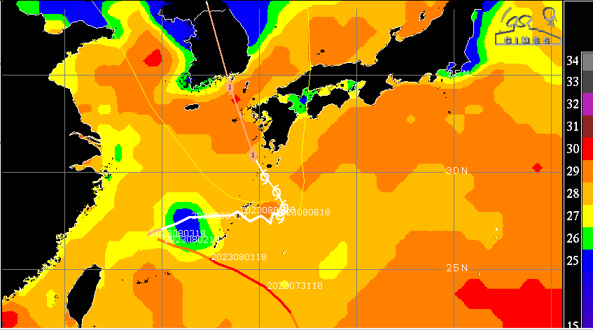
Super typhoon ‘ Khanun’ over the Philippines Sea has now travelled to East China Sea and is heading for South Korea. The super typhoon, after wandering over the Philippines Sea and South China Sea for nearly one week, has now weakened to a Cat-I equivalent hurricane. Due to unfavourable sea conditions, it is likely to drop its strength further to become tropical storm but only to revive later while heading for South Korea.

The typhoon is now centered around 28.2°N and 131.3°E over East China Sea. Its inner core is becoming slightly disorganized and therefore weakening temporarily. Presently, it is churning wind field with speed in excess of 100kmh. Shortly, the storm will move to the warmer waters with increasing outflow. Wind field will strengthen again to sustained speed of 140kmh, before ingressing Korean coastline. The typhoon s likely to pass west of Kyushu islands (southern chain of islands-Japan), passing through the Goto Islands. Eventually, the severe storm will make landfall in South Korea, west of Busan, on 10thAugust 2023. Yellow Sea on the left and Sea of Japan on the right of its track will keep the system live even after moving inland.
Though these typhoons track rather far from the Indian sub-continent, but they do have influence in mitigating the monsoon surge, thousands of kilometers away. Excess of typhoon activity in the West Pacific, Philippines Sea and South & East China Sea does not augur well for the monsoon stream over the Indian region. These large scale churners do sap the moisture carried by streaming monsoon westerlies from the Arabian Sea, racing across Bay of Bengal. These are also responsible for suppressing formation of monsoon systems over the Indian Seas. Also, they have a tendency to drag the monsoon trough, north of its normal position, close to the foothills of Himalayas. Resultant weak monsoon conditions can last for days together and run in to weeks, sometimes....


