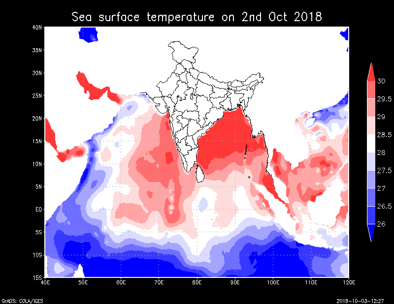
Indian Ocean with proximity of Arabian Sea and Bay of Bengal on either side, is presently a hot basin for the development of cyclonic storms in the region.
We have been reiterating that at present, ITCZ (Inter Tropical Convergence Zone) is lying close to the equator, with series of embedded cyclonic circulations, moving from east to west direction. This has led to a cyclonic circulation presently lying over Lakshadweep Islands and Southeast Arabian Sea.
Besides this, another cyclonic circulation is over Southwest Bay of Bengal, with a trough extending between them. Both the systems would be complimenting each other, i.e. they would be giving more strength to each other, movement would become slow or may be even stationary for some time and spell of heavy rains would be prolonged.
Besides this, the system is moving favourable weather conditions, with warm sea surface temperatures to the tune of 29°C or 30°C and low wind shear. According to statistics, 27°C is the threshold for formation of any tropical storm.
 According to Skymet Weather, we are expecting a low pressure area or a well-marked low pressure area over Southeast Arabian Sea off the Kerala coast around October 5.
The system would undergo rapid intensification in subsequent 48 hours and induce a depression and further into a deep depression in quick succession. In fact, chances are bright that would see this system intensifying into a cyclonic storm over Central Arabian Sea during this time only. If this happens, this tropical storm would be named as ‘Cyclone Luban’.
Now, this is the position, where they would leave lots of uncertainty in terms of intensity and direction. From here, it could head for Oman or it might recurve towards Indian coast of Gujarat.
In fact, even if system gets closer to Oman, threat does not get over. There have been instances when the cyclonic storm despite being few hundred kilometers away from Oman still re-curves towards Gujarat. As they get closer to Oman, these systems encounter with steering winds which might take away them back to Gujarat or Pakistan. If these conditions arrive it would be around October 12.
All this while, the weather system would be moving in northwest direction, shifting slightly away from the Indian coast. However, spiral bands of this potential storm would be extending beyond 500 km, putting West Coast on alert for some torrential rains with Kerala bearing the maximum brunt.
Rain Alert
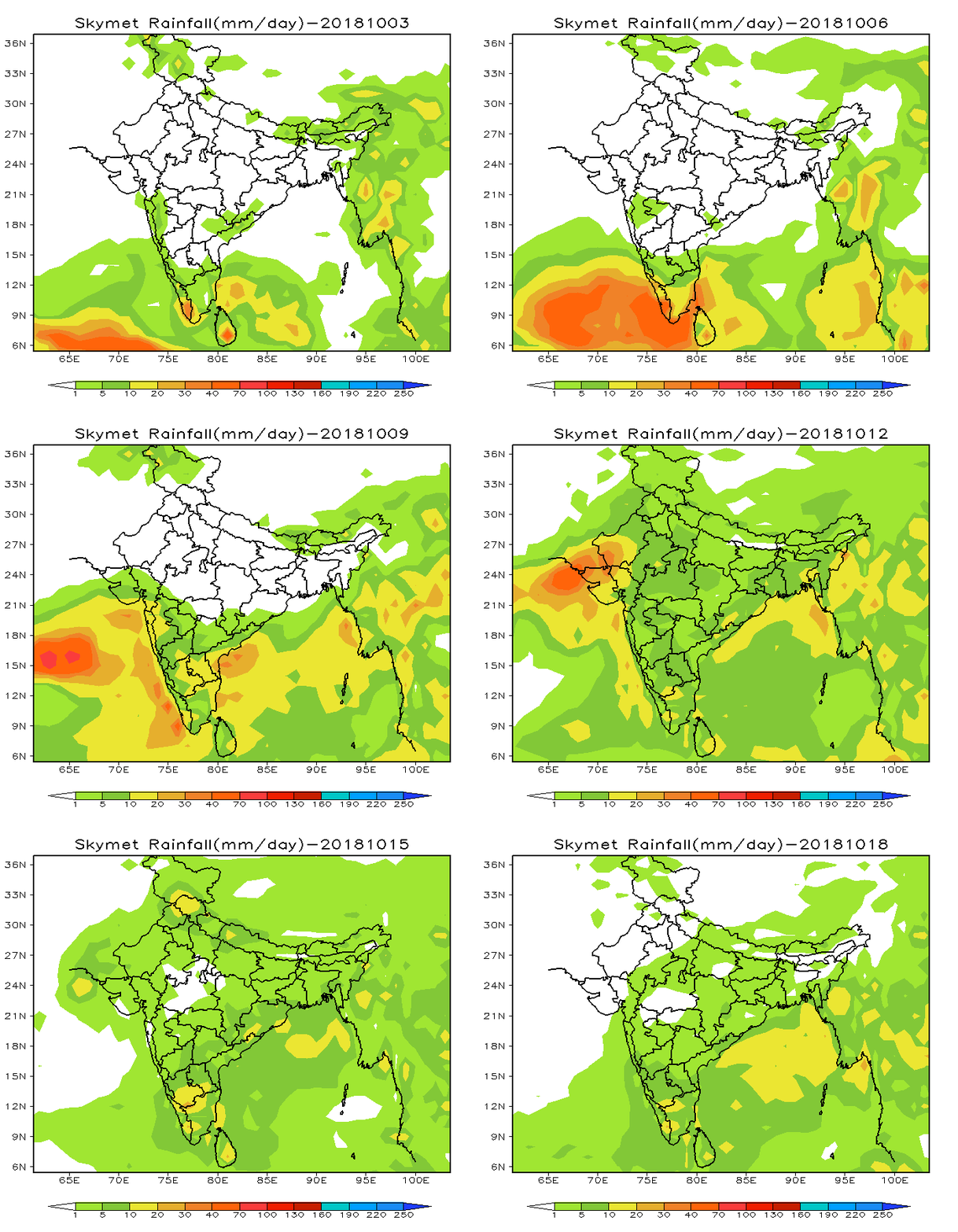
October 4:In wake of the system, Kerala has already started recording moderate rains, with few heavy spells. The state would continue with these rains with few heavy rainy spells for the next 24 hours.
October 5:Heavy to very heavy rains to lash Kerala, with few parts of Coastal Karnataka would too begin with some rains. Under the influence of this system, light rains with thunderstorm cannot be ruled out over Goa and Coastal Maharashtra.
 October 6-7:Torrential rains would continue to mar Kerala and Coastal Karnataka. Kerala stands a chance of flash flooding, landslides and over flowing of dams. Moderate rains are also over Goa. Coastal Maharashtra would see light rains with few moderate spells.
October 8:No respite likely from heavy rains in Kerala and Coastal Karnataka. Kerala stands a chance of flash flooding, landslides and over flowing of dams. While Goa and Coastal Maharashtra would see light to moderate rains, Gujarat would also see light rains.
Sea conditions would remain rough to very rough along and off the coast throughout from October 5-8. Fishermen and locals are advised against venturing out in the sea.
Image Credit:en.wikipedia.org
Any information taken from here should be credited to skymetweather.com


