It is the season of Cyclonic Storms for India. As a pattern, basins remain quite active till November before a gradual slowdown thereafter. After thedevastation caused by Storm Bulbulrecently, India successfully skipped the havoc brought along by the succeedingStorm Nakri. However, the threat isn’t over yet as another storm is ready and brewing over the Pacific Ocean which might soon emerge over the Bay of Bengal in a few days. Looking back into the data, 50% of such storms move further westwards and then affect the Bay of Bengal. Such storms are also one of the major sources of Indian cyclones.
These storms have a pattern of making more than one landfall while covering a long sea travel lasting many days.
Moreover, two new storms can be traced over the Pacific Ocean at present, both over the western end. One is the Tropical Depression ‘Kalmaegi’ which can anytime start becoming a storm. Another one is ‘Fengshen’ which is already a storm but is located far to the West.
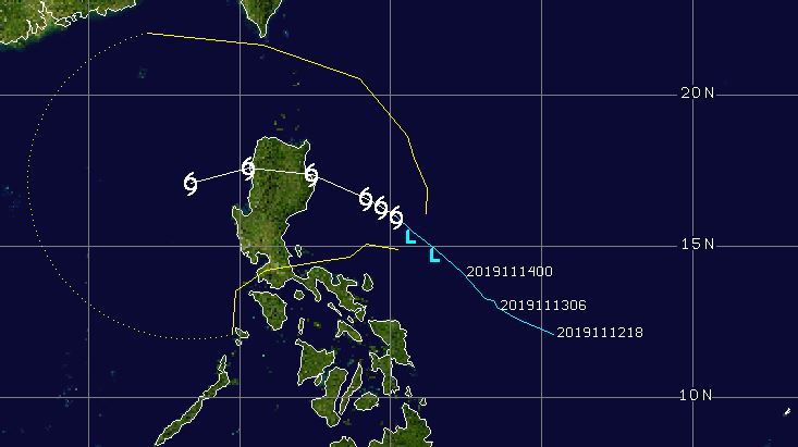
Out of these two storms, Kalmaegi holds a devastating potential and might soon threaten Philippines by becoming a Tropical Storm reaching northern parts of Manilla after about three days, while lashing the coast with strong winds gusting up to 100 kmph.

After making a landfall, Kalmaegi will move westwards, and might re-emerge again on the fifth day in South China Sea while picking strength yet again.
The other storm namely Fengshen is a little less threatening for India as it’s located deep in the sea far to the West, affecting just a few islands. The storm has a peculiar track making a 3/4th circular loop.

However, the system doesn’t seem coming near any major landmass and will hang around the same area for the next few days.
However, as these systems are known for defying tracks, a continuous watch on their paths is a necessity.
Image Credits– Livemint
Any information taken from here should be credited to Skymet Weather


