
Around the globe, the cyclone season is almost coming to an end. North Atlantic Ocean, East and West Pacific Ocean along with Arabian Sea and Bay of Bengal are the basins for the formation of cyclones. West Pacific Ocean is the most active cyclone basin in terms of formation of cyclone storms. As per the records, 30% of total global tropical cyclone develops in this area only.
On an average there are about 16 typhoons and about 26 tropical storms which occur every year on an average in the West Pacific Ocean. Storms can occur anytime between May 1 to November 30. On the contrary, they have got no official bounds. As per the experts, month of August is generally the peak season for them.
This basin witnessed 26 typhoons in the year 1964 and the lowest was observed in 1999 when only 5 typhoons occurred. Coming to this season, the basin has already seen 14 typhoons and 17 tropical storms. The first super typhoon titled, Jelawat for this season was formed on March 30 which was way much ahead of its usual time.
Typhoon Maria has been the strongest typhoon by far for this season which occurred in July. The windspeed was around 260kmph which affected the regions of Taiwan, China, Guam and Philippines.
The east Pacific Ocean cyclones are called Hurricanes and this season 13 hurricanes have been witnessed out of which 3 were of category 5(Highest) and 7 were of category 4. Whereas, south of Atlantic Ocean remains free from storms. The hurricane season in North Atlantic is from June 1 till November 30. They too have no official boundaries and can occur anytime. Any hurricane above Category three and five are termed as ‘major hurricanes.’
This time NOAA (National Oceanic Atmospheric Administration) predicted above average hurricane season which later was revised to normal. Initially, it was predicted that number of hurricanes will be between five and nine and other normal storms will be between 10-16.
This season, in mid-October Michael was the strongest hurricane which stuck Florida and was marked under Category 4.
Coming to Indian Seas, prominent period for the storms to take place is usually around pre and post monsoon which is like from March to May and October to December, respectively.
This year, till date six cyclones have been witnessed. Three were in the Arabian Sea and rest three were seen in Bay of Bengal. Cyclones Sagar, Mekunu and Luban occurred in Arabian Sea out of which Mekunu was the strongest. Whereas in Bay of Bengal, Cyclones Daye, Titli and Gaja occurred amongst which Titli was the strongest.
As per Skymet, presently we don’t see any such weather systems which can give birth to any major storm. In one week’s, time a depression can form over Bay of Bengal which may give extensive rains over Tamil Nadu and Andhra Pradesh.
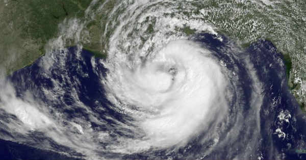
Image Credit: NOAA
Please Note: Any information picked from here must be attributed to skymetweather.com
