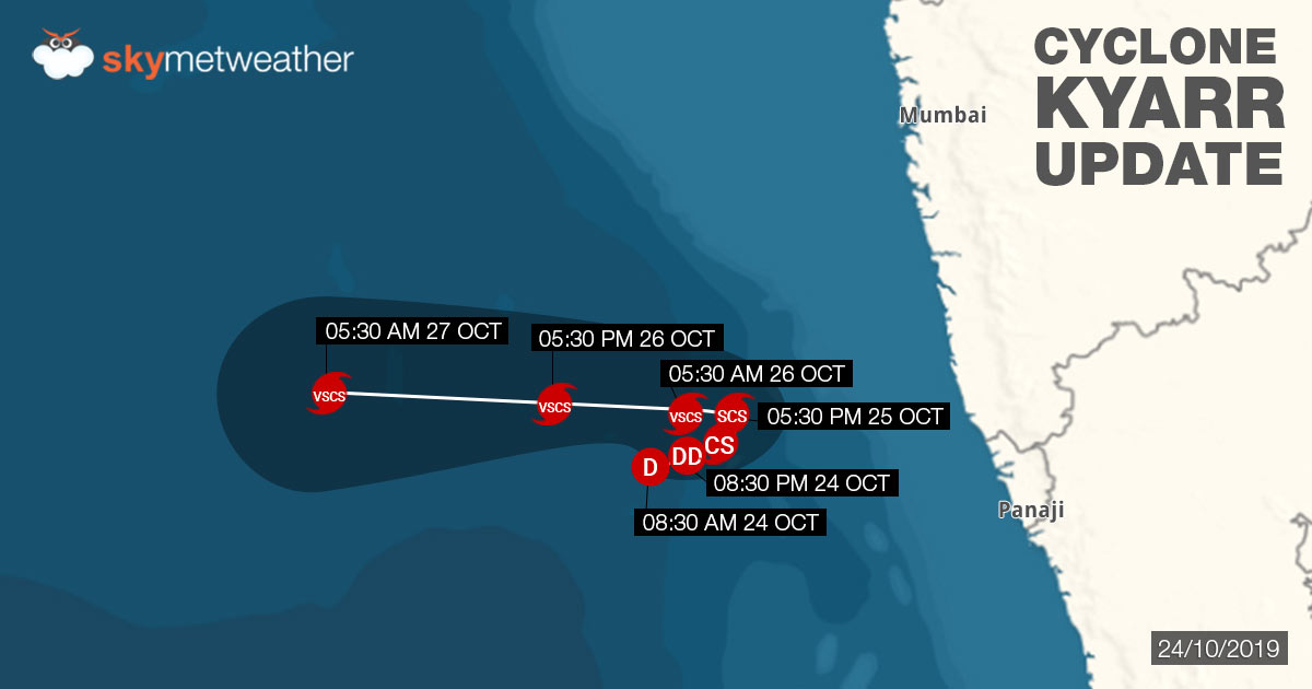
The depression in East-Central Arabian Sea has intensified not a deep depression and is likely to become acyclonic storm Kyarranytime now. The system is presently centered at Latitude 15.7°N and Longitude 71.3°E, about 250 km west-southwest of Ratnagiri, 400 km southwest of Mumbai and 1860 km east-southeast of Salalah, Oman.
As reiterated, the deep depression would continue to track north-northeast, closer to the coast till October 25. Thereafter, the maidentropical stormof is likely to re-curve and move westwards towards Oman and adjoining Yemen coast.

However, by the time, the system transforms into Cyclone Kyarr, it would start drifting away from the Indian coast. Thus, majority of the weather activity would be confined to sea. However, peripherals of Kyarr would continue to govern the weather over the West Coast but with much reduced intensity.
During the next 24 hours, light to moderate rain and thundershowers with isolated heavy falls across CoastalKarnataka, Goa and Coastal Maharashtra. However, there would be strong winds to the tune of 40 kmph -50 kmph, gusting up to 65 kmph. Sea conditions would be rough to be very rough, due to which fishermen are not advised to venture out in the sea for next 48 hours.
With the long sea travel ahead along with extremely warm sea surface temperatures settling between 30 degree Celsius and 35 degree Celsius, we expect potential Cyclone Kyarr to further intensify into a severe cyclone. In fact, indications are there that the storm may even become very severe cyclone during the next 72 hours.
Image Credit: NDTV
Any information taken from here should be credited to skymetweather.com


