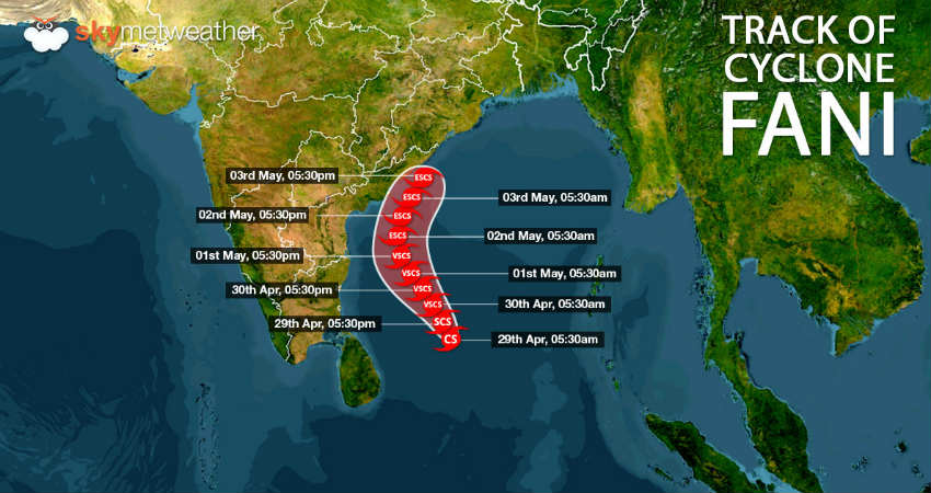
Cyclone Fani has had a long journey so far, but there not has been any clarification on its track. Initially weather models had been indicating that system might hit North Coastal Tamil Nadu. Thereafter, it was anticipated that Fani would re-curve and head towards Bangladesh.
However, weather models are now indicating towards new location. According to Skymet Weather, there are now bright chances that Fani might re-curve north-northeast and cross Odisha and adjoining North Coastal Andhra Pradesh. However, one thing is now ruled out that the Cyclonic storm Fani is now likely to escape Tamil Nadu.
As per weathermen, the orientation of East Coast is such that Fani while moving north-northeast would not be able to avoid Odisha coast. Places like Kalingapatnam, Gopalpur, Puri and Paradip would be under scanner for cyclone landfall.

However, one must not forget that during April, climatology does not support cyclonic storms moving in west direction towards East Coast. So far, almost all the cyclones brewing in Bay of Bengal have made landfall either over Myanmar or Bangladesh.
At present, the cyclonic storm is centered at Latitude 9.2°N and Longitude 86.9°E over southeast Bay of Bengal and adjoining areas. This is around 610 km eastsoutheast of Trincomalee, Sri Lanka, 840 km southeast of Chennai and 980 km southsoutheast of Machilipatnam.
Fani is already showing characteristics of a severe cyclone and is likely to intensify into very severe cyclone in the next 24 hours. It would further gain more strength and become extremely severe cyclone in subsequent 24 hours.
Image Credit:en.wikipedia.org
Any information taken from here should be credited to skymetweather.com


