Earlier speculations of likely tropical storms over the Bay of Bengal (BoB) are getting hardened. Evidence has now built up further for the maiden cyclone of the pre-monsoon season anytime during next week. However, it is a bit early to comment on its likely track and intensity. There has been a great deal of divergence amongst various numerical models and clarity will come only after the weather system gets configured judiciously.
A broad cyclonic circulation is likely to form over Southeast BoB and South Andaman Sea on 05th May. This feature will get organised and is expected to percolate to the ocean surface as a low-pressure area around 06-07 May. All the decisive parameters seem to be getting aligned favourably. The low pressure is likely to intensify as depression/ deep depression around the 08th night. Hereon, the timelines, track and intensity will be nearly conclusive.
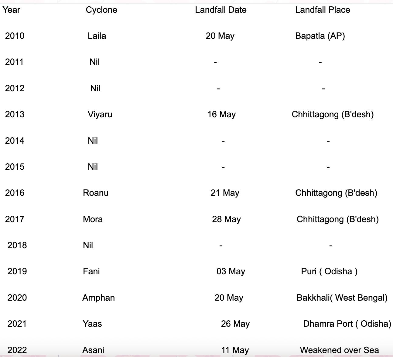
The coastline from Andhra Pradesh to West Bengal is vulnerable to the strike of pre-monsoon cyclones during this month. Going further, Bangladesh and Myanmar also become susceptible to the landfalling of tropical storms, more so for Bangladesh. History of such storms is a testimony that the east coast of India and Bangladesh has been smashed more than once, since May 2010. The Bay has remained mysterious for a churning range of cyclones, right from simple tropical storms to super cyclones battering the Indian coast and Bangladesh.

Bay of Bengal has hosted mild storms like Viyaru and Roanu (cyclonic storms) and catastrophic super cyclones like Amphan. Prior to 2018, most of the storms skirted the Indian coastline and headed for Bangladesh. However, for the last 4 successive years, between 2019 and 2022, the state of Andhra Pradesh, Odisha and West Bengal has been struck fiercely. Fingers crossed for potential storm Mocha.


