Although late but pre-Monsoon rains and thundershowers have finally picked up pace in southern parts of the country. According to Skymet Weather, a trough extending from this East Bihar to interior parts of Tamil Nadu across Gangetic West Bengal, Odisha, Coastal Andhra Pradesh, Telangana and South Interior Karnataka would be helpful in giving more rains over Tamil Nadu, Kerala and parts of South Interior Karnataka.
The experts have to say that this trough is semi-permanent feature during the pre-Monsoon season that keeps oscillating east and west, at times over Kerala and at times pass through interior Tamil Nadu. Thus, South Interior Karnataka including Bengaluru is all set to witness intermittent rain and thundershower activities.
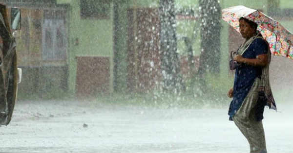
Kerala has already been receiving pre-Monsoon rain and thundershowers since last many days. These rains are expected to continue for the coming days as well. The intensity would be much more in Kerala and interior Tamil Nadu. However, coastal parts ofTamil Nadu might also witness on and off rain activities.
Chennaiwhich has been experiencing dry weather for last many days would now get to witness these isolated pre-Monsoon showers during next two to three days. Still it is believed that rains would remain confined to interior parts of Tamil Nadu and Kerala only.
Coimbatoreand Kochi have already witnessed good rains. In the past 24 hours,Thiruvanathapuramin Kerala has recorded around 33 mm of rains. While, Cochin saw nearly 38 mm of rains with high humidity levels over the same.Kozhikodeand Coimbatore both recorded 19 mm of pre-Monsoon rains.
Thunderstorm accompanied with gusty winds wherein wind speed reaching 30-50 kmph and lightning at isolated places are very likely over Tamil Nadu and Kerala.
Along the trough, wind discontinuity or confluence zone is also expected to develop over interior parts of Tamil Nadu and Kerala leading to moisture incursion from Bay of Bengal and Arabian Sea. Thus, resulting in further continuation of rain and thundershowers over these two states for the coming three to four days.
Also Read: Pre Monsoon rains to pick up pace in Hyderabad, Telangana, Andhra Pradesh in 24 hours
Image Credit: The Weather Channel
Any information taken from here should be credited to Skymet Weather


