Updated on June 7, 10:30 PM: Cyclone Biparjoy becomes Very Severe Cyclonic Storm, to maintain intensity
Cyclone Biparjoy has become a Very Severe Cyclonic Storm during the evening hours of today. As far as the track of the storm is concerned, it is going to initially move northward, thereafter taking a northwestward path.
The system is expected to remain a very severe Cyclonic Storm for the next three to four days. Since the storm has a long sea travel, it may intensify further as well due to favourable conditions.
As the storm remains far away from the coastline, in deep waters, the West Coast of India remains free from any significant weather activity or any kind of threat from the Cyclone. Skymet will keep you updated regarding the storm's status.
Published on June 7, 1.45 PM:BIPARJOY To Intensify Into Very Severe Cyclonic Storm Shortly, To Maintain Safe Distance From Coast
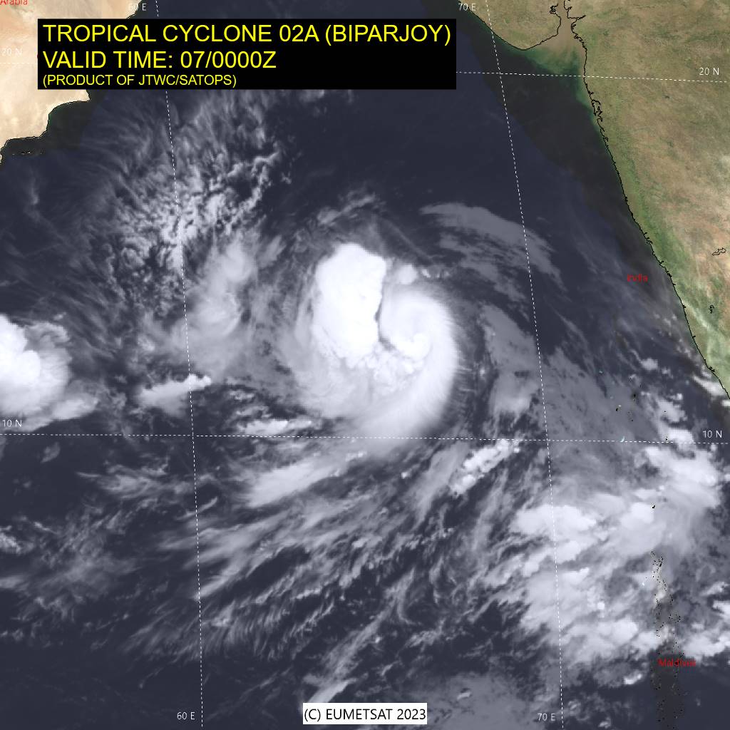
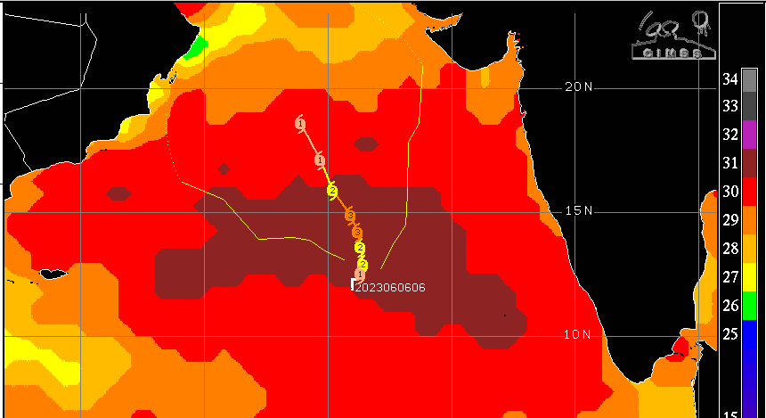
The maiden tropical storm of this year in the Arabian Sea ‘BIPARJOY’ intensified into a severe tropical cyclone yesterday. It is now centred around 12.5°N and 66.3°E, about 900 km southwest of Goa and 1000 km from Mumbai. The storm has moved northeastward very slowly in the past 6 hours. Now it is expected to change track and move more northward, keeping a safe distance from the coastline.
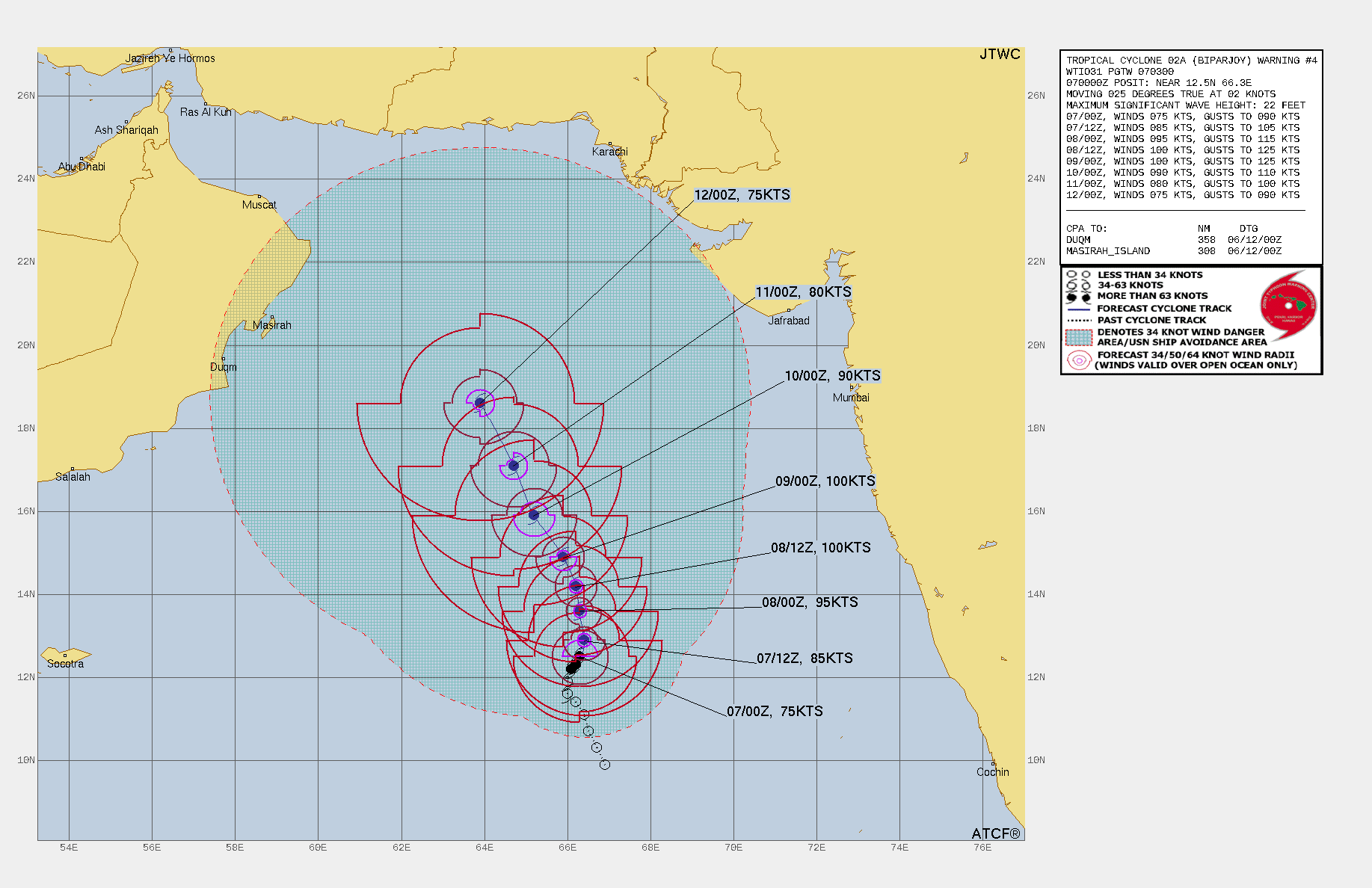
The cyclone is moving over the East-Central Arabian Sea with a speed limited to 10 kmh. It is sailing in a favourable environment with a very warm sea surface (30-31°C) and low wind shear. Its strong poleward and equatorward flow are suggestive of rapid intensification to a very severe cyclonic storm in another 6 hours. This will possibly become equivalent to a category-3 hurricane over the next 48 hours and will be packed with winds in excess of 175 kmh. The storm may even be upgraded to an extremely severe cyclone after 48 hours, albeit for a short duration. It is likely to move northwestward tomorrow onwards without impacting severely the Indian coastline.
There is no agreement between the numerical models on its track in the final leg. Most models are moving the storm away towards Oman and the Strait of Hormuz, few of these take it closer to Pakistan/ Makran coast. Freak tracks also indicate its movement towards Kutch (Gujarat) as a weak system. As such, because of cooler temperatures over the North and Northeast Arabian Sea, these storms have a tendency to wear out before making landfall.
Tropical storms over the Arabian Sea are not frequent in the month of June. Ingress of the monsoon stream diminishes the development of cyclones. ‘NISARGA’ was the last storm over the Arabian Sea between 01-04 June 2020. This was a Cat-2 equivalent hurricane, striking the coastal town of Alibag (Konkan) as a severe cyclonic storm on 03rd June 2020.
The probability of Biparjoy sparing the Indian landmass from its fury is rather large. As these storms are notorious for defying the timelines and track, they need to be observed closely. In any case, the storm will keep surfing over the deep ocean waters for the next 3 days without any proximity to the landmass.