
Very Severe Cyclonic Storm ‘Biparjoy’ has moved nearly northward and very slowly in the past 12 hours. The cyclone is lying over the east-central Arabian Sea and is centred around 14°N and 66°E today morning. The storm continues to track at a very safe distance from the Indian Coast and is abeam Honnavar (coastal Karnataka) at a distance of about 800km. It is likely to move north-northwest for the next 36 hours over the open sea waters.
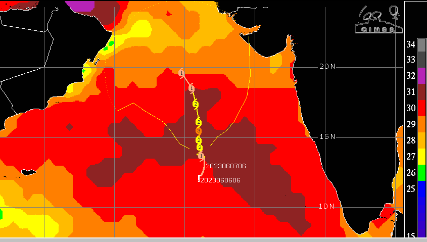
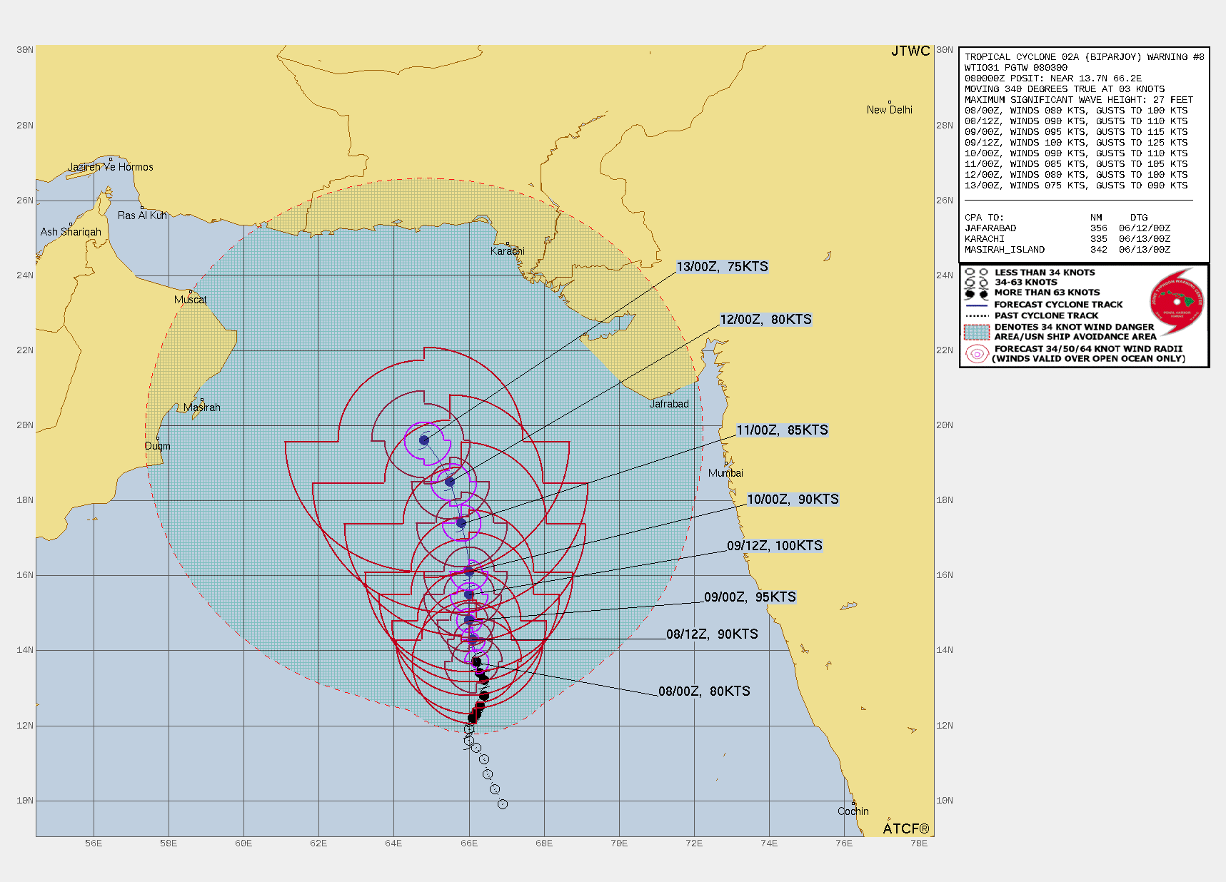
After initial rapid intensification, the storm has struggled a bit to gain commensurate strength in the past 12 hours. The proximity of the Sub-Tropical ridge has slowed the storm considerably. However, the storm will retain its strength of ‘Very Severe’ for the next 24 hours. The ocean surface is very warm maintaining a temperature of 31°C. Favourable steering current, weak wind shear and strong heat potential may lead to further intensification of the cyclone to become ‘extremely severe’ by tomorrow evening. The cyclone may not be able to sustain the status of a Cat-3 equivalent hurricane for long due to more wind shear, decreased outflow and relative cooling of the sea surface. Accordingly, after 36 hours, the storm will steadily weaken while over the sea and may keep dropping its strength right up to the coastline. Biparjoy will head for Pakistan/Iran coast or at best move towards Oman and the Strait of Hormuz ( Persian Gulf).
Biparjoy is the maiden storm of this year in the Arabian Sea. It is not very common for the Arabian Sea to host ferocious storms in June. The last severe cyclonic storm ‘NISARGA’ evolved between 01st and 04th June 2020 and struck Alibag over the Konkan coast. A recent powerful cyclone over the Arabian Sea was ‘Tauktae’ in May 2021. Tauktae was Cat-4 equivalent cyclone over the Arabian Sea between 14th-19th May 2021. The storm had tracked close to the West Coast and moved nearly northward to cross the Saurashtra coast between Diu and Una on 17th May 2021.


