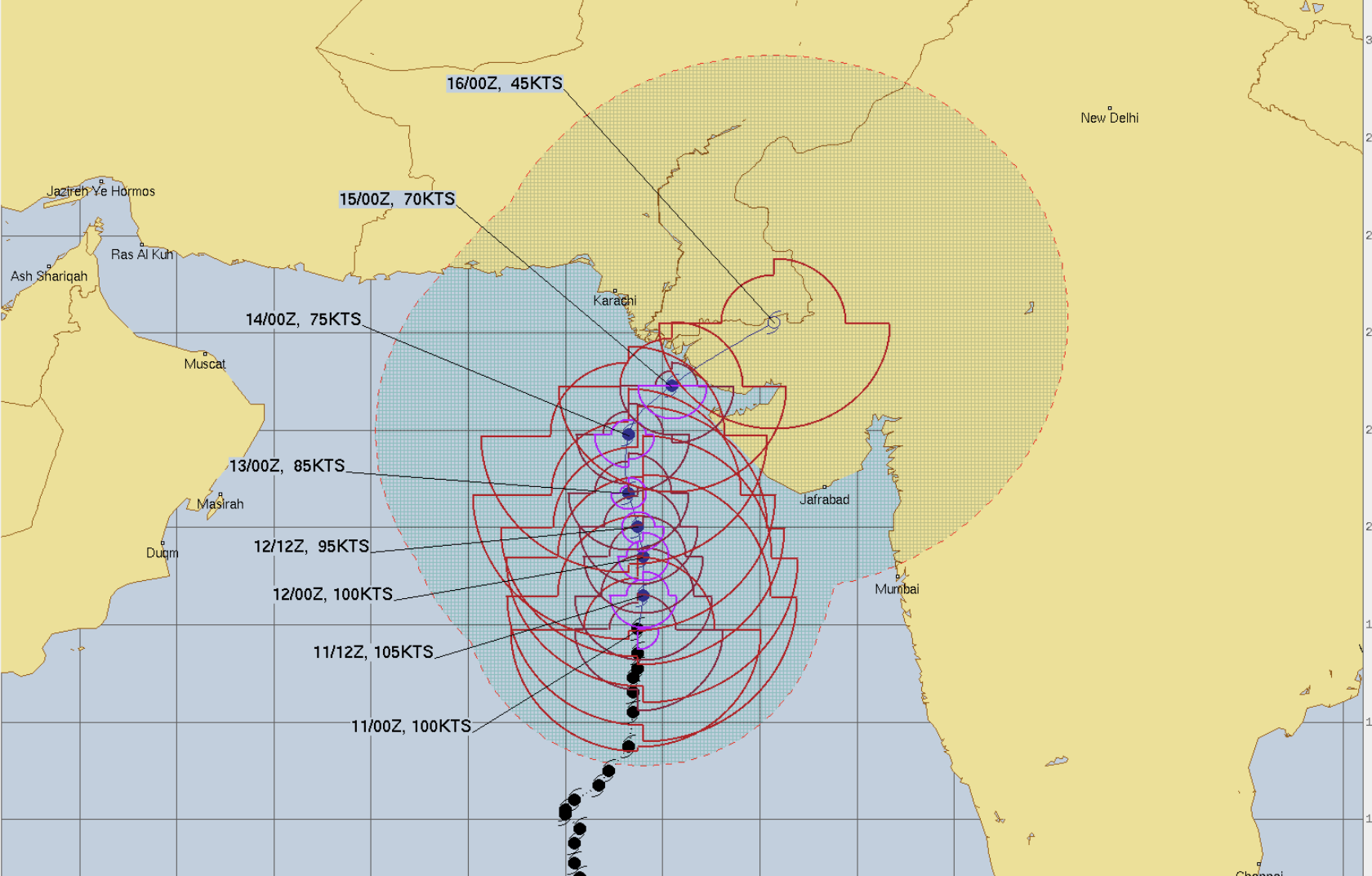
Cyclone Biparjoy has now become an extremely severe Cyclone now as had bene predicted earlier. The storm is centered around 18 degrees N and 67.5 degrees East. Winds around the system are at about 100 knots which means about 185 kmph.
The system is now moving more of a northward track and will continue to do so for the next 24 hours, retaining its intensity as an extremely severe Cyclonic Storm. Thereafter, because of lower temperatures in the northern parts of Arabian Sea, it will start to weaken.
At that time, it will become a grade lower, CAT 2 Hurricane equivalent, i.e. a very severe Cyclone, it is currently CAT 3 equivalent. After 48 hours, it will weaken further but retain its intensity of a severe Cyclonic Storm, CAT 1 equivalent.
From thereon, after it crosses the sub tropical ridge, it is likely to recurve and move more of northeastward, towards the Kutch region. The system is likely to skirt Saurashtra Coast and it will come abeam Okha, Jamnagar, and Porbandar at about a distance of more than 100 km from the coast.
Then, the system is expected to recurve towards the extreme northern parts of Kutch, around the Delta region, and may strike very close to Naliya, around June 15. After crossing inland, it will weaken due to the terrain.
Parts of Gujarat i.e. particularly the coastal parts may see heavy rains as it will be in the strike range of the storm. Even the Kutch region is vulnerable to some intense weather activities. Interior regions of Gujarat will remain safe from intense weather.


