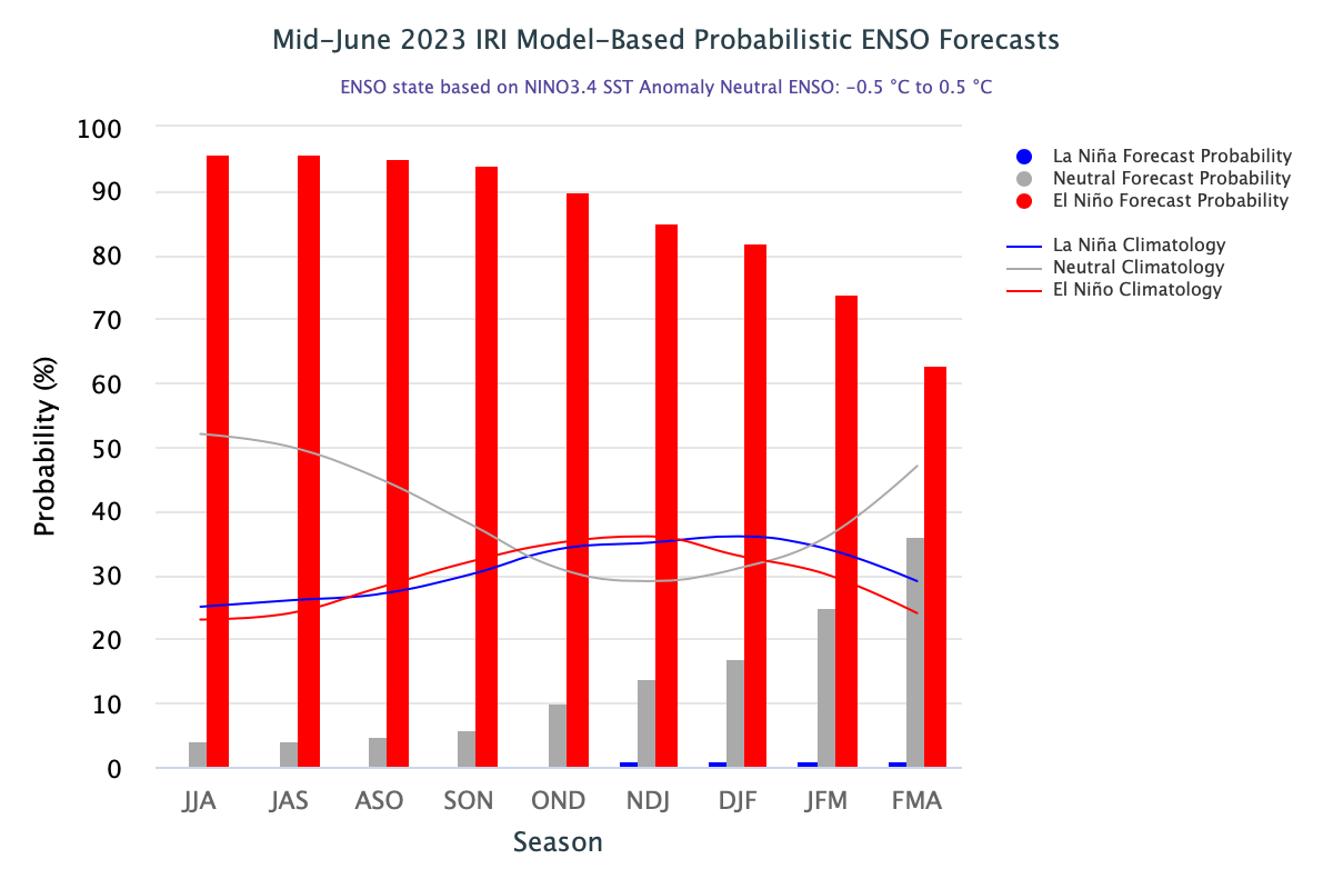
Central and eastern Pacific sea surface temperatures (SSTs) currently exceed the El Nino threshold. Models suggest further warming of the Tropical Pacific Ocean. The ENSO outlook remains at ‘El Nino Alert’. Going by the records, when El Nino Alert criteria were met in the past, an El Nino event developed around 70% of the time.
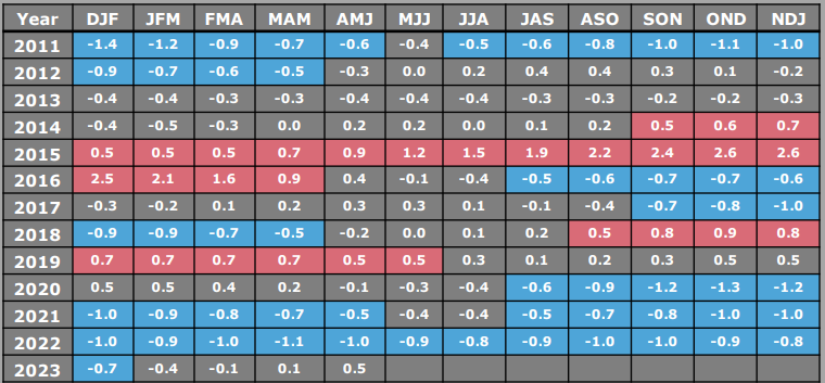
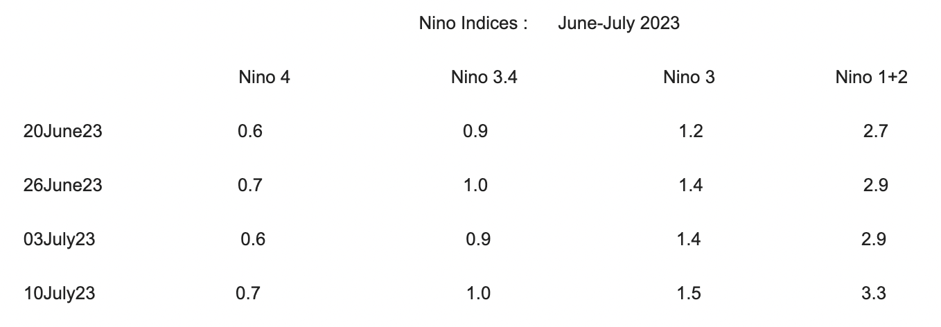
ENSO: All four Nino indices have maintained values above the threshold mark of 0.5°C for the last 6 weeks. Nino 1+2 has been exceptionally hot at 3.3°C, equaling its earlier highest record on 13 July 2015. Nino 3.4, the principal measure of ONI(Oceanic Nino Index) was more or less stable at +1°C for the last 4 weeks. The quarterly ONI for April-May- June has the first time touched the threshold mark of 0.5°C. For an El Nino event, this needs to sustain for consecutive 5 quarters.
The Southern Oscillation Index (SOI) which had earlier turned -VE, has risen back to a neutral level. The average SOI for May 2023 was -1.0 and now for June 2023, it stands at +0.3. The 90-day SOI remains close to, but just short of El Nino level. This means that the ocean and atmosphere have yet to enter in to sound coupling which is essentially needed for a full-fledged El Nino event.
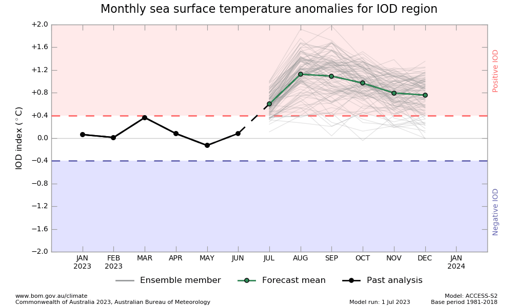
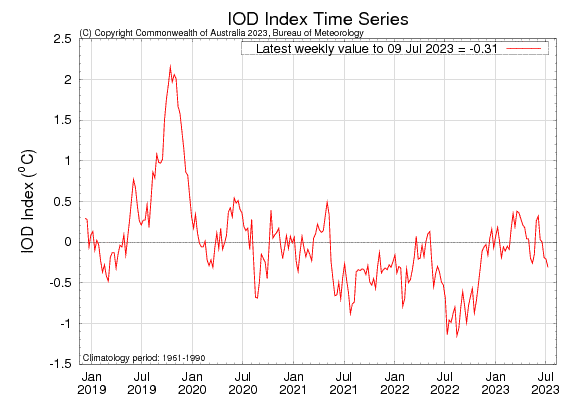
IOD: The Indian Ocean Dipole is currently neutral. The IOD index for the week ending 09th July 2023 was -0.31°C, almost nearing the negative threshold. This is the lowest value since 06 Nov 2022. Though the models suggest a positive IOD likely to develop but the model output for June 2023 and July 2023 so far, finds a mismatch.
Models have predicted +VE neutral IOD, against the actual read of -VE neutral for the last 3 consecutive weeks. Strong positive IOD does provide rescue from the drying effect of El Nino and has the potential to neutralize its scars.
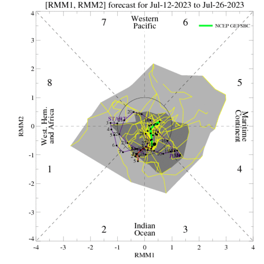
MJO: The Madden – Julian Oscillation is currently weak or indiscernible. Earlier, the MJO with weak amplitude remained over the Indian Ocean and the observations continue to show a disorganized MJO meandering over the Indian Ocean and Maritime Continent in Phases 3&4, till the last week of July. It may mildly support the formation of a monsoon system over the Bay of Bengal during 3rd week of July.
ENSO-related sea surface temperature anomalies in the Pacific and Indian Oceans are believed to be a primary factor responsible for the intra-seasonal variability of the monsoon. Also, intra-seasonal oscillations are an important component of monsoon variability. They are responsible for several active and break sequences occurring within each monsoon season. Monsoon seems to be entering into an active phase shortly, enhancing rainfall activity over the central and western parts of the country.


