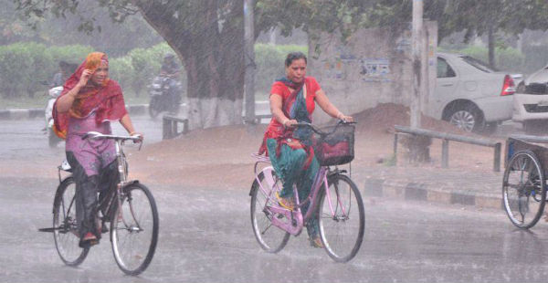
Despite the fact that Southwest Monsoon has not yet reached the state of Haryana, it is still one of the rain surplus state of the country with the rainfall statistics being 106% surplus as on June 19. On and off showers have been showing up in parts ofHaryanaand this has led the rainfall statistics to increase and climb high.
In fact, the last 24 hours have also been blessed with some good showers over the parts of the state. Further, these rainy spells are likely to continue lashing parts of the state. Moreover, rains in districts like Ambala, Bhiwani, Faridabad, Fatehabad, Gurgaon, Hisar, Jhajjar, Jind, Kaithal, Karnal, Kurukshetra, Mahendragarh, Mewat, Palwal, Panchkula, Panipat, Rewari, Rohtak, Sirsa, Sonepat, Yamuna Nagar are expected during the late afternoon or evening hours today.
Click the image above to see the live lightning and thunderstorm across Haryana
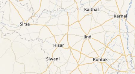
Within a span of the last 24 hours from 08:30 am as on Monday, Hisar witnessed 36.7 mm of rains,Gurugram4 mm and Karnal recorded light rainy traces of 2 mm.
[yuzo_related]
Skymet Weather reiterates that the reason for these showers can be attributed the Western Disturbance over North Pakistan and adjoiningJammu and Kashmir which has now induced a cyclonic circulation over Central Pakistan and adjoining NorthwestRajasthanandPunjab. Moreover, a trough is also seen extending from this system up to eastern parts of the country.
These rains are considered to be beneficial for the Kharif crop for restoring the soil moisture. In the wake of all the three weather systems, rains are likely to keep showing up in parts of Haryana.
Thus the districts in West and North Haryana likeAmbala, Karnal,Kurukshetra, Hisar, Gurugram, and Faridabad can anticipate on and off good showers to continue for the next 2-3 days. These rains are expected to further increase the rainfall statistics across Haryana.
ImageCredit: Hindustan Times
Any information taken from here should be credited to skymetweather.com


