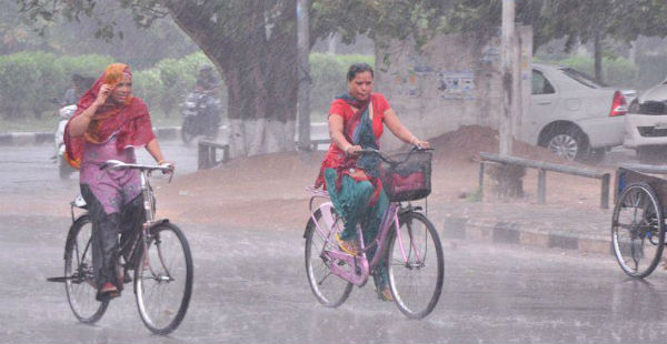
The weather over the northwestern plains has been dry since last many days. Even though, isolated dust storm and thunderstorm activities were witnessed in between but no significant weather activities were observed.
[yuzo_related]
The maximum temperatures also remined very high over few places of South Haryana and Rajasthan. Some places even witnessed heatwave conditions. Now also many pockets of Rajasthan are still reeling under severe heatwave conditions and recording their maximum temperatures above 45˚C.
Due to the cyclonic circulation over Punjab and adjoining area since last few days, pre-Monsoon rains have once again resumed over Punjab, Haryana and North Rajasthan. Many parts of these states received moderate thundershower and dust storm activities. In fact, a few areas in Haryana even saw heavy rainfall activity
In the last 24 hours from 8:30 am on Tuesday, Karnal recorded a whopping 130 mm of rain, Narnaul 90 mm, Amritsar 28.6 mm, Jalandhar 24 mm, Chandigarh 20.2 mm, Ludhiana 15.6 mm, Kurukshetra 5 mm, Sirsa 6 mm, Patiala 4.6 mm and Hisar 0.7 mm.
Currently, a trough is extending from Punjab to East India across Haryana, parts of Rajasthan and West Uttar Pradesh. Therefore, we expect on and off pre-Monsoon activities to continue over these states for at least next 24 hours.
Thereafter, intensity and spread of these rains is likely to decrease over the area. We expect rain and thundershowers to commence once again around June 10 over isolated pockets of these states which are likely to continue for the next 3-4 days.
However, during that time these activities will remain patchy and will not have much impact of temperatures.
Image Credit: Times of India
Any information taken from here should be credited to skymetweather.com


