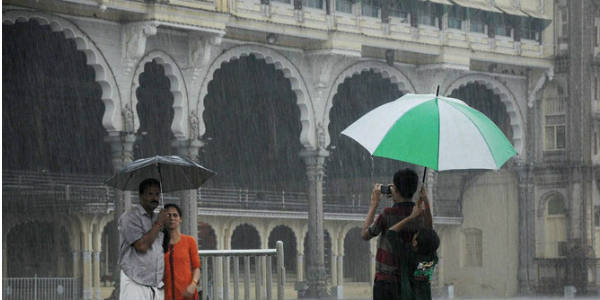
The Depression has given vigorous Monsoon conditions over most parts of Central India. Most pockets of Marathwada, Vidarbha and Madhya Pradesh has recorded heavy to extremely heavy rains. Some parts of Gujarat also received light showers.
However, in Madhya Pradesh, the western half of the state also recorded intense Monsoon rains. However, rains over East Madhya Pradesh remained mainly light to moderate in nature.
In the last 24 hours, from 08:30 am on Thursday, Khandwa recorded 173 mm of rains, Raisen 37 mm, Dhar 33 mm, Narsinghpur 28 mm, Chhindwara 27 mm, Ratlam 21 mm, Pachmarhi 18 mm, Gwalior 15 mm, Indore 13 mm, Betul 12 mm, Umaria 12 mm, Ujjain 11 mm, and Seoni witnessed 5 mm of rains.
As per Skymet Weather, the depression has now weakened into a well-marked low-pressure area and is presently seen over Southwest Madhya Pradesh and adjoining regions.
As per Skymet Weather, this weather system is likely to weaken further into a low-pressure area and would move in a west-northwest direction. In view of its further westward movement, rains over Madhya Pradesh is likely to reduce now. However, parts of West Madhya Pradesh, mainly southwestern parts of the state like Khandwa, Indore, Dhar, Ujjain would continue to witness moderate with isolated heavy showers.
These rains may even trigger flood like situation or waterlogging issues in some parts. Power outages may also be a chance.
On the other hand, parts of East Madhya Pradesh like Rewa, Satna, Sidhi, Umaria may get to witness light rains.
These rains are sure to improve the rainfall statistics of the state as a whole which as on August 16 stands at -8% for West Madhya Pradesh and at -13% for East Madhya Pradesh, both are considered to be normal.
Image Credit: YouTube
Any information taken from here should be credited to skymetweather.com


