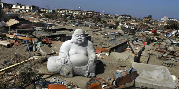
Studies and research estimate that more than 200,000 earthquakes are recorded each year globally, making earthquake forecasting and prediction an active topic for geological research for scientists for years. Today’s earthquake in Japan has left many people questioning whether an earthquake can be predicted or not?
How earthquakes occur?
For centuries, people wondered what causes the Earth to shake. In the 1960s, scientists finally settled on the theory of tectonic plates. These plates move around, slide past and bump into each other. Energy is released thereafter and radiates outward in the form of waves, causing an earthquake. The closer you are to the epicenter of an earthquake, the more you are at risk.
Why predicting is a challenge?
Weather forecasting is possible to an extent but foreseeing earthquakes and their time is still a challenge as identifying diagnostic precursors of earthquakes have remained unsuccessful in the past.
Diagnostic precursor is a characteristic pattern of seismic activity or a physical, chemical or biological change, which indicates a high probability of an earthquake taking place in a small window of space and time.
Though pinpointing the exact time and size of an earthquake is currently impossible, scientists can estimate the probability of an earthquake occurring in a region over a span of decades. Knowing the date of the last earthquake helps improve forecasting, because scientists can estimate whether they’re early or late, based on the repeat time of earthquakes on that particular fault.
“The public is accustomed to the uncertainties of weather forecasting, but foreseeing where and when earthquakes may strike is far more difficult. Plus, too much reliance on earthquake hazard maps can have serious consequences”, says a Chinese scientist, Mian Liu. “Hazard maps fail because historical records in most places don’t go back long enough to get a good sense for patterns…since earthquake trends tend to emerge only on long timescales. The combination of bad and incomplete data, with a complicated system, means that hazard maps are guesses at best”, he added.
Some possible ways of predicting
Earthquakes are not as easy to predict as volcanic eruptions. However, there are still some possible ways of monitoring the chances of an earthquake:
1) Laser beams can be used to detect plate movement.
2) A seismometer is used to pick up the vibrations in the Earth's crust. An increase in vibrations may indicate a possible earthquake.
3) Radon gas escapes from cracks in the Earth's crust. Levels of radon gas can be monitored - a sudden increase may suggest an earthquake. In 2009, a technician at Italy's National Institute for Nuclear Physics claimed that he was able to predict the L'Aquila earthquake by measuring the radon gas seeping from the Earth's crust. His findings remain controversial.
4) Scientists from Edinburgh believe new aerial studies of the earth’s surface could help predict where earthquakes and landslides may occur. Specialist sensors carried by airplanes can be used to take measurements allowing experts to pinpoint areas of land, which are changing shape as a result of the earth’s plates moving.
5) Using radiocarbon dating of offset river sediments and collapsed hill-slope deposits, a research team led by Nanyang Technological University (NTU) discovered that massive earthquakes in the range of 8 to 8.5 magnitudes on the Richter scale leave clear ground scars in the central Himalayas. The study explained devastating earthquakes in the Himalayas in the past means that quakes of the same magnitude could happen again in the region in future.
6) A group of scientists from Wadia Institute of Himalayan Geology (WIHG) in Dehradun, stated that a host of Instruments such as workhorse seismometers, gravimeters, essentially ultrasensitive weighing machines can be used to study the possibilities of an earthquake in a particular area. Even specialized magnetometers that measure minute changes in the gravitational force, the ups and downs of the magnetic field surrounding the rocks within a 50 km radius, as well as a continuous survey of the radioactivity of the water table in the vicinity, can be used to study the possibilities of an earthquake in a particular area.
7) Just as the way animals can help majorly in forecasting certain weather phenomenon, they can also be of a lot of help in predicting a possible earthquake in a place.
Some claim that an oarfish washing ashore is a sign that an earthquake will soon follow. Shortly before the 2011 Tohoku earthquake and tsunami struck Japan, about 20 oarfish stranded themselves on beaches in the area.
There have been reports throughout history of reptiles, amphibians, and fish behaving in unusual ways just before an earthquake. Frogs and snakes, for example, may help in predicting an earthquake, as they can sense chemical changes in groundwater that occur when a quake is about to strike.
“We have learned that predicting an earthquake is a tough nut to crack. To make the kind of accurate, short-term prediction for an earthquake, one would need to identify a reliable signal that a quake is coming. Until then, preparedness is our best defense”, says Jatin Singh CEO of Skymet Weather Services.
Picture credit- SILive.com

 New Delhi, Monday, September 10, Due to the late onset of monsoon, the milled rice production is expected to come down by 6% to 98.5 million tonnes during the current Kharif season. The delay in monsoon has led to rains being deficit in key northern and southern growing regions. However, the late rain has increased the water levels in important reservoirs and the moisture in the soil to benefit Rabi crops.
 New Delhi, Monday, September 10, Showers are likely to increase over the east and the central India in Orissa, Chhattisgarh, east Madhya Pradesh, Vidarbha and Telangana during the next twenty four hours. The West coast would also see an increase in the rainfall activities during this period but rain would decrease over the western border region in west Rajasthan, west Punjab and western areas of Jammu and Kashmir.
 New Delhi, Friday, September 7, An earthquake measuring 5.7 on the Richter scale jolted southwestern provinces of Yunnan and Guizhou provinces at 11:19 am on Friday. The epicenter was just about 15 km from Yiliang's county seat in Yunnan province.
 New Delhi, Friday, September 7. The extended season of rain over upper Kullu has made it difficult for the farmers to harvest apples. Apple harvesting has just started in upper Kullu but due to continuous rain it has become hard to pluck apple.
 New Delhi, Friday, September 7, Rain deficiency in the first half of the monsoon season over the major growing region is likely to bring down the total production of raw Jute in the country. The drop in production is mainly due to a lower acreage as the sowing of the crop has been less by about ten per cent this year as compared to the last year.
 New Delhi, Friday, September 7, Heavy to very heavy rain is expected at one or two places over the entire Gujarat including Saurashtra and Kutch during the next twenty four hours. Rain would reduce over west Madhya Pradesh and central peninsular region during this period. Rain surge is expected over Jammu and Kashmir and Punjab during the next twenty four to forty eight hours.
 New Delhi, Thursday, September 6, The good rains during the last few days have revived the Pushkar lake and it is now brimming with life as for the first time in many years the lake is filled with water. The water is also overflowing to the surrounding ghats. The water level in the lake is 19 feet at the moment and the ghats are making a spectacular sight.
 New Delhi, Thursday, September 6, The central state of Madhya Pradesh has received most of the inland rainfall during the period June 1 to September 5 this year. Madhya Pradesh received a total of 1731.4 mm of rain during this period. It is one of the few states where rainfall has been above the normal during this monsoon. The normal seasonal rainfall for the state of Madhya Pradesh is 1652.7 mm.
 New Delhi, Thursday, September 6, The moderate rain is likely to continue over west Madhya Pradesh, Gujarat and southeast Rajasthan in the next twenty four hours. After this period, the rain belt would shift northwestward over northwest Madhya Pradesh and northwest Rajasthan. The rainfall activities over the Gangetic West Bengal will continue with lesser intensity but would subdue after twenty four hours.
 New Delhi, Thursday, September 6, At least three people died and 30 more injured when a 7.6 magnitude earthquake jolted western coast of Costa Rica on Wednesday morning. The epicenter of the earthquake was reported 8 km off northeast Samara in Costa Rica and 151 km west off San Jose, the capital.
 New Delhi, Wednesday, September 5, Moderate to heavy rain is likely to lash Bikaner, Barmer, Jodhpur and Jaisalmer districts of Rajasthan during the next twenty four to forty eight hours.