Skymet weather

Good rains lash hills and plains of North India, clearance ahead

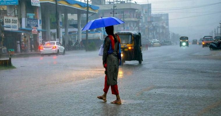
The hills and plains of North India have seen some decent rainfall activities. During the last 24 hours from 8:30 am on Thursday, Jammu saw 42 mm of rains, Gulmarg 22 mm, Srinagar 22.4 mm, Udhampur 38 mm.

Usually, Western Disturbances are not very strong in November. As it is, going by the time of the season, rains have been good and intensity has been great for the region.

The plains including Punjab, Haryana, Rajasthan and even parts of West Uttar Pradesh and Delhi have seen some rains. However, this spell will not last long and will get over today itself. There could be one odd showers today but nothing significant expected as it is. Tomorrow onward, conditions will clear up.

For Delhi Pollution, winds may temporarily pick up but the situation may not persist for very long. Thus, as far as reduction in pollution is concerned, no long term relief is expected.

Delhi Overcomes Jinx Of Dry Weather, Capital And Suburbs Witness Winter Rains

National capital finally lifted the dry spell barrier to witness decent showers last night and early morning. Delhi rained last on 16-17 October 2023 and a prolonged break, thereafter.  Main observatory at Safdarjung recorded 6mm rainfall and the airport observatory measured just 3mm. The highest rainfall of 12mm was registered at Jafarpur. Meteorological office at Lodhi Road recorded rainfall of 5.8mm.

Rain and showers still continue across the capital city and NCR, albeit mostly light to moderate in nature.  Palam, Safdarjung, Noida, Gurugram, Ghaziabad and Faridabad are simultaneously observing intermittent showers.  Conditions remain favourable for continuation of this activity till early evening and exit thereafter. Prevailing wind pattern is shifting these rains from west to east direction. Clearance will start from Rewari, Jhajhar and Nuh to cross beyond Bulandshahar and Aligarh by late evening.

The weather activity has been in association with the anticipated fresh western disturbance and induced cyclonic circulation over North India.  Fairly wide spread activity lashed the northern mountains and the foothills of Jammu & Kashmir, Punjab, Haryana and West Uttar Pradesh.  Moderate activity spilled over to northern half of Punjab and Haryana plains. Tail end of the system managed to reach the capital city, strapping most areas with much needed sporadic showers.

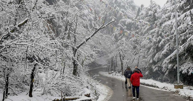
The weather activity is expected to cease anytime in the late evening or latest by early night. In the wake of system, cold winds will bring some nip in the air. Clear sky, moist and cold winds, coupled with average breeze will drop the minimum temperatures by 3-4°C, over the next 3-4 days. Snow in the higher and mid reaches of mountains and medium rains in the lower hills with chilly northwesterly winds  will support significant drop of mercury levels , across the region. No fresh western disturbance will cause any further interruption for the next 10 days.

Clear weather in Ahmedabad as SA takes on AFG in WC Match 42

The 42nd instalment of the ICC World Cup Cricket Match is all set to be played between South Africa and Afghanistan at the Narendra Modi cricket stadium in Ahmedabad on November 10, i.e., today.

The temperature will remain hot and sunny during the initial period of the match as the temperatures will be around 34 or 35 degrees. Humidity will be low around 25%. It will increase to 55% during the second half of the match. We do not expect dew to fall on the ground or the pitch.

Weather will become gradually comfortable after 7:00 p.m. and temperatures are expected to settle between 26 and 27 degrees. We do not expect any disturbance weather-wise during the match.

Barring extreme South India, Diwali to be dry for most parts of the country

Most parts of the country have enjoyed rains in the past few days. While the North has been seeing the effect of a Western Disturbance, the southern parts are seeing rains, all thanks to Northeast Monsoon.

Moreover, the cities of Chennai, Mumbai as well as Bengaluru have been seeing some rains. Now, rainfall activity will reduce and showers will be limited to extreme southern parts around Diwali.

Extreme parts of the South Peninsula including Tondi, Madurai, Trichy, Trivandrum, Alappuzha, Nagapattinam, Kanniyakumari, Tuticorin, Palayankottai, Cuddalore, Punalur, Thanjavur will see some showers. Other parts will remain dry for the festival of Diwali.

The northern parts are likely to see a nip in the air, and some wintry chill in late evening and night hours including the day of Diwali.

Unseasonal rains lash Goa and Mumbai, rains today as well

Cities of Mumbai and Goa have been seeing some rainfall activities for the past couple of days.

Moreover, parts of Konkan may see some showers today. In Mumbai, Colaba saw 24 mm but Santa Cruz did not receive any. Goa saw heavy rains a day before, and 6.2 mm rain was seen in the last 24 hours.

Now, we can expect similar conditions today as well. Conditions remain the same and rainfall may take place over Mumbai, Goa as well as parts of Alibagh, Sindhudurg, and Ratnagiri as well.

Usually, the city of Mumbai or its adjoining areas do not see rains during this time unless a weather system persists in the Arabian Sea, which is the case now.

Active Northeast Monsoon Over South India, More Rains Likely

Northeast monsoon activity has picked up over all the five sub divisions of South Peninsula, for the last 4 days. Weather activity extended further to the neighbouring sub divisions of Telangana, Madhya Maharashtra, Konkan & Goa, Coastal Karnataka and North Interior Karnataka for the last 48hours. Locations like Cannur, Kavali and Goa have been lashed with 100mm rainfall in 24 hours. During last 24 hours, heavy rains have lashed both coast and interiors of Tamil Nadu and Kerala.  Konkan, Madhya Maharashtra, North Karnataka and Telangana were drenched with moderate to heavy showers at many places.

Chief amounts of rainfall, outside the monsoon sub divisions include :  Sangli, Satara, Sholapur, Kolhapur in Madhya Maharashtra ; Gadag, Chitradurga,  Mangalore in Karnataka; Nizamabad, Rentachintala, Mahabubnagar, Hyderabad in Telangana; Mahabaleshwar, Matheran, Mumbai in Konkan region.  Weather activity is likely to continue over next 48 hours and reduce thereafter. Spread and intensity of rains will be higher in the eastern half of South Peninsula covering Madhya Maharashtra, Konkan & Goa, Kerala and interiors of Tamil Nadu.  Chennai, Bengaluru and Thiruvananthapuram are expected to have moderate thundershowers over next 24 hours.

There are two weather systems responsible for these bursts of northeast monsoon.  A cyclonic circulation is marked over the East-Central Arabian Sea, off the Kerala-Karnataka coast.  Another cyclonic circulation is traced over the Comorin region. The combined influence of these features is keeping the monsoon active over southern parts. Typical monsoon activity will last for the next 48 hours and reduce later on. Very limited activity is expected around Diwali.  Light spells of intermittent rain will be confined to South Coastal Tamil Nadu and the southern tip of Kerala on Sunday, 12thNov. Rest parts of the country can enjoy festivities without weather playing spoilsport.

[Hindi] पश्चिमी विक्षोभ पहाड़ों पर पहुंचा, उत्तर भारत में बारिश और बर्फबारी की संभावना

ऊपरी वायु प्रणाली के रूप में ताज़ा पश्चिमी विक्षोभ उत्तरी पाकिस्तान और जम्मू-कश्मीर पर पहुँच गया है। उत्तरी पंजाब और उसके आसपास एक कमजोर प्रेरित चक्रवाती परिसंचरण चिह्नित है। इन प्रणालियों के संयुक्त प्रभाव के तहत, उत्तरी पहाड़ों और पंजाब और हरियाणा के कुछ हिस्सों में मौसमी गतिविधि की उम्मीद है। थोड़े समय के लिए मौसम की मार दिल्ली और बाहरी इलाकों तक पहुंच सकती है। यह मौसम गतिविधि इन भागों में दो दिनों, 09 और 10 नवंबर को क्रमबद्ध तरीके से फैली रहेगी।

जम्मू-कश्मीर, लद्दाख और हिमाचल प्रदेश के मध्य और ऊंचाई वाले इलाकों में 09 और 10 नवंबर को छिटपुट बारिश और बर्फबारी होगी। निचली पहाड़ियों और उत्तराखंड राज्य में इन दो दिनों में रुक-रुक कर बारिश और गरज के साथ बारिश होगी। पंजाब और हरियाणा में, मौसम की गतिविधि उत्तरी पंजाब और उत्तरी हरियाणा के तलहटी इलाकों और कुछ मैदानी इलाकों तक ही सीमित रहेगी। तलहटी और निकटवर्ती मैदानी इलाकों में मौसम की गतिविधि आज रात और कल सुबह होगी। दिल्ली में भी कल तड़के कुछ देर के लिए बारिश हो सकती है और 10 नवंबर की सुबह तक जारी रह सकती है। राजस्थान के सुदूर उत्तरी हिस्सों में भी मौसम की ऐसी ही स्थिति हो सकती है।

सिस्टम के मद्देनजर, अगले सप्ताह की शुरुआत में न्यूनतम तापमान में 2-4 डिग्री सेल्सियस की गिरावट होने की संभावना है। सप्ताहांत और अगले सप्ताह की शुरुआत में निचले स्तर की हवाएँ भी थोड़ी तेज़ हो सकती हैं। हल्की बारिश और हवाओं से हवा की गुणवत्ता में सुधार होगा। हालाँकि, तापमान में गिरावट से वातावरण में अधिक स्थिरता आ सकती है और अन्य दो कारकों के साथ मिलकर काम करने की संभावना नहीं है। सिस्टम के गुजरने के बाद, पूरे उत्तरी मैदानी इलाकों में मौसम साफ रहने की संभावना है और यह 11 नवंबर से 19 नवंबर के बीच जारी रहेगा, जो अगले सप्ताह तक भी बढ़ सकता है।

Western Disturbance Arrives Over Mountains, Rain And Snow Likely Over North India

Fresh western disturbance as an upper air system has arrived over North Pakistan and Jammu & Kashmir. A weak  induced cyclonic circulation is marked over North Punjab and neighbourhood.  Under the combined influence of these systems, weather activity is expected across northern mountains and some parts of  Punjab and Haryana.  Tail of the weather belt may reach up to Delhi and outskirts, for a brief sprinkle. This weather activity will be spread over 2 days, 09th and 10th Nov, In a staggered manner over these parts.

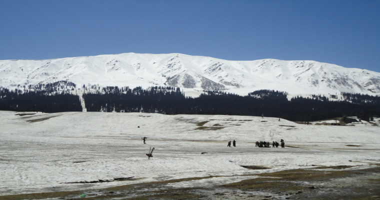
Mid and higher reaches of Jammu & Kashmir, Ladakh and Himachal Pradesh will have scattered rain and snow on 09th and 10th Nov. Lower hills and state of Uttrakhand will have intermittent rain and thundershowers on these two days. Over Punjab and Haryana, the weather activity will remain confined to foothills and some pockets in plains of  North Punjab and North Haryana. Weather activity along the foothills and adjacent plains will occur tonight and tomorrow morning. Delhi may also get some fleeting showers in the wee hours tomorrow and extend till morning on 10thNov.  Extreme northern parts of Rajasthan may also have similar weather conditions.

In wake of the system, the minimum temperatures are likely to drop by 2-4°C by early next week. Low level winds may also pick up slightly during the weekend and early next week. Light rain and winds will tend to improve the air quality. However, drop in temperature may bring more of stability in atmosphere and not likely to work in tandem with the other two factors. After the passage of the system, fair weather conditions are likely across northern plains and these will persist between 11thNov and 19th Nov, extendable to the subsequent week, as well.

Rain in Bengaluru likely to play spoilsport amidst NZ vs SL clash of WC Match 41

The 41st instalment of the ICC World Cup Cricket Match between New Zealand and Sri Lanka will be played at the M Chinnaswamy cricket stadium on November 9, i.e. today in the city of Bengaluru. The match will start at 2:00 p.m.

However, rain gods seem to be visiting today as there is a high probability for the match to get delayed due to rainfall activities. The sky will remain cloudy throughout and the weather will be cool and comfortable.

The intermittent rain may disrupt the match to quite an extent. Moreover, it is very likely that the match may be completed with reduced overs.

Heavy Rains Lash Goa, More Showers For Next Three Days

Goa received unusually heavy rainfall in the past 24 hours.  Almost all parts of the state were lashed with moderate showers, but the central parts received freak heavy downpour. Panjim recorded 99.4mm and old Goa 57mm rainfall in the past 24 hours. Moderate rainfall amounting to 44mm was measured at Panjim- Mapusa. More showers are expected today, may be heavier at places and reducing thereafter for subsequent 2 days.

Off shore cyclonic circulation, coupled with north-south trough along the coast triggered unseasonal showers. Normally, after the withdrawal of the southwest monsoon, such heavy showers are rare. If at all, heavy rainfall is seen in association with some storm in the Arabian Sea, venturing close to Konkan & Goa.  One such similar downpour was witnessed on 20thNov 2021, recording three digit rainfall of 121mm in 24 hours.  Goa has a normal of 21.3mm rainfall in November and such deluge is not very common.

Cyclonic circulation over the Arabian Sea will shift away from the coast, albeit slowly. Therefore, moderate showers are expected for today and tomorrow. Activity will slow down subsequently and fair weather conditions are likely from 11thNovember onward.

Northeast Monsoon Rains Reach Telangana And Maharashtra, Stay Till Weekend

Spread and intensity of monsoon rains have increased in the last 24hours. Normally the northeast monsoon showers are limited to Tamil Nadu, Coastal Andhra Pradesh and Kerala. Decent rains have lashed entire state of Karnataka, Rayalaseema, Telangana and some parts of Maharashtra, as well.  Similar pattern of spread and intensity is expected for the next 24 hours and slow down thereafter, on 09th and 10thNov, before vacating 11thNovember onward.

In addition to moderate showers at Chennai and Bengaluru, decent rains were witnessed over Telangana, Coastal Karnataka, Madhya Maharashtra and Konkan region.  Karwar, Mangalore, Shimoga,  Nalgonda, Khammam, Rentachintala, and Bhadrachalam received scattered showers. Hyderabad received its first post-monsoon rains after more than 45 days.  Moderate showers lashed parts of Konkan and Madhya Maharashtra, both, on the windward and lee side of Western Ghats.  Ratnagiri, Sindhudurg, Dapoli, Malvan, Goa,  Sholapur and Kolhapur received intermittent rainfall.  Mumbai just fell short of reach of the system.

A cyclonic circulation is marked over the east-central Arabian Sea in the lower levels, off coastal Karnataka and Goa. Also, there is a feeble trough extending alongside Kerala and Karnataka. A fair amount of moisture incursion has triggered these rains. The circulation will gradually move deep into the sea. The intensity and spread of rains will decrease tomorrow and reduce further the day after. Clouds are likely to lift up, paving way for sunshine across the region.

[Hindi] उत्तर भारत में मैदानी इलाकों की तुलना में पहाड़ों पर अधिक बारिश होगी

जम्मू-कश्मीर और लद्दाख क्षेत्र में आज शाम तक पश्चिमी विक्षोभ आ रहा है। मुख्य रूप से ऊपरी वायुमंडल में एक चक्रवाती परिसंचरण के रूप में देखा जाने वाला, मौसम प्रणाली उत्तरी पहाड़ों और पंजाब और हरियाणा की तलहटी में सक्रिय होगी। इन दोनों राज्यों के मैदानी इलाकों के उत्तरी हिस्सों में भी छिटपुट बारिश और गरज के साथ बौछारें पड़ेंगी। आंतरिक भाग इस गतिविधि को छोड़ सकते हैं और संभवतः कुछ बादल छा सकते हैं।

पश्चिमी विक्षोभ को क्षेत्र साफ होने में लगभग 3 दिन लगेंगे। पहाड़ों और मैदानी इलाकों दोनों के लिए अधिकांश मौसमी गतिविधियां 09 नवंबर को देर रात में होंगी और 10 नवंबर की सुबह तक चलेंगी। जबकि 12,000 फीट से ऊपर के मध्य और ऊंचे इलाकों में बर्फबारी हो सकती है, निचली पहाड़ियों पर बारिश और गरज के साथ बौछारें पड़ेंगी। पंजाब, हरियाणा और चंडीगढ़ के कुछ हिस्सों में भी बारिश होने की संभावना है। उधमपुर, जम्मू, सांबा, कठुआ, पठानकोट, अमृतसर, जालंधर, रोपड़, मोहाली, पंचकुला, अंबाला, करनाल, चंडीगढ़ और कुछ अन्य पड़ोसी स्टेशनों पर 09 नवंबर की देर रात और 10 नवंबर की शुरुआत में इस मौसम गतिविधि का अनुभव होने की संभावना है। इस अवधि के दौरान दिल्ली में टच एंड गो की स्थिति रहेगी और हल्की बारिश देखने को मिल सकती है।

अगले 2 दिनों में रात के तापमान में लगभग 2 डिग्री सेल्सियस की वृद्धि और उसके बाद गिरावट की संभावना है। इस सिस्टम के चलते पहाड़ों और मैदानी इलाकों में हवा में थोड़ी ठंडक आने की संभावना है। कई स्थानों पर पारा का स्तर न्यूनतम 10°C-12°C तक गिर सकता है। इसके अलावा, 10 से 13 नवंबर के बीच सतही और निचले स्तर की हवाएं तेज हो जाएंगी। इससे कुछ हद तक प्रदूषकों को फैलाने में मदद मिल सकती है। 22 नवंबर तक किसी भी पश्चिमी विक्षोभ से मौसम की स्थिति बाधित नहीं होगी।


latest news