Skymet weather

Heavy Rains Recede From Tamil Nadu, Weather Conditions To Improve Further

Southern parts of Tamil Nadu got ravaged by extremely heavy and incessant rains over the weekend, on 16th and 17th Dec 2023.  Four of the southern districts were literally marooned on account of non – stop torrential rains for over 24 hours.  Fury of devastating rains was largely witnessed by four districts and their talukas

Including Thoothukudi, Tirunelveli, Kanyakumari and Tenkasi.  Kayalpattinam in Thoothukudi district recorded massive 95cm rainfall in 24 hours. Palayamkottai in Tirunelveli district measured 442 mm of rainfall in 24 hours, beating its earlier record of 292mm n 1931.  Kanyakumari also recorded over 300mm in 48 hours, far more than the normal  figures at this time of the year.

A broad scale cyclonic circulation moved from  east to west across South Sri Lanka, Comorin, Maldives in the equatorial region. Northward extension of this system impact extreme southern parts of the state of Tamil Nadu. Catastrophic rainfall in some pockets submerged the area with the fast moving streams of water. Prediction of such heavy rains was beyond the competency of numerical weather models.  The current weather system has cleared the Comorin region and gone a way ahead of Lakshadweep, after lashing the islands of Minicoy and Agathi airport.  Lakshadweep Islands and Southeast Arabian Sea will be the focus of heavy rains for another 48 hours.

Heavy rains have since ceased with and weather conditions have improved over Tamil Nadu.  Air operations  could be resumed and the relief work accessible in the distressed areas, by the disaster management agencies. As such, weather conditions behaved well in other parts of the state including the state capital Chennai.  Mostly light rain, interspersed with few moderate showers are likely along and off the coast of Tamil Nadu, for the next one week or so.

There are series of weather system lined up across the Indian Ocean. However, these disturbances are  travelling between equator and about 6°-7°N latitude, keeping a safe distance from the southern parts of the state.  As such, the northeast monsoon tends to move towards its concluding phase during the last 10 days of December.  Formation of a cyclone becomes rare and the perturbation activity gets limited to, near the equatorial belt. Sri Lanka, Comorin area and Maldives region remain within strike range of these systems.  State of Tamil Nadu can focus on rescue and rehabilitation, without any fear of weather playing a spoil sport.

[Hindi] दिल्ली में न्यूनतम तापमान में गिरावट, सर्दी बढ़ेगी

दिल्ली में दिसंबर महीने की शुरुआत में न्यूनतम तापमान लगभग 9 डिग्री रहता है और महीने के अंत तक सामान्य तापमान 6-7 डिग्री तक पहुंच जाता है।

इस विशेष महीने में, दिल्ली में वास्तव में कोई बारिश नहीं हुई है। 4 दिसंबर को हल्की बूंदाबांदी हुई थी, अन्यथा, अब तक राष्ट्रीय राजधानी में व्यावहारिक रूप से कोई बारिश नहीं हुई है।

इसके अलावा, तापमान में भी बदलाव आया है और 15 दिसंबर को न्यूनतम तापमान 4.9 डिग्री दर्ज किया गया था। आज न्यूनतम तापमान 7.1 डिग्री दर्ज किया गया। अब, चूंकि पश्चिमी विक्षोभ दूर चला गया है, हम तापमान में गिरावट की उम्मीद कर सकते हैं।

इसके अलावा, मध्य सप्ताह में न्यूनतम तापमान 4-5 डिग्री के आसपास रह सकता है। हालाँकि, 24 दिसंबर या उसके आसपास, हम एक बार फिर ताजा पश्चिमी विक्षोभ की उपस्थिति के कारण तापमान में वृद्धि देख सकते हैं। पूरे क्षेत्र में ऊंचे बादल देखे जा सकते हैं।

दूसरी खासियत यह है कि 6 दिसंबर से लेकर अब तक दिल्ली में न्यूनतम तापमान केवल एकल अंक में ही देखा गया है, जो काफी लंबा दौर है।

आने वाले दिनों में घने कोहरे की संभावना नहीं है, जिससे रेल, सड़क या हवाई यातायात बाधित हो। हालांकि 24-26 दिसंबर के बीच तापमान में बदलाव हो सकता है, लेकिन हमें राष्ट्रीय राजधानी में बारिश की उम्मीद नहीं है।

Delhi to see drop in minimums, winter chill to intensify

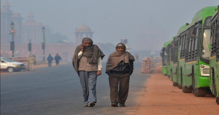
Delhi in the beginning of the month of December sees a minimum of about 9 degrees, and by the end of the month, the pentand normal goes to 6-7 degrees.

For this particular month, Delhi has actually seen no rain. There was a light sprinkle on Dec 4, otherwise, no rain so far has been practically absent from the national capital.

Moreover, there has been a change in temperatures with the lowest minimum being recorded at 4.9 degrees on Dec 15. Today, the minimum settled at 7.1 degrees. Now, as the western Disturbance has moved away, we can expect a dip in temperatures.

Moreover, the minimum may settle around 4-5 degrees mid week. However, around December 24 or so, we can once again see a rise in temperature due to the presence of a fresh Western Disturbance. High clouds may be seen over the entire region.

Other speciality is that Delhi since 6th December, till now, has seen single digit minimums only, which is a fairly long spell.

In the coming days, no dense fog is likely, which may disrupt rail, road or air traffic. While the temperatures may change between December 24-26th, we do not expect any rainfall over the national capital.

Minimums drop significantly over the North Indian Plains, further reduction expected

The North Indian Plains have not seen any rains as such, only sprinkles here and there, otherwise dry weather has been seen. After the passage of this system, temperatures have dropped in the plains as well.

In fact, many places are seeing minimums around 5 degrees, and some even recording minimum less than 5 degrees. Amritsar has seen the season's lowest minimum at 3.6 degrees. Bathinda has recorded 4.4 degrees, Pathankot 5.5 degrees. In fact, foothills of plains at modest elevations of less than 3000 feet have gone sub-zero.

Since the Western Disturbance has moved away, temperatures may continue seeing a dip over the plains, including Rajasthan and adjoining areas. No rains are likely for now, some light sprinkle may be seen over Rajasthan and adjoining areas around December 22, and clouding may be there in some parts.

Thereafter, around December 24th -26th, Western Disturbance will arrive, which may result in rise in temperatures. Before that, shallow fog may be seen, chill in the air is likely and more single digit temperature.

Western parts of Uttar Pradesh have also come under the grip of intense cold wherein Bareilly saw 3.6 degrees as minimum one of the days.

Western Disturbance dumps heavy snow over Jammu and Kashmir, system moves away now

The recent Western Disturbance has resulted in heavy snow over some parts of Jammu and Kashmir. Moreover, this spell has been the season's heaviest wherein the mid and higher reaches saw decent snowfall. Ski resorts of Pahalgam, Gulmarg and Sonmarg saw some snow along with parts of Bandipur, Sadhna Top, Gurez Valley, Mughal Road, Machil region etc. These activities started on Saturday evening and continued until Sunday morning. Moreover, Mughal Road was also closed due to these snowfall activities.

The Western Disturbance that moved across the region on 16 and 17th giving rain and snow has now moved away but resulted in closure of roads. In fact, as per reports, tourists were stranded in the Gulmarg ski resort because of such heavy snowfall.

As the system has moved away, the snowfall activities have also cleared completely. In the wake of the system, temperatures have gone to sub-zero across the Kashmir Valley including Shopian region at -6.5 degrees. Qazi Gund, Srinagar and adjoining areas also saw minimums in the negative range.

The system is moving further away, which will result in further fall in temperatures, which will continue until December 23. Fresh Western Disturbance will affect the hills by the weekend itself between December 24 and 26, wherein mid and higher reaches will see spell of snow. During that time, temperatures may rise temporarily but fall again after it moves away.

Warm Winters To Continue For Mumbai

Mumbai  has experienced relatively warm winters so far. January is the best and the coldest month, wherein minimum temperature drops to mid-teens quite often. Even, month of December has an average of about 18°C. However, the lowest temperature so far, as recorded by airport observatory Santacruz was 19.4°C on 13th and 16th December 2023.  Rest, all the days, it clocked above 20°C. Today  morning, this observatory recorded the highest minimum  of last 2 weeks. The mercury rose to 23.6°C, huge 6°C above the normal. Earlier, on 05thDecember, the city measured a low of 23.8°C. But, there is seasonal progressive drop of mercury expected from the start o month to the middle and go on till the end. This feature has been missing.

There is no active western disturbance, affecting the northern plains and the hills, simultaneously, so far.  Only weak weather systems have moved across the mountains, except the last one on 16th and 17th Dec, which spread a blanket of snow over Kashmir Valley, but only in the mid and higher reaches. The lower hills did not have rains even.  The cold winds in the wake of these systems have not been penetrating deep in the plains and further down to South Rajasthan, Gujarat and Maharashtra.  Anticyclone over Rajasthan has been wavering a lot, with uncertain and weak wind pattern. It is not conducive enough to take the cold from the mountain slopes right up to the central parts.

Significant drop of mercury level has been rather confined to small pockets of Punjab, Haryana and Delhi. And that too, it happened for a brief period. Sustained spread and intensity of cold gives amiss, so far over northern plains.  Wind pattern is not likely to become any better for chilly conditions, as another interruption on account of weak system is expected for Rajasthan on 22nd Dec or so.  Another mild western disturbance is likely to arrive over the mountains between 23rd and 25thDec 2023.  Conditions are going to remain unsettled for the next, at least about one week.  Drop  of temperatures over Maharashtra , including Mumbai, will be restricted to just a degree or two, over the next 3 days.

Last year, Mumbai had lowest minimum of about 15°C, around Christmas. Otherwise also, the mercury did hover around 16°C on few days in the 2nd half of December.  This December, so far, Mumbai has yet to find sweeping winds across from the plains of North India.  City has been observing either warm winds coming from the sea or more of easterly or southeasterly winds from the land. Persistent northerly or northeasterly winds are needed to transport the cold from the north, uninterrupted to parts of Madhya Maharashtra and Konkan.  Mumbai may have to continue, without the typical wintery flavor, at least for a week or even more.

Torrential Rains Over Tamil Nadu, More Showers Likely Today

South Tamil Nadu has experienced heavy rains and few places exceptionally heavy rains in the past 24 hours.  Isolated locations have received all time record high rainfall in the past 24 hours. Heavy rains thronged Nilgiris and Palani Hills as well.  Extreme southern coastal stations were impacted more than the rest. Deluge at some places, continuing for hours together has derailed the normal life, affecting rail, road and air traffic simultaneously.

Heavy rains were anticipated for the region, in association with the cyclonic circulation moving east to west across South Sri Lanka, Comorin region in the equatorial region.  However, incessant downpour measuring in excess of 400mm in 24 hours was beyond the range of model prediction.  Palayankottai, a little away from the coast and almost west abeam Thoothukudi received all time record of 442mm rainfall in 24 hours.  Kodaikanal, a town with an elevation of about 2,000 mtr, sitting almost on a plateau, in the Palani Hills, measured 103mm rainfall in the same duration.  Chief amount of rainfall at few other places include  Kanyakumari – 173mm, Tondi -70mm, Pamban – 52mm, Madurai – 35mm.

Cyclonic circulation is shifting westward, but still remain close enough to dump heavy rains at some places, today as well.  Northward extension of trough from this system will cause heavy showers over Tirunelveli, Kanyakumari, Nagercoil, Kalakkad, Tiruchedur, Thoothukudi, Palayankottai, Pamban, Tondi, Tuticorin and Ramanathapuram, today.  Continuation of this wet spell will increase the level of disruption and water logging in the low lying areas.  Rescue work is likely to be hampered and the connectivity remain impacted.  North Coastal parts and interior region of the state will not experience any inclement weather conditions.

Weather system is likely to move over Maldives and Lakshadweep region, by tomorrow. Weather conditions will substantially improve over the marooned areas and relief and rescue operations could be resumed.  The next weather system trailing behind the existing one is relatively tracking southward across South Sri Lanka, Comorin and Maldives area. It will spare the Indian landmass of any adverse weather.  Overall, weather conditions will behave over the state of Tamil Nadu for the next one week.

[Hindi] राजस्थान में छिटपुट बेमौसम बारिश संभव है

राजस्थान, जो अपने शुष्क मैदानों और चिलचिलाती धूप के लिए जाना जाता है, मौसम में एक आश्चर्यजनक बदलाव का सामना कर रहा है - बेमौसम बारिश! यह अप्रत्याशित मेहमान, 23 दिसंबर के आसपास आने वाले पश्चिमी विक्षोभ के कारण, 23 और 24 दिसंबर को राज्य के पश्चिमी और मध्य भागों में कुछ हल्की बारिश हो सकती है।

यह बारिश, हालांकि स्वागतयोग्य है, एक अस्थायी आगंतुक है। मध्य पाकिस्तान और पश्चिमी राजस्थान के ऊपर बने एक प्रेरित चक्रवाती परिसंचरण के साथ साझेदारी करते हुए, यह रात के तापमान में थोड़ी वृद्धि कर सकता है, जिससे सर्दियों की ठंड से थोड़ी राहत मिलेगी।

25 दिसंबर के बाद, राजस्थान सहित उत्तर-पश्चिम भारत के अधिकांश हिस्सों में न्यूनतम तापमान में फिर से गिरावट आने की उम्मीद है। पश्चिमी विक्षोभ आगे बढ़ेगा, जिससे सर्दियों को फिर से अपना सिंहासन हासिल करने का मौका मिलेगा।

हालांकि इस बेमौसम बारिश से मौसमी बारिश के पैटर्न पर महत्वपूर्ण प्रभाव पड़ने की संभावना नहीं है, लेकिन यह मौसम की विचित्र प्रकृति की याद दिलाने का काम करती है। यह वास्तव में बसने से पहले सर्दियों की अनिश्चितता की एक झलक पेश करता है, जो रेगिस्तानों को अपने ठंढे स्पर्श से चित्रित करता है।

तो, रेगिस्तान में बारिश की बूंदों के इस क्षणभंगुर नृत्य का आनंद लें। ठंड से थोड़ी राहत का आनंद लें, लेकिन अपने थर्मल और गर्म चाय को पास रखें, क्योंकि सर्दियों की सिम्फनी बस अपने चरम पर पहुंचने का इंतजार कर रही है।

Northwest India Braces for Temperature Rollercoaster as Winter Struggles to Take Hold

Northwest India has been experiencing a strange dance of temperatures, swinging between unseasonably warm days and chilly nights. This ongoing "sea saw" pattern, meteorologists say, is a prelude to a more dramatic meteorological drama unfolding in the region. Successive western disturbances, those moisture-laden air masses from the Mediterranean, are poised to waltz with the wind flow, bringing a rollercoaster ride of rain, snow, and temperature fluctuations.

For the next 24 hours, the current western disturbance will linger, and night temperatures may increase marginally offering a brief respite from the chilly nights. But don't let your guard down, for cold winds from the northwest is set to sweep in, sending the mercury plummeting once again.

Just as you start adjusting to the cozy evenings, brace yourself for another act in this meteorological play. Around December 23rd, another western disturbance takes the stage, promising rain and snow for the Western Himalayas. This snowy interlude will be short-lived, however, temperatures will fall once again once the disturbance passes.

This temperature tango will continue well into the holidays, with each western disturbance acting as a temporary intermission, bringing a brief increase in temperatures before the cold winds from north reclaims its dominance. But fear not, winter isn't giving up without a fight. After Christmas, the impact of the persistent winter chill will finally be felt across the plains, marking the true arrival of the season.

So, buckle up, Northwest India! The coming days promise a whirlwind of weather, a story where rain, snow, and sunshine battle for supremacy. Keep your thermals handy, your raincoats close, and an eye on the skies, for this winter is bound to be a memorable one, a testament to the fickle nature of nature's grand performance.

Patchy unseasonal rain is possible over Rajasthan

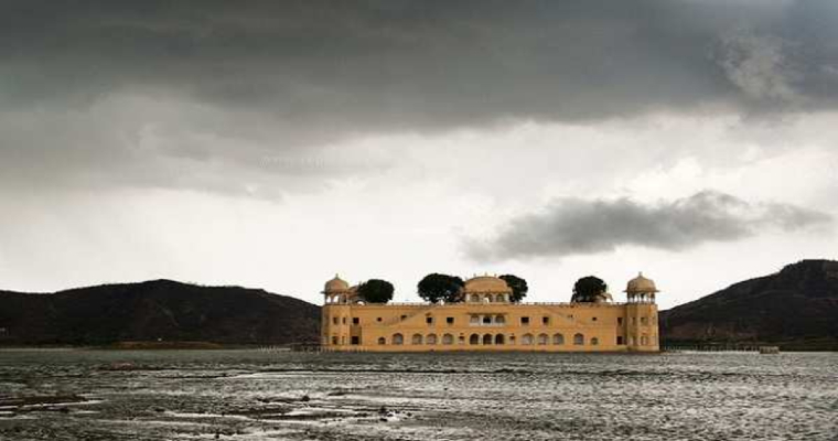
Rajasthan, known for its arid plains and scorching sun, is experiencing a surprising weather twist – unseasonal rain! This unexpected guest, courtesy of an approaching western disturbance around December 23rd, may sprinkle some light rain over western and central parts of the state on December 23rd and 24th.

This rain, although welcome, is a temporary visitor. Partnering with an induced cyclonic circulation forming over central Pakistan and western Rajasthan, it may briefly bump up night temperatures, offering a short relief from the winter chill.

After December 25th, the minimum temperatures are expected to dip again across most of northwest India, including Rajasthan. The western disturbance will move on, leaving winter to reclaim its throne.

While this unseasonal rain is unlikely to significantly impact seasonal rain patterns, it serves as a reminder of the capricious nature of weather. It offers a glimpse of winter's indecisiveness before it truly settles in, painting the deserts with its frosty touch.

So, enjoy this fleeting dance of raindrops in the desert. Savor the brief respite from the cold, but keep your thermals and warm chai close, for winter's symphony is just waiting to crescendo.

[Hindi] ताज़ा पश्चिमी विक्षोभ पहाड़ों पर बारिश और बर्फबारी लाएगा, पर्यटकों के लिए खुशी की बात

एक ताजा पश्चिमी विक्षोभ 16 और 17 दिसंबर को गिलगित बाल्टिस्तान, मुजफ्फराबाद, जम्मू और कश्मीर की पहाड़ियों और 17 दिसंबर को हिमाचल प्रदेश में बारिश और बर्फबारी ला सकता है। यह इस क्षेत्र के लिए एक स्वागत योग्य राहत होगी, जिससे जल संसाधनों की भरपाई होगी।

गिलगित बाल्टिस्तान, मुजफ्फराबाद और जम्मू और कश्मीर: इन क्षेत्रों में 16 और 17 दिसंबर दोनों को हल्की से मध्यम बारिश और बर्फबारी की उम्मीद हो सकती है। अधिक ऊंचाई पर बर्फबारी होने की संभावना है, जिससे एक सुरम्य शीतकालीन वंडरलैंड बन जाएगा।

हिमाचल प्रदेश: हिमाचल प्रदेश को भी सर्दियों का भरपूर लाभ मिलेगा, 17 दिसंबर को बारिश और बर्फबारी की उम्मीद है। रोहतांग पास और मनाली जैसे राज्य के ऊंचे इलाकों में बर्फबारी होने की संभावना है, जो स्कीइंग और अन्य शीतकालीन खेलों के लिए उपयुक्त है। .

उत्तर भारत के मैदानी इलाकों में 16 दिसंबर को तापमान में मामूली वृद्धि होगी, इसके बाद तीन दिनों के बाद इसमें गिरावट आएगी क्योंकि पहाड़ों से ठंडी हवा नीचे आएगी।

बारिश और बर्फबारी का यह ताजा दौर पर्यटकों के लिए निश्चित रूप से आनंददायक होगा, खासकर उन लोगों के लिए जो शहरों की हलचल से बचकर हिमालय की सुंदरता में डूब जाना चाहते हैं। बर्फ से लदे पहाड़, सर्दियों की धूप में चमकते हुए, मनमोहक दृश्य और साहसिक गतिविधियों के लिए पर्याप्त अवसर प्रदान करते हैं।

हालांकि बर्फबारी रोमांचक है, इन क्षेत्रों के यात्रियों को फिसलन भरी सड़कों और बंद होने के कारण संभावित यात्रा व्यवधानों के बारे में पता होना चाहिए। किसी भी यात्रा पर निकलने से पहले मौसम के पूर्वानुमान और सड़क की स्थिति की जांच करना आवश्यक है।

तो, पहाड़ों में एक सर्द वंडरलैंड के लिए तैयार हो जाइए! अपने गर्म कपड़े पैक करें और प्रकृति के जादू को देखने के लिए तैयार हो जाएं क्योंकि ताजा पश्चिमी विक्षोभ पहाड़ों को सफेद रंग में रंग देता है।

Fresh Western Disturbance to Bring Rain and Snow to the Hills, Delight for Tourists

A fresh western disturbance may bring much-needed rain and snow to the hills of Gilgit Baltistan, Muzaffarabad, Jammu and Kashmir on December 16 and 17, and Himachal Pradesh on December 17. This will be a welcome respite for the region, replenishing water resources and painting the landscapes in a pristine white.

Gilgit Baltistan, Muzaffarabad and Jammu and Kashmir: These areas can expect light to moderate rain and snowfall on both December 16 and 17. Snowfall is likely to accumulate at higher altitudes, making for a picturesque winter wonderland.

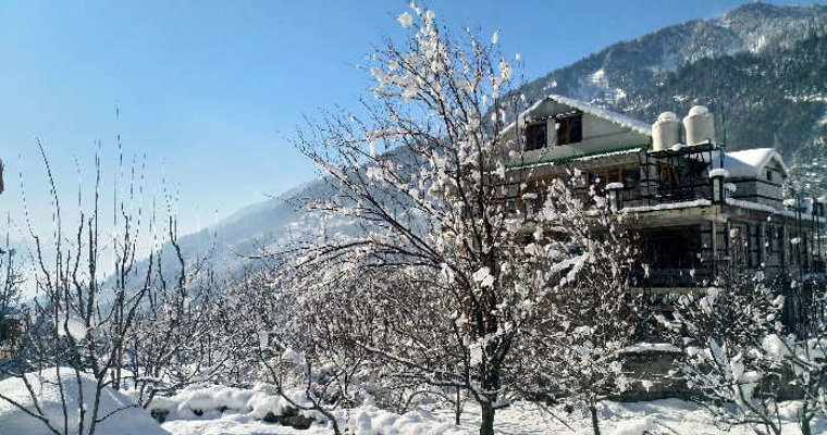
Himachal Pradesh: Himachal Pradesh will also receive its share of the winter bounty, with rain and snowfall expected on December 17. The higher reaches of the state, like Rohtang Pass and Manali, are likely to see snow, perfect for skiing and other winter sports.

The plains of North India will experience a marginal rise in temperature on December 16, followed by a drop after three days as the cold air from the hills descends.

This fresh spell of rain and snow is sure to be a delight for tourists, especially those seeking to escape the bustling cities and immerse themselves in the beauty of the Himalayas. The snow-laden mountains, glistening under the winter sun, offer breathtaking views and ample opportunities for adventure activities.

While the snowfall is exciting, travellers to these areas should be aware of potential travel disruptions due to slippery roads and closures. It is essential to check weather forecasts and road conditions before embarking on any journey.

So, brace yourselves for a wintry wonderland in the hills! Pack your warm clothes, grab your hot cocoa, and get ready to witness the magic of nature unfold as the fresh western disturbance paints the mountains white.


latest news