Skymet weather

Pre-Monsoon rains to intensify over Kerala, Tamil Nadu, dry spell to end in Chennai too

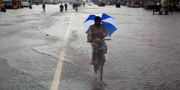
Rain in Tamil Nadu and Kerala

Although late but pre-Monsoon rains and thundershowers have finally picked up pace in southern parts of the country. According to Skymet Weather, a trough extending from this East Bihar to interior parts of Tamil Nadu across Gangetic West Bengal, Odisha, Coastal Andhra Pradesh, Telangana and South Interior Karnataka would be helpful in giving more rains over Tamil Nadu, Kerala and parts of South Interior Karnataka.

The experts have to say that this trough is semi-permanent feature during the pre-Monsoon season that keeps oscillating east and west, at times over Kerala and at times pass through interior Tamil Nadu. Thus, South Interior Karnataka including Bengaluru is all set to witness intermittent rain and thundershower activities.

Kerala has already been receiving pre-Monsoon rain and thundershowers since last many days. These rains are expected to continue for the coming days as well. The intensity would be much more in Kerala and interior Tamil Nadu. However, coastal parts of Tamil Nadu might also witness on and off rain activities.

Chennai which has been experiencing dry weather for last many days would now get to witness these isolated pre-Monsoon showers during next two to three days. Still it is believed that rains would remain confined to interior parts of Tamil Nadu and Kerala only.

Coimbatore and Kochi have already witnessed good rains. In the past 24 hours, Thiruvanathapuram in Kerala has recorded around 33 mm of rains. While, Cochin saw nearly 38 mm of rains with high humidity levels over the same. Kozhikode and Coimbatore both recorded 19 mm of pre-Monsoon rains.

Thunderstorm accompanied with gusty winds wherein wind speed reaching 30-50 kmph and lightning at isolated places are very likely over Tamil Nadu and Kerala.

Along the trough, wind discontinuity or confluence zone is also expected to develop over interior parts of Tamil Nadu and Kerala leading to moisture incursion from Bay of Bengal and Arabian Sea. Thus, resulting in further continuation of rain and thundershowers over these two states for the coming three to four days.

Also Read: Pre Monsoon rains to pick up pace in Hyderabad, Telangana, Andhra Pradesh in 24 hours 

Image Credit: The Weather Channel

Any information taken from here should be credited to Skymet Weather

Hyderabad to continue receiving rains, relief from heat wave in sight

hyderabad-during-monsoons

Hyderabad has received heavy rain and thundershower activities yesterday that comprised of a few moderate spells associated with strong gusty winds. The Hyderabad Airport recorded 20.1 mm of rain in the last 24 hours.

The reason- a trough which is extending from Jharkhand to interior Tamil Nadu across Odisha, South Tamil Nadu, Chhattisgarh and Telangana. Due to this, Pre-Monsoon weather activities are taking place over the city. These activities take place particularly during late evening hours as whenever temperatures increase and moisture is readily available, this is when the rain activities occur.

Now, Southwesterly winds from Bay of Bengal are meeting with dry and hot Northwesterly winds over Telangana, leading to development of convective clouds.

These on and off rain activities are expected to continue for the next 24 to 48 hours. Strong winds are also likely to blow over the region.

Today temperatures are expected to be recorded somewhere around 38 to 40 degrees in the city. In the next 24 hours, temperatures are expected to drop marginally, however. This will mean a relief from the prevailing heat wave conditions. Humidity on the other hand will continue keep soaring.

Thereafter, this trough will oscillate slightly towards East over coastal Andhra Pradesh and Rayalaseema. Therefore, these weather activities will recede thereafter.

However, this Trough is a semi-permanent feature during this time of the year. So, the weather will not go completely dry over Telangana as well as Hyderabad. With short breaks it will resume, and pre-monsoon activities may continue thereafter also.

Image Credits – Indian Eagle 

Any information taken from here should be credited to Skymet Weather


Pre Monsoon rains to pick up pace in Hyderabad, Telangana, Andhra Pradesh in 24 hours

Pre Monsoon Rain in Telangana and Andhra Pradesh

Andhra Pradesh and Telangana have been witnessing pre-Monsoon rain and thundershowers of varying intensity in the wake of several weather systems prevailing near the region. One is the Cyclonic Circulation over eastern parts of Bihar. From this system a trough is seen extending to interior parts of Tamil Nadu across Coastal Andhra Pradesh, Telangana and South Interior Karnataka.

Hence, the rain activities, which have occurred over Odisha, Andhra Pradesh, South Interior Karnataka and Tamil Nadu, will continue for coming three to four days. This north-south trough is a semi- permanent feature, which keeps oscillating east and west. Now, this trough is expected to shift its base to east over Andhra Pradesh, therefore intensity of rains might go up in Coastal Andhra Pradesh as well as in Rayalaseema. We also expect intermittent rain and thundershower activities to continue across many parts of Telangana.

These being the pre-Monsoon activities, therefore thunderclouds would start developing towards afternoon and intensity is expected to increase during that time period.

Telangana, so far, has witnessed good rain and thundershower activities. Hyderabad has also received good rains  in past 24 hours and recorded around 20.1 mm of rains.

Similar weather activities are expected in pockets of Telangana as well. During pre-Monsoon, rain and thundershowers are witnessed in patches and are not fairly widespread in nature. Thus, now few districts of Telangana might see good rains coupled with intense thundershowers towards afternoon and evening.

Temperatures are expected to remain below normal at many places of Telangana. Andhra Pradesh too has been witnessing intermittent rain and thundershowers from the last few days. On April 18, Anantapur  in Andhra Pradesh recorded 33.2 mm of rains and also the minimums dropped and settled at 19.6 degrees, which is six degrees below normal. Similarly, Hyderabad and Hanamkonda  in Telangana recorded 20.1 mm and 23 mm of rains respectively in past 24 hours. The minimums over these regions too have fallen by a couple of degrees.

Also Read: Andhra Pradesh and Telangana to witness Pre-Monsoon rains with increased intensity

Image Credit: DNA India

Any information taken from here should be credited to Skymet Weather

 

Heat wave to make a comeback in Punjab and Haryana in the next two days

image_750x_5b09004cc4e29

The last week was a one filled with lots of weather activities for the duo states of Punjab and Haryana- be it the reoccurring dust storms, on and off rains or the thundershowers with intense lightning and strong winds. The residents however, seemed to enjoy the weather as it brought along a relief from otherwise peaking temperatures. Day temperatures dropped by a whopping 10 to 12 degrees in most parts. A few places even recorded a 14 to 15 degree drop.

Talking meteorologically, the reason for this weather was a strong Western Disturbance over the hills in the influence of which a Cyclonic Circulation had formed back at Plains. Now both these systems however have moved away eastwards. A much weaker system has replaced the Western Disturbance in Jammu and Kashmir.

Absence of weather activities has already led to a rise in day temperatures in the last 24 hours over Punjab and Haryana. Since, temperatures are set to rise gradually, heat wave conditions are being ruled out as of now for at least next few days. However, heat wave may make a comeback around April 20 or 21. Today, the day temperatures are likely to be recorded in higher 30s over most parts of the state.

As of now, dry weather will prevail over the regions at least in the coming next two days.

Image Credits – Pollywoods 

Any information taken from here should be credited to Skymet Weather

Pre Monsoon rain in Kolkata, Ranchi, Jamshedpur for 48 hrs, to keep mercury below normal

Rain in West Bengal and Jharkhand

Pre-Monsoon rains and thundershowers continue to grip parts of East India, particularly West Bengal and Jharkhand. These weather activities have kept temperatures under check and have kept heat wave at bay.

All thanks to a Cyclonic Circulation which is seen over eastern parts of Bihar and a trough extending from this system to interior parts of Tamil Nadu across Gangetic West Bengal, Odisha, Coastal Andhra Pradesh, Telangana and South Interior Karnataka.

With this, light to moderate rain and thundershower activities would continue over parts of Jharkhand and Gangetic West Bengal for next 48 hours. Although, these rain activities won’t be that heavy, however isolated intense short spells of rain and thundershowers with lightning strikes and strong winds cannot be ruled out.

As per weathermen, these activities are expected to subside post 48 hours when this Cyclonic Circulation would weaken. While, the trough along the East coast would continue. Hence, temperatures in Jharkhand and West Bengal would remain below normal. They have already dropped due to recent pre-Monsoon showers. At present, both day and night temperatures over these states are below normal.

In past 24 hours, Bokaro recorded a maximum of 32.6 degrees, which is six degrees below normal with a record of 7.6 mm of rains. Similarly, Daltonganj  witnessed its maximums at 35.8 degrees, which is four degrees below normal. While, Jamshedpur witnessed a drop both in day and night temperatures and are four to five degrees below normal. Ranchi witnessed a drop in tis minimums by three degrees and settling at 18.5 degrees. Malda in West Bengal recorded maximums two degrees below normal and settled at 35 degrees.

Image Credit: Telegraph India

Any information taken from here should be credited to Skymet Weather
Temperatures to rise once again over Rajasthan and Gujarat

Gujarat heatwave

During the last two to three days, many parts of Rajasthan received rain and thundershower activities along with dust storm and hail storm activities. Southwest parts of Rajasthan such as Jodhpur, Jaisalmer and Barmer received much less rain in comparison to other areas. Many parts of Gujarat also received heavy rain and thundershower on April 16.

These rain activities were due to an induced Cyclonic Circulation which was persisting over Western parts of Rajasthan. Moreover, humid winds from Arabian sea were pushing moisture over Gujarat and Rajasthan. Now the induced Cyclonic Circulation has weakened, and the rain belt has shifted towards the eastern parts of the country. Winds have also changed direction form Southwesterly/ Southeasterly to Northwesterly.

The winds blowing from Northwest will be hot and dry therefore, we now expect temperatures to increase over both the states. In fact, due to the recent rain activities both day and night temperatures witnessed a significant fall. Gradual increase in temperatures may lead to heat wave like conditions over both the states in the next two to three days. Although, heat wave will not make a comeback very soon and the next 4 to 5 days will be rather pleasant.

Image Credits – India Today

Any information taken from here should be credited to Skymet Weather
Lansdowne: Visit to an elegant station with a pinch of weather insight

Vacation in Lansdowne

Lansdowne is an elegant hilly station that is a short distance away from Kotdwar. It is a clean and pretty hill station in the Pauri Garhwal District of Uttarakhand.

It is one of those destinations that serve the purpose of giving the brain and body an escape from the daily 9-6 office grind routine.

It is a place with scenic view of mountain ranges and snow-capped peaks that justifies the reason as to why nature lovers should embark on a journey to this destination.

This beautiful hill station witnesses pleasant summers and freezing winters. March to November is usually considered to be the best time to visit this place. Summers are pretty enjoyable because of the pleasant temperature, while the chill in spine can be felt during December to February. Not only this, monsoon too accounts for pretty good visit and makes the place look quite fresh and amazing.

Let us understand the weather in detail:

Summers (March- June): Summers are really pleasant and warm; they are the best time for trek lovers and those seeking respite from the summer heat. The temperature during peak summer time is around 30 degree Celsius.

Monsoon (July-September): Lansdowne is known for sudden rainfall and the temperature remains around 28 degrees Celsius during monsoon months of June to September. Hence, those who love the freshness and the mediocre rain should plan a trip here.

Winters (October-February): Lansdowne has a freezing winter season with intermittent snowfall. The temperature remains between sub-zeros to minus 15 Degree Celsius during the winter months of October to March.

The hill station also comprises of a small artificial lake where one can enjoy boating, and one should not miss out on walking to the Tip- in-Top from where one can see spectacular views of the Shivalik Range, also en route sighting of St Mary’s Church is a bonus. In Lansdowne shopping for leather products at Javed Boot House can also be a great experience. Apart from this, like other hill stations in Uttarakhand, Lansdowne is a perfect bird watching destination and is an excellent base for some nice hikes in the hills.

Image Credit: GoIbibo

Any information taken from here should be credited to Skymet Weather


19 अप्रैल का मौसम पूर्वानुमान: उत्तर और मध्य भारत में गर्म और शुष्क मौसम की वापसी, बिहार व झारखंड में होगी बारिश

उत्तर भारत में पहाड़ों से लेकर मैदानी राज्यों तक के मौसम को बदलने वाला पश्चिमी विक्षोभ अब आगे निकल गया है। लेकिन कश्मीर, हिमाचल और उत्तराखंड के ऊंचाई वाले इलाकों में छिटपुट बारिश आज हो सकती है। जबकि श्रीनगर, शिमला, और देहारादून सहित अधिकांश शहरों में मौसम शुष्क हो जाएगा।

पहाड़ों से होकर उत्तर-पश्चिमी शुष्क हवाएँ उत्तर में चलेंगी, जो पंजाब, हरियाणा, दिल्ली, राजस्थान और पश्चिमी उत्तर प्रदेश में भी पहुँचेंगी। इन राज्यों में पहले से ही मौसम सूखा हो गया है। तापमान बढ़ने लगा है। दिल्ली-एनसीआर, चंडीगढ़, जयपुर, आगरा समेत ज़्यादातर शहरों में दिन और रात में तापमान और ऊपर जाएगा। लेकिन राहत की बात है कि लू का प्रकोप जल्द शुरू नहीं होगा।

शुष्क उत्तर-पश्चिमी हवाएँ देश के मध्य भागों को भी अब अपनी गिरफ्त में फिर से ले लेंगी। कोई मौसमी सिस्टम नहीं है जिससे की भी उम्मीद अब नहीं है। बल्कि तेज़ धूप और गर्म हवाओं के कारण सूरत, अहमदाबाद, कोटा, भोपाल, इंदौर, पुणे, नाशिक सहित मध्य भारत के शहरों में तापमान 2 से 4 डिग्री बढ़ जाएगा। हालांकि छत्तीसगढ़ में एक-दो स्थानों पर हल्की बारिश हो सकती है।

पूरब में चलें तो बिहार से पश्चिम बंगाल और ओड़ीशा होते हुए तमिलनाडु तक एक लंबा ट्रफ पूरे पूर्वी तट पर बना है। इसके कारण बंगाल की खाड़ी से पूर्वी आर्द्र हवाएँ आएँगी। इसी कारण पश्चिम बंगाल और ओड़ीशा के शहरों में अगले 24 घंटों तक बादलों की गरज के साथ बारिश होगी। बिजली भी कुछ स्थानों पर गिर सकती है। दोनों राज्यों में एक-दो स्थानों पर मध्यम बारिश भी हो सकती है।

Click the image below to see the live lightning and thunderstorm across IndiaRain in India 

पूर्वोत्तर भारत में असम और अरुणाचल प्रदेश में आज कुछ स्थानों पर बारिश की उम्मीद है। क्योंकि यहाँ एक चक्रवाती क्षेत्र हवाओं में बना हुआ है। पूर्वोत्तर भारत के बाकी हिस्सों में एक-दो स्थानों पर बारिश के आसार हैं।

दक्षिण भारत में भी एक ट्रफ बनी है। कुछ हिस्सों के मौसम को प्रभावित कर सकती है। इसके चलते आज दक्षिणी कर्नाटक, केरल, आंतरिक तमिलनाडु और रायलसीमा में कुछ स्थानों पर जबकि अंध प्रदेश और तेलंगाना में एक-दो जगहों पर हल्की बारिश हो सकती है।

Any information taken from here should be credited to skymetweather.com


Weather Forecast April 19: Rain in Bihar, West Bengal, Odisha; Mercury to rise across North India

Beginning from North India, a Western Disturbance which was persisting over East Jammu and Kashmir has now moved away. Due to this, we expect only light rains over one or two places in Jammu and Kashmir and Himachal Pradesh. Now dry and hot winds from Northwest will commence over Northwest India, therefore dry and warm weather will make a comeback over Punjab, Haryana, Delhi and Uttar Pradesh.

Day and night temperatures will increase over entire North India. However, heat wave will not return anytime soon. These dry and warm winds would also reach Central parts of the country, leading to dry and warm weather conditions with clear sky. Day temperatures across Gujarat, Maharashtra, Chhattisgarh and Madhya Pradesh will increase by two to four degrees. Only Chhattisgarh can see isolated light rains but possibility is less.

Meanwhile in East and Northeast India, the trough persists from East Bihar to Tamil Nadu across West Bengal and Odisha. Scattered rains are possible over West Bengal and Odisha during the next 24 hours. Intensity of these rains will remain light with one or two moderate spells. Isolated rains are also likely over eastern parts of Bihar and Jharkhand.

Meanwhile in Northeast, the prevailing Cyclonic Circulation persisting over Arunachal Pradesh and adjoining areas, along with moisture incursion from Bay of Bengal would continue to give scattered rains over parts of Assam and Arunachal Pradesh. Isolated rains are likely over rest of the states.

Click the image below to see the live lightning and thunderstorm across IndiaRain in India

Down in South India, a trough is passing through Andhra Pradesh, South Interior Karnataka and Kerala. Thus, rain and thundershower will continue over South Interior Karnataka, Kerala, Interior Tamil Nadu and Rayalaseema. Some isolated rains may also be witnessed over Andhra Pradesh and Telangana.

Bengaluru might see light rains, leading to pleasant evening. However, Chennai and Hyderabad would continue with hot weather.

Any information taken from here should be credited to skymetweather.com


Dry weather in Odisha, West Bengal, Jharkhand, Bihar after 24 hours, isolated thunderstorm until then

Weather in East India

Rain and thundershowers have occurred over many parts of Bihar. Hailstorm activities were also witnessed in Muzaffarpur, and adjoining areas. Jharkhand too saw scattered rains, but the states of West Bengal and Odisha only saw isolated weather activities in the last 24 hours.

Now, the weather system has moved further east and a trough is extending from East Bihar to Interior Tamil Nadu across East Jharkhand, Gangetic West Bengal and Coastal Odisha. Thus, isolated rains are expected over eastern parts of Bihar, Jharkhand, West Bengal as well as Odisha during the next 24 hours or so.

Weather of western parts of Bihar, Jharkhand and East Uttar Pradesh will be dry. Due to the recent rainy spell, a drop in temperatures of about three to four degrees was seen in the rain affected areas. However, now, gradual increase in maximum temperatures are likely as a result of clear weather conditions.

After 24 hours, entire Odisha, Jharkhand, West Bengal as well as Bihar will become dry. However, isolated thunderstorm may continue over some areas of Gangetic West Bengal as well as Odisha. Also, we do not expect any significant weather activity over these parts after that which means, dry weather will make a comeback over East India.

Image Credit:

Please Note: Any information picked from here must be attributed to skymetweather.com

Isolated thunderstorm in Vidarbha, Marathwada, heat wave next week

Weather in Maharashtra

On April 16 and 17, many parts of Maharashtra, particularly Vidarbha, North Madhya Maharashtra and parts of Marathwada saw light to moderate rain and thundershowers. Few intense spells of thunderstorm activities were also seen over that area during the same time frame.

Due to these weather activities, temperatures have dropped by 6 to 7 degrees over Vidarbha and Marathwada while a drop of 2 to 3 degrees has been seen over Madhya Maharashtra. These weather activities occurred due to a trough extending from East Madhya Pradesh to South Interior Karnataka across Vidarbha and Marathwada.

Now, this trough has become insignificant thus weather activities have shifted to the east towards Andhra Pradesh and Telangana. Thus, no weather activities are over most parts of Maharashtra. However, isolated thunderstorms cannot be ruled out over parts of Vidarbha and Marathwada during the next 48 hours.

Meanwhile, Konkan and Goa is expected to remain dry. Also, dry northerly, northwesterly winds will start to blow over most parts of the state leading to increase in temperatures. Day temperatures which were at around 40 degrees have dropped over entire Maharashtra. Heat wave conditions were prevailing over some areas of Vidarbha and Marathwada.

Temperatures will see a gradual increase over these areas, heat wave conditions will make a comeback over many parts of Vidarbha and Marathwada and a few areas of Madhya Maharashtra by April 22 and 23.

Image Credit:

Please Note: Any information picked from here must be attributed to skymetweather.com

[Hindi] आईपीएल 2019: दिल्ली में मुंबई इंडियंस और डेल्ही कैपिटल्स के मैच के दौरान राहत भरा रहेगा मौसम

आईपीएल के 12वें सीज़न का 34वां मैच आज डेल्ही कैपिटल्स और मुंबई इंडियंस के बीच खेला जायेगा। यह मुक़ाबला दिल्ली के फ़िरोज़ शाह कोटला स्टेडियम में खेला जायेगा। आईपीएल के इस सीजन में दिल्ली और मुंबई दोनों टीमों का प्रदर्शन बेहतर रहा है। दोनों टीमों ने अब तक 8-8 मैच खेले हैं। और उनमे से 5 मैच अपने नाम किये हैं। इस साल अंकतालिका में दिल्ली दूसरे स्थान और मुंबई की टीम तीसरे स्थान पर बनी हुई है।

आज दिल्ली के मौसम का हाल

स्काइमेट के मौसम विशेषज्ञों के अनुसार, आज मैच के दौरान दिल्ली का मौसम सुहावना बना रहेगा। यहां का तापमान 22 से 24 डिग्री सेल्सियस के करीब बने रहने के आसार हैं। दिल्ली में बारिश का कारण रहे मौसमी सिस्टम के आगे बढ़ जाने से यहां बारिश नहीं होने की उम्मीद है। इसके अलावा यहां आद्रता 65 से 70 प्रतिशत तक बनी रहेगी। मौसम सामान्य और सुहावना बने रहने के कारण खिलाडियों और दर्शकों को गर्मी और पसीने से राहत मिलने की उम्मीद है।

बात आंकड़ों की

आईपीएल के इस सीज़न में दिल्ली और मुंबई दोनों टीमों ने बेहतरीन खेल का प्रदर्शन किया है। दिल्ली की टीम रन बनाने और रन बचाने दोनों में कामयाब रही है। इसी बेहतर प्रदर्शन के कारण दिल्ली आईपीएल 2019 की अंकतालिका में दूसरे स्थान पर बनी हुई है। वहीं मुंबई की टीम भी बराबर अंको के साथ अंकतालिका में तीसरा स्थान बनाये हुए है।

इस सीज़न में आज से पहले भी यह दोनों टीमें आपस में मुक़ाबला कर चुकी हैं। जिसमे दिल्ली की ओर से ऋषभ पंत (78 नाबाद), इसके अलावा कॉलिन इंग्राम (47) और शिखर धवन (43) रनों की पारी खेलकर 213 रन बनाये। लक्ष्य का पीछा करने उतरी मुंबई की ओर से युवराज सिंह की अर्धशतकीय पारी के बावजूद मुंबई की टीम लक्ष्य तक नहीं पहुँच पायी और 176 रनो पर पूरी टीम वापस पवेलियन पहुँच गयी।

पुराने आंकड़ों के अनुसार, इससे पहले इन दोनों टीमों के बीच हुए 23 मुक़ाबलों में से 12 मैच दिल्ली के नाम रहे तो मुंबई के खाते में 11 मैच रहे। इन दोनों टीमों ने अपने घरेलू मैदान में हुए ज्यादातर मैच जीते हैं।

ऐसे में आज यह देखना दिलचस्प रहेगा कि अपने घरेलू मैदान में खेल रही डेल्ही कैपिटल्स की टीम पुराने आंकड़ों के मुताबिक यह मैच जीत पाती है या फिर मुंबई अपने पिछले मैच की हार का बदला लेकर दिल्ली की टीम से उसी के घर में जीत छीन पायेगी।

Also Read In English: IPL 2019: Pleasant Delhi to host DC v MI battle

बात पिछले मैच की

आईपीएल 2019 का 33वां मुक़ाबला, कल यानि 17 अप्रैल को रात 08:00 बजे से सनराइज़र्स हैदराबाद और चेन्नई सुपरकिंग्स के बीच खेला गया। जिसमे चेन्नई ने पहले बल्लेबाजी करते हुए 132 रन बनाये। जवाब में हैदराबाद की टीम ने 16.5 ओवर में ही 137 रन बनाकर मैच जीत लिया।

बता दें कि इस मैच में चेन्नई की कप्तानी सुरेश रैना कर रहे थे। हालांकि इस हार के बावजूद चेन्नई सुपरकिंग्स अंकतालिका में पहले स्थान पर बनी हुई है।

Image Credit: India Tv

कृपया ध्यान दें: स्काइमेट की वेबसाइट पर उपलब्ध किसी भी सूचना या लेख को प्रसारित या प्रकाशित करने पर साभार: skymetweather.com अवश्य लिखें।


latest news