Skymet weather

With Cyclone Fani brewing in Bay, pre-Monsoon rains in Tamil Nadu, Karnataka to seize

Cyclone Fani

Tamil Nadu has seen good amount of rainfall activity during the last three to four days, particularly over the interior parts. During the pre-Monsoon season, the state gets to see rains on account of two reasons. The first one being the peninsular trough, which is a semi-permanent feature and keeps oscillating from east-west and vice versa. The second feature is the wind discontinuity which is another regular one and is seen during the season that spans from March to May.

However, these pre-Monsoon rains and thundershowers are now likely to cease. This can be attributed to the likely tropical storm Fani brewing in Bay of Bengal. The system, which was just a cyclonic circulation, has now become more organized and is now a low pressure area over Southeast Bay of Bengal and Equatorial Indian ocean.

Also Read: Cyclone Fani to form in the next 48 hours

According to weathermen, the system will continue to move in west-northwest direction towards Sri Lanka and Tamil Nadu coast. Atmospheric conditions and cloud mass are already indicating towards its further strengthening into a depression shortly and it will take the shape of a cyclonic storm very soon in the next 48 hours, i.e. either by evening of April 27 or early morning of April 28.

By this time, Fani would have moved closer to the Tamil Nadu coast and would start governing the wind pattern over the Peninsular region. The winds are expected to then concentrate around the system, taking away all the moisture from the southern parts of the country. Winds will be predominantly easterly over the region. Majority of the intense rains would be confined to the sea.

In fact, whenever such situation arrives, all the pre-Monsoon features get merged with the system. Thus, for the next three days, we would not see much of pre-Monsoon activities over Tamil Nadu and adjoining areas. Thereafter, as the cyclone Fani inches closer to the coast, rains will once again commence.

Image Credit: Financial Express

Any information taken from here should be credited to skymetweather.com

No relief in sight from heat in Delhi, hotter days ahead

Delhi recorded a sizzling 41.7°C as the day temperature yesterday, which is the highest recorded maximum of the season so far.

Just a day before, on April 23 Delhi had recorded 40.3°C as maximum that was the second time the city had crossed the 40-degree mark.

The month of April sees a large variation in terms of weather in Delhi. April starts with an average temperature of 34°C and ends at 39°C. The second half of April is quite hot, the start however is a little influenced with the flavors of March (Cooler temperature). True to this, the last three days in Delhi are experiencing very hot temperatures, breaching the season’s record every single day.

A figure close to 43°C is considered quite common for Delhi in April and generally happens towards the end of the month.

The temperatures are however not expected to rise in the next 24 hours- all thanks to the recent Western Disturbance that has formed in the hills, giving light rains over the northern plains. Also, the winds have changed direction from north-westerly to south-easterly.

Today, the weather will remain clear and sunny, with a few clouds appearing during the later part of the day.

Now, the weather is expected to remain dry for at least the remaining days of April. The temperature during this period is likely to settle beyond the 40 degrees Celsius mark. Heat wave like conditions cannot be ruled out since day temperatures are ought to be recorded at least 4 degrees above the average. Even the night temperatures might record well above normal. ‘Loo’ like conditions cannot be ruled out either.

Image Credits –  The Financial Express 

Any information taken from here should be credited to Skymet Weather

Madhya Pradesh to remain hot and dry for the coming week, parts to reel under heat wave

The state of Madhya Pradesh in Central India does not get affected directly by most of the pre-Monsoon weather systems, due to its geographical location. But few northern districts such as Bhind, Morena, Gwalior, Sheopur, Shivpuri and Datia that lie close to the vicinity of northwestern plains tend to observe on and off isolated weather activities.

Rest all other central, eastern and southern parts of the state witness very little weather activities during the pre-Monsoon season.

In March, West Madhya Pradesh was rain deficient by a large margin of 63%, while East Madhya Pradesh had witnessed near normal rains with a surplus of 8%.

The first half of April also saw a similar pattern but thereafter several spells of weather activities struck the region. In fact, on April 16, widespread rain and thundershowers accompanied with dust storm, hailstorm and strong winds caused a lot of disruption in the state. Few lives were also lost due to lightning strikes.

Thereafter, intermittent scattered pre-Monsoon rains occurred over the state and as of today, West Madhya Pradesh is rain surplus by a huge margin of 87%, while East Madhya Pradesh is surplus by 30%.

Since the last few days now, dry and hot weather conditions are prevailing in Madhya Pradesh with day temperatures exceeding 40˚C. Some of the places in western and southern parts of the state are reeling under heat wave conditions.

Yesterday, Khargone recorded seasons highest maximum temperature at 45.6˚C, making it the hottest city in India. Many other places in West Madhya Pradesh such as Dhar recorded day temperatures between 43˚C to 44˚C.

In the coming days, due to the absence of any significant weather systems, the entire state of Madhya Pradesh will remain dry and very hot. Temperatures will also continue to rise, and few more pockets of the region may come under the influence of heat wave condition.

Image Credit: Pinterest

Please Note: Any information picked from here must be attributed to skymetweather.com

Low pressure area forms in Bay, Cyclone Fani likely in next 48 hours

Cyclone Fani

After gaining more strength, the cyclonic circulation has finally induced a low pressure area. The system is presently marked over Southeast Bay of Bengal and Equatorial Indian ocean. It continues to move west-northwest and gaining latitude.

According to Skymet Weather, the low pressure area has become a compact circulation, which is a sign of organization. In fact, weathermen are of the view that the system is showing enough signs of depression, which is likely to form shortly, most likely in less than 24 hours.

The system has a dense circular cloud mass with a feeder band, which are the prominent features of depression or even a deep depression.

The likely depression would continue to travel in favorable weather conditions of warm sea surface temperatures to the tune 30°C and low vertical wind shear. Long sea travel will continue to feed moisture, which is expected to further enhance the intensity of the system. Moreover, MJO is still in the close vicinity of Indian Ocean

We can expect the system to strengthen into a tropical storm during the subsequent 24 hours i.e. by either by evening of April 27 or early morning of April 28. It is to be named as Cyclone Fani. By this time, it would have reached Southwest Bay of Bengal, close to Sri Lanka.

Gradually, it will come in close proximity of North Tamil Nadu coast in the Southwest Bay of Bengal. Weather models are then showing tendency of the system to move more of north-northwestwards and re-curve thereafter.

As mentioned before, it is already a slow-moving system and if the system re-curves, it is likely to further make it slower. This means that the system may become more intense and spend more time in proximity of Tamil Nadu coast, resulting in good rains over the state including Chennai for a prolonged period.

Image Credit:en.wikipedia.org

Any information taken from here should be credited to skymetweather.com

The land of nawabs, Bhopal and when to visit it

Bhopal is a twin city divided by two lakes present almost at the heart of the country and rightly fitting in to the tagline of Madhya Pradesh Tourism ‘Hindostan ka Dil Dekho’. Towards South, you find the Old city embellished with history and towards the North you find the Modern city filled with shopping complexes and plush hotels.

It is highly ornamented with the majestic mosques, beautiful havelis and museums. The Nawabi food found here is an absolute delight for the foodies.

Bhopal is also the cultural hub with numerous art performing centers in the city. Sadly, the city is also a reminiscence of a tragic disaster in the chemical plant of Union Carbide that took a toll on a thousand lives.

Summers (April - June)

This is when the temperature range from 24° C to a whopping 47° C. The Summer months are hot, dry and sultry. This isn't a very good time to visit the city. If you do visit Bhopal during Summers, make sure you carry your summer essentials like scarves, light cotton clothes and keep yourself hydrated.

Monsoon (July - September)

Any place becomes beautiful during the rainy months. Although due to increased humidity and heavy rainfall, visiting places might get difficult back at Bhopal. Monsoon months are a good time to visit the city after lowered temperatures and cool showers. The added greenery and beauty is breathtaking.

Winters (October - March)

The weather at this time is misty and chilly. The temperature is an average 6° C. These months are perfect to visit Bhopal. This period witnesses a lot of tourists from far and wide.

Things to do and Places to be in Bhopal

Explore history at Yodhasthal Museum or get awestruck by the ancient paintings in the Rock Shelters of Bhimbetka Caves. Go meditating amidst the Buddhist architecture at Sanchi Stupa. Go for picnic at Van Vihar National Park or enjoy a boat ride in Bhojtal.

As much as the town is for religious seekers it is alike for foodies where you can enjoy Mughlai, Awadhi and Peshawari cuisine or go skinny-dipping your taste buds in the immense variety of Biryanis. You can also head out for a shopping spree at the DB Mall.

Image Credits –  Goibibo(MP) Tourism 

Any information taken from here should be credited to Skymet Weather

Dust storm in Sri Ganganagar, Bikaner, Jaisalmer, Churu, Sikar and Alwar

As predicted by Skymet, during the last 24 hours, dust storm activities accompanied with strong winds have been observed in western parts of Rajasthan such as Sri Ganganagar, Bikaner, Jaisalmer and Hanumangarh.

These pre-Monsoon weather activities occurred over the region in association with the Western Disturbance over the hills of North India and its induced cyclonic circulation over West Rajasthan.

At present, moisture incursion is taking place in Rajasthan from the Arabian Sea. Moreover, the Western Disturbance is also feeding moisture to most parts of the state.

Along with this, the day temperatures in most parts of Rajasthan are currently very high and settling above 40˚C. In some parts it is touching 44˚C. Yesterday, Churu recorded its maximum temperature at 44.4˚C, followed by Phalodi 44.2˚C, Chittorgarh 43.1˚C, Sri Ganganagar 43.0˚C and Bikaner 42.8˚C.

Thus, due to moisture, high temperatures and instability of atmosphere, dust storm activities along with isolated rain and thundershowers are expected to continue over western and northwestern parts of Rajasthan during the next 24 hours.

Places like Sri Ganganagar, Bikaner, Jaisalmer, Hanumangarh, Churu, Jhunjhunu, Sikar, Alwar, Bharatpur and Jaipur may witness these weather activities.

The intensity of dust storm will not be very severe but still gusty winds may reach up to 50 or 60 kmph in few parts of Rajasthan. These weather activities will mainly take place during late afternoon and evening hours. But the sky will remain partly cloudy to cloudy throughout.

In the wake of these weather activities, marginal relief will be observed from the ongoing hot weather conditions, as day temperatures may drop by 1˚C to 2˚C. But as pre-Monsoon activities last for short duration only, the relief will be temporary.

As we move further towards May, temperatures are expected to increase and due to the combination of such high temperatures and moisture, the intensity of pre-Monsoon weather activities such as dust storm and strong winds will also keep increasing.

Image Credit: Wikipedia

Please Note: Any information picked from here must be attributed to skymetweather.com

Pre-monsoon rains in Pathankot, Amritsar, Chandigarh, Ambala and Yamunanagar to continue

The Western Disturbance which is currently affecting the hills of North India has induced a cyclonic circulation over North Rajasthan. Due to the combined effect of both these weather systems, scattered rain and thundershower activities occurred over northern districts of Punjab and Haryana such as Ambala.

Now we expect rain and thundershowers to continue in parts of Punjab and Haryana. In fact, isolated dust storm activity may occur over few parts of these states. Rain intensity will be more over the northern parts of both these states.

Districts like Pathankot, Gurdaspur, Hoshiarpur, Amritsar, Kapurthala, Tarn Taran, Rupnagar, Jalandhar, Shahid Bhagat Singh Nagar in Punjab and Chandigarh, Panchkula, Ambala, Yamunanagar, Karnal and Kurukshetra in Haryana will be getting rain and thundershower activities during the next 24 hours.

Rest parts of Punjab and Haryana may also witness spell of dust storm followed by thunderstorm and light rainfall activity.

In the wake of these weather activities, both day and night temperatures over most places of Punjab and Haryana will drop and bring some relief from the ongoing hot weather conditions.

April 27 onwards, as the weather systems will move away eastwards, the weather conditions in Punjab and Haryana will once again become dry and very warm. Temperatures will also start rising.

These on and off pre-Monsoon activities are expected to continue over the northwestern plains including Punjab and Haryana from time to time, as whenever a Western Disturbance will affect the Western Himalayas, its effect will also be seen over the northern plains.

Image Credit: Wikipedia

Please Note: Any information picked from here must be attributed to skymetweather.com

Weather Forecast April 25: Depression likely to develop in Bay of Bengal, heat wave in North and Central India

Down South, a Low-Pressure area has developed in Southeast Bay of Bengal which is expected to intensify into a depression in next two days and would move in West/Northwest direction towards Tamil Nadu. Models are also indicating towards strengthening into the season’s first cyclonic storm by early next week.

Meanwhile, a trough is extending from Comorin area to North Interior Karnataka across Kerala. Therefore, scattered rain and thundershower activities are possible over Kerala and isolated activities will be seen over South Interior Karnataka and Interior Tamil Nadu.

Up in the North, a fresh Western Disturbance is seen over North Jammu and Kashmir with its induced Cyclonic Circulation over Northwest Rajasthan and adjoining areas. Thus, we expect light to moderate Pre-Monsoon rain and thundershowers at many places of Jammu and Kashmir and Himachal Pradesh and at few places of Uttarakhand.

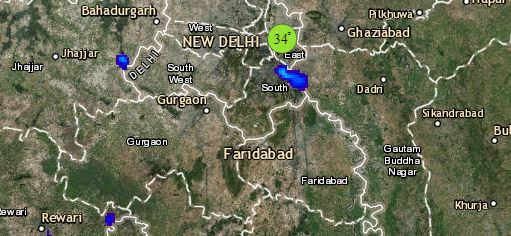
Isolated rainfall is also a possibility over the foothills of Punjab, Haryana and West Uttar Pradesh. The national territory, Delhi would battle heat wave, mercury soaring beyond 44-degree mark. While, dust storm activities accompanied with light rain activities might occur at few places of West and Northwest Rajasthan like Sri Ganganagar, Hanumangarh, Jaisalmer, Bikaner and Churu.

Click the image below to see the live lightning and thunderstorm across IndiaRain in India

While in Central India, with unabated hot northwesterly winds, heat wave conditions would persist at few places of Madhya Pradesh, Vidarbha and isolated places of East Rajasthan and Gujarat.

Heading towards East and Northeast, a Cyclonic Circulation is seen over South Assam and adjoining parts. A feeble trough is extending from Northeast Bihar to West Bengal. Therefore, we expect light rain and thundershowers at few places of Sub Himalayan West Bengal and Sikkim and at one or two places of Arunachal Pradesh, Assam and Meghalaya. Whereas, weather of Bihar, Jharkhand, Odisha and Gangetic West Bengal would be dry.

Any information taken from here should be credited to skymetweather.com

 

Divine Dalhousie, the snowy colonial part of Himachal Pradesh

Dalhousie WeatherThe astonishing mountain views and the pine clad valleys are what make Dalhousie one of the most beautiful hill stations in Himachal Pradesh. Dalhousie was founded by the British viceroy Lord Dalhousie, hence the name. To flee away from the plain heat, not only families but honeymooners also flock to the divine Dalhousie.

While Shimla remains touristy, Dalhousie continues to maintain its colonial charm. And if you are looking for some Disney’s Frozen moments, Dalhousie is your best bet in the winters. So much so that the hindi make of O Henry’s last leaf was shot in Dalhousie.

Dalhousie Weather

Let us tell you when is the best time to Visit Dalhousie

Summer (Apr-Jun): Dalhousie is beautiful in all seasons, however if you want to get away from the heat, Dalhousie is a place you must visit. Days are pleasant with temperatures settling well below 30 degrees Celsius. Evenings get slightly cool, where you can relax with a hot cup of tea. If you want to see the lush green mountains, summer is the time when all the snow has melted.

Monsoon (Jul-Sep): Monsoon is also not a bad time to visit the delightful Dalhousie as it does not rain cats and dogs and the temperatures also remain in the comfortable range. Just make sure you check the weather and it does not turn out to be a couple of rainy days.

Dalhousie Weather

Winter (Oct-Feb): If you want some snow show, Dalhousie is beautiful during the winter season. Visit around and after December and you will be treated with white blankets of snow. Make sure to pack a few extra layers as the temperatures even end up reaching zero degrees at times as well.

Things to do in Dalhousie, Places to Visit in Dalhousie

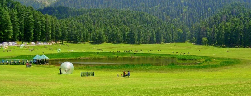
Make sure you visit Khajjar, which is also known as the Mini Switzerland, a very small town close to Dalhousie.

Satdhara falls is another attraction that you must not miss while on your trip to Dalhousie.

Situated 2 km from Dalhousie, Panjpulla is also a must visit. You can trek to this area and click some pictures on the way as well.

The Kalatop wildlife sanctuary is another place you must visit if you want to add some wildlife spice to your trip.

Other attractions include the Sach Pass, Ganji Pahadi, St. Johns Church, and Daikund Peak

Image Credit: Zostel, Riyareviews.blogspot, Thrillophilia

[Hindi] अल नीनो लगातार मजबूत स्थिति में, मॉनसून 2019 पर रहेगी इसकी छाया

बीते एक सप्ताह में अल नीनो की स्थिति में कोई बदलाव देखने को नहीं मिला, क्योंकि भूमध्य रेखा के पास समूचे प्रशांत महासागर क्षेत्र में समुद्र की सतह का तापमान लगातार औसत से ऊपर बना रहा। हालांकि इस दौरान 3.4 नीनो इंडेक्स में मामूली बदलाव देखने को मिला, जबकि अन्य सभी जगह पहले की स्थितियां बरकरार नहीं। स्काईमेट के मौसम विशेषज्ञों के अनुसार नीनो इंडेक्स 3.4 में मामूली गिरावट दर्ज हुई, उसके बावजूद भी यह थ्रेशहोल्ड वैल्यू 0.5 डिग्री से काफी ऊपर बना रहा।

नीनो 3.4 क्षेत्र में समुद्र की सतह का 3 महीनों जनवरी-फरवरी-मार्च का औसत तापमान यानी ओ एन आई ओशनिक नीनों इंडेक्स 0.8 डिग्री सेल्सियस बना रहा। उसके बाद के दो त्रैमासिक चरणों यानी फरवरी-मार्च-अप्रैल और मार्च-अप्रैल-मई में भी तापमान पिछले स्तर पर ही रहने की संभावना है।

Also Read In English: EL NINO LOOMS LARGE, MONSOON 2019 TO REMAIN UNDER SHADOW

इसके अलावा भी अन्य क्षेत्रों में समुद्र की सतह का तापमान पिछले 7 महीनों में मजबूत स्थिति में ही रहा। इसमें अक्टूबर महीने में तापमान चरम पर था, जो दिसंबर में गिरा और अपने न्यूनतम स्तर पर रिकॉर्ड किया गया। तापमान में एक बार फिर से वृद्धि का रुझान देखने को मिल रहा है और यह बढ़ते हुए जनवरी एवं फरवरी महीनों में थ्रेशहोल्ड वैल्यू को पार कर गया। अब फिर से हम देख रहे हैं कि इसमें हल्की गिरावट दर्ज की गई है।

मौसम विशेषज्ञों के अनुसार तापमान में इस उतार-चढ़ाव के लिए अनेक पहलू जिम्मेदार हैं जो निम्नलिखित हैं:

  1. ओशन करंट एक डायनेमिक माध्यम है, जो समय-समय पर बदलता रहता है।
  2. हवा का दबाव और हवा की चाल भी समुद्र की सतह के तापमान को प्रभावित करने वाली एक अहम कारक है, जो निरंतर अल नीनो के अनुरूप बनी हुई है।
  3. मॉडन जूलियन ओषिलेशन (एम जे ओ) भी तापमान में कुछ बदलाव लेकर आता है। हालांकि इसकी प्रकृति स्थाई नहीं होती है। इसके शुरुआती चरण में समुद्र की सतह का पानी गर्म हो जाता है, जबकि इसके निकलते समय पानी अपेक्षाकृत ठंडा हो जाता है। एमजेओ हाल ही में प्रशांत महासागर से गुजरा है, जो तापमान में हाल ही में आई गिरावट का प्रमुख कारण हो सकता है।

मॉनसून 2019 पर पड़ेगा प्रभाव

मॉनसून का समय धीरे-धीरे नजदीक आता जा रहा है, लेकिन प्रशांत महासागर लगातार सभी क्षेत्रों में उत्तरोत्तर गर्म बना हुआ है, और जैसा कि पहले बताया गया था कि दक्षिण पश्चिम मानसून 2019 पर बढ़ते तापमान का प्रमुखता से प्रभाव पड़ेगा, खासकर मॉनसून के शुरुआती महीने जून में इसका सबसे बुरा असर देखने को मिल सकता है।

इसको ध्यान में रखते हुए स्काईमेट ने अपने मॉनसून पूर्वानुमान में जून में अकाल पड़ने की आशंका जताई है। स्काइमेट के अनुसार संभावना है कि जून में 77% बारिश दर्ज की जाएगी। लेकिन चूँकि यह अल नीनो की विदाई का वर्ष होगा ऐसे में जुलाई में स्थितियां कुछ सुधर सकती हैं और 91% मानसून वर्षा हो सकती है। इसके बावजूद जुलाई भी सामान्य से कम वर्षा के साथ विदा होगा।

मॉनसून के 4 महीनों में अगस्त एकमात्र ऐसा महीना होगा जिससे कुछ बेहतर की उम्मीद की जा रही है। अगस्त में सामान्य से कुछ बेहतर 102% बारिश की संभावना है। सितंबर में भी कमोबेश हाल ऐसा ही रहेगा और उम्मीद 99% बारिश की है।

हालांकि मॉनसून के कमजोर होने का एकमात्र कारण अल नीनो ही नहीं होगा, बल्कि हिंद महासागर से गुजर रहा मॉडन जूलियन ओषिलेशन भी जिम्मेदार होगा जिससे मॉनसून पर असर पड़ेगा। इसके अलावा इंडियन ओशन डाइपोल आईओडी भी मॉनसून के शुरुआती दो महीनों में तटस्थ स्थिति में रहेगा जबकि आखिरी दो महीनों में सकारात्मक स्थिति में पहुंचेगा।

यह दोनों पहलू भी मॉनसून को बेहतर करने में अगस्त और सितंबर में खासकर अपनी भूमिका निभाएंगे। हालांकि इन दो महीनों में जो बारिश होगी वह शुरुआती दो महीनों में बारिश की रह गई कमी की भरपाई करने में नाकाम होगी। परिणाम समग्रता में मॉनसून 2019 कमजोर रहेगा और दीर्घावधि औसत के मुक़ाबले 93% बारिश इस बार देखने को मिलेगी।

Image Credit: The Indian Express

कृपया ध्यान दें: स्काइमेट की वेबसाइट पर उपलब्ध किसी भी सूचना या लेख को प्रसारित या प्रकाशित करने पर साभार: skymetweather.com अवश्य लिखें।


25 अप्रैल का मौसम पूर्वानुमान: पंजाब, हरियाणा व उत्तर प्रदेश में बारिश, दिल्ली में हीट वेव

नीचे दक्षिण भारत में, एक निम्न दबाव का क्षेत्र, दक्षिणपूर्वी बंगाल की खाड़ी पर बना हुआ है जो अगले दो दिनों में, पश्चिमी-उत्तरपश्चिमी दिशा में तमिलनाडु की ओर आगे बढ़ जाएगा।

इस बीच, एक ट्रफ रेखा कोमोरिन क्षेत्र से केरल होते हुए उत्तर आंतरिक कर्नाटक तक जा रही है। इसके चलते, केरल और दक्षिण आंतरिक कर्नाटक और आंतरिक तमिलनाडु में कुछ जगह बारिश और गरज बौछारें होने का आनुमान है।

उत्तर भारत की बात करें, तो एक ताजा पश्चिमी विक्षोभ उत्तरी जम्मु-कश्मीर पर देखा जा सकता है। इससे प्रेरित चक्रवाती हवाओं का क्षेत्र उत्तर-पश्चिमी राजस्थान और साथ लगे क्षेत्रों पर बना हुआ है। इसके चलते, जम्मु-कश्मीर, हिमाचल प्रदेश और उत्तराखंड के कुछ क्षेत्रों पर बारिश और गरज-बौछारें हो सकती हैं।

पंजाब, हरियाणा और पश्चिमी उत्तर प्रदेश में एक-दो जगह बारिश होने की संभावना है। देश की राजधानी दिल्ली में हीट वेव की स्थिति बनी रहेगी। यहाँ पारा 44 डिग्री के पार भी मापा जा सकता है। वहीं, पश्चिमी और उत्तर-पश्चिमी राजस्थान जैसे श्री गंगानगर, हनुमानगढ़, जैसलमेर, बीकानेर और चुरू में हल्की बारिश के साथ धूल भरी आँधी चल सकती है।

वहीं, मध्य भारत की बात करें तो, गरम उत्तर-पश्चिमी हवाएँ बहने के कारण यहाँ मध्य प्रदेश, विदर्भ, पूर्वी राजस्थान और गुजरात में हीट वेव की स्थिति बनी रहेगी।

Click the image below to see the live lightning and thunderstorm across IndiaRain in India 

पूर्वी और उत्तरपूरवी भारत की बात करें, तो एक चक्रवाती हवाओं का क्षेत्र दक्षिणी असम और साथ लगे क्षेत्रों पर देखा जा सकता है। एक कमजोर ट्रफ रेखा उत्तर-पश्चिमी बिहार से पश्चिम बंगाल की ओर जा रही है। इसके चलते, उप-हिमालयी पश्चिम बंगाल, सिक्किम, असम और मेघालय में एक दो जगह हल्की बारिश और गरज-बौछारें होने का अनुमान है। वहीं, बिहार, झारखंड, ओड़ीशा और गंगीय पश्चिम बंगाल में मौसम शुष्क ही रहेगा।

Any information taken from here should be credited to skymetweather.com
 

Agriculture in Chhattisgarh being hit by Climate Change

Climate Change and Chhattisgarh

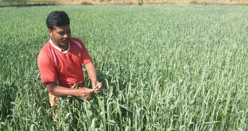
In the early days, rainfall pattern used to be different with more number of rainy days and longer duration of rainfall. The intensity also used to be less, but such pattern of rainfall was beneficial for crops as the water used to get absorbed in the soil, which helped in replenishing the depleting water.

However, climate change now has adversely affected the rainfall pattern. Rainy days have now shrunk, and the amount of ground water has also decreased. Although the frequency of intense showers has risen its duration has become shorter. This pattern is not beneficial for the farmers as short intense bout of rain -two to three hours- doesn’t get absorbed by the soil. Such rains lead to intense flash flooding and don’t benefit the crops.

The farmers of Chhattisgarh are not well equipped with technology. They are largely dependent on  monsoon rains for irrigation purpose. Natural irrigation facilities like rivers, water bodies are also rare in the state due to its terrain.

Therefore, there is a need to discuss latest cropping patterns and hybrid methods with the farmers of Chhattisgarh as they are still stuck with traditional farming methods. Due to less rainfall, paddy crop that is grown in the area is majorly hit as it requires more water. Farmers need to be educated about weather and climate resilient farming methods and techniques. It seems like all these new variety of seeds clubbed with climate resilient farming methods would help improving the farming methods as well.

The present government has taken steps to directly help farmers by building capacity in the form of the ‘Narwa, Garuwa, Ghurwa, and Baadi’ scheme that is aimed at developing micro-watershed structures for groundwater recharge and increasing surface water irrigation, livestock development, promoting vermicomposting and developing kitchen gardens. This would help develop climate resilience and encourage sustainable agriculture. Its implementation at the field-level, though, is yet to be evaluated.

Image Credit: Nikkei Asian Review

Please Note: Any information picked from here must be attributed to skymetweather.com


latest news