Starting with South India, a Trough is extending from Southwest Bay of Bengal to West-central Bay of Bengal in the lower levels. Due to the presence of this system, light to moderate rains and thundershower will be affecting Tamil Nadu, Kerala, South Interior Karnataka and a few regions of Andhra Pradesh. There are slight chances of rain in Chennai and Bengaluru. Hyderabad will remain dry.
Talking about East and Northeast India, here a Cyclonic Circulation lies over eastern parts of Assam and adjoining regions. Due to the presence of this system, light to moderate rains and thundershowers are likely at some places over Arunachal Pradesh, upper Assam, and Nagaland. Other parts of Northeast India will remain dry with a partly cloudy sky. One or two places might see shallow fog in the morning hours. Eastern states like Bihar, West Bengal, and Odisha as well as the city of Kolkata are likely to remain dry as well.
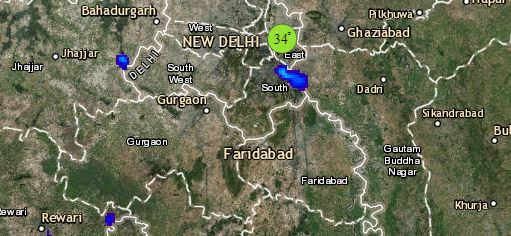
Click the image below to see the live lightning and thunderstorm across India
Coming onto North India, a feeble Western Disturbance as an upper air Cyclonic Circulation lies over eastern parts of Ladakh which will be moving further away. Due to this system, higher reaches over Ladakh and adjoining parts of Jammu and Kashmir might be affected by light rains and snow. On the other hand, dry northwesterly winds are prevailing over Northwest plains of the country. Hence, dry weather is likely to continue over Punjab, Haryana and Rajasthan. Delhi might wake up to shallow fog in the morning.
Lastly in Central India, which will remain dry as Northwesterly dry winds are prevailing. Slight fall in night temperatures are likely. Day will remain slightly warm with a clear sky. Mumbai might also see dry and very warm weather.
Any information taken from here should be credited to skymetweather.com


