Up in the North, a fresh Western Disturbance is over North Pakistan and adjoining Jammu and Kashmir. Its induced Cyclonic Circulation is over Central Pakistan and adjoining parts of Punjab. Now, rain intensity would increase over Jammu and Kashmir, Himachal Pradesh and Uttarakhand with hailstorm activities over parts of Himachal and Uttarakhand.
Over the plains, scattered rain and thundershowers would occur over Punjab, Haryana, parts of Delhi, West Uttar Pradesh and North Rajasthan. The experts have to say that due to this temperature might remain below normal over most places in the Northwest Plains, bringing relief from heat.
In East and Northeast India, a Cyclonic Circulation is over South Bihar and adjoining areas. Another Cyclonic Circulation is over East Assam. Due to moisture feed coming from the Bay of Bengal, moderate rains with one or two heavy spells would continue over Northeast India with scattered rains over Sub Himalayan West Bengal and Sikkim. However, weather of East Uttar Pradesh, Bihar, Jharkhand and Gangetic West Bengal will be almost dry. Also, temperatures are not expected to increase over East India for at least next two days.
While in Central India, due to continuous humid winds coming from the Arabian Sea, temperatures will not increase. Hence, heat wave conditions will not make a comeback over Rajasthan, Gujarat and West Madhya Pradesh anytime soon. Weather in Maharashtra inclusive of Mumbai would remain dry. Whereas, heat wave conditions might still persist in isolated pockets of Vidarbha.
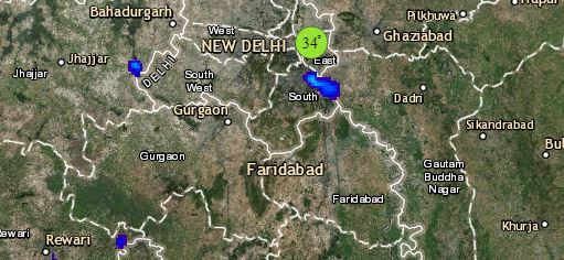
Click the image below to see the live lightning and thunderstorm across India
Lastly in South India, a north-south trough is extending from Jharkhand to Interior Tamil Nadu across Telangana and Rayalaseema. Hence, scattered pre-Monsoon rain and thundershowers would continue over interior parts of Tamil Nadu, parts of Kerala and one or two places of South Interior Karnataka and Andhra Pradesh. While, Telangana and North Interior Karnataka will continue to witness dry and hot weather conditions.
Any information taken from here should be credited to skymetweather.com


