The Northern Limit of Monsoon (NLM) passes through Ratnagiri, Solapur, Adilabad, Brahmapuri, Pendra, Varanasi, Gorakhpur. Conditions are becoming favourable for further advance of Southwest Monsoon into remaining parts of Central Arabian Sea, Konkan, Madhya Maharashtra, Marathwada, Vidarbha and Chhattisgarh, some parts of North Arabian Sea, south Gujarat and Madhya Pradesh and some more parts of east Uttar Pradesh during next two to three days.
The Low-Pressure Area has weakened and presently a trough is running from Northwest Rajasthan to Madhya Maharashtra across Rajasthan and West Madhya Pradesh. Thus, there are chances of rainfall activity to enhance over Southwest Madhya Pradesh, North Madhya Maharashtra, Marathwada and eastern parts of Gujarat. Lightning is a possibility at some places of South Gujarat, rest Maharashtra except North Konkan, East and South Madhya Pradesh. While, rainfall activity is likely to recede from Chhattisgarh due to absence of any significant weather system close to the area.
Down South, an off-shore trough is extending from South Karnataka to Kerala. Rainfall activity with moderate to heavy rains would continue to prevail over Coastal Karnataka, Kerala and isolated parts of South Konkan including Goa. Moderate spells are likely over, extreme North Karnataka, South Karnataka, parts of North Telangana. While, scattered light rains will be seen over rest parts of South Peninsula and subdued activities over East coastal Tamil Nadu including Chennai.
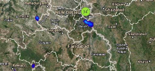
Click the image below to see the live lightning and thunderstorm across India
In Northeast India, light to moderate spells at many places will be seen inclusive of Sub-Himalayan West Bengal and Sikkim. Rainfall activity is likely to decrease over Gangetic West Bengal, most parts of Bihar and Jharkhand. With this, temperatures are expected to rise over these regions. Along with this, Odisha and East Uttar Pradesh would receive scattered light to moderate rainfall activities at some places while good rains are likely to be seen over Northwest Bihar.
Finally, up in the North, a Cyclonic Circulation is over Central Pakistan and adjoining Rajasthan. A feeble Western Disturbance as an upper air system is moving across Jammu and Kashmir. With this, scattered light rain and thundershowers will be seen over the North Hills with isolated moderate spells in pockets. Punjab, Haryana, Northwest Uttar Pradesh and Rajasthan are likely to witness dust storm and thundershower activities. With the blowing of easterlies over these regions, temperatures are likely to drop over the region. Delhi would witness uneasy and humid weather conditions with chances of rain and thundershowers at few places during late afternoon or the evening hours.
Any information taken from here should be credited to skymetweather.com


