To begin with South India – Cyclonic storm Pabuk now lies as a deep-depression over East central Bay of Bengal off Andman Sea. Further, this system would be moving northeastwards and weakening. However, due to this system, moderate rains with few heavy spells and strong winds are likely over Andaman and Nicobar Islands. In fact, coastal parts of Tamil Nadu may also receive isolated light rains. Rest all parts of south peninsula will remain dry.
Moving to North India, due to the Western Disturbance over East Jammu and Kashmir, light to moderate rain and snow will occur over eastern parts of Jammu and Kashmir, Himachal Pradesh and Uttarakhand. Moreover, due to the above Western Disturbance, cold northwestly winds will be setting over the northwestern plains. Therefore, significant fall in temperatures along with moderate to dense fog will occur over Punjab, Haryana, Delhi and Rajasthan.
In East/Northeast India, due to the induced cyclonic circulation over East Uttar Pradesh and adjoining Bihar, light rains are possible over North Uttar Pradesh, Bihar and Sub-Himalayan West Bengal. In fact, due to approaching of Western Disturbance and cyclonic storm, temperatures would be increasing slightly over the eastern and northeastern states. Hence, moderate to dense fog will also continue. Isolated places over Arunachal Pradesh and Nagaland may experience rain, due to the cyclonic circulation over East Bangladesh.
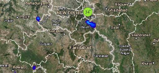
Click the image below to see the live lightning and thunderstorm across India
Lastly in Central India, now cold northwesterly winds will affect over most parts of Central India. Hence temperatures will drop over entire central India. Though weather will remain mostly dry with clear sky.
Any information taken from here should be credited to skymetweather.com


