To Begin with North India, a Western Disturbance is over Jammu and Kashmir and its induced Cyclonic Circulation is over Central Pakistan and adjoining Indian region. Thus, widespread rain and snow are likely over Jammu and Kashmir, Himachal Pradesh and Uttarakhand with possibility of one or two heavy spells. Parts of Uttarakhand might witness hailstorm.
Scattered rains are expected to commence over Punjab, Haryana, Delhi and North Rajasthan by the evening/night of January 5. Day temperatures will then drop by 3-4 degrees over the hills and adjoining areas of Punjab and Haryana.
In Central India, an Anti-Cyclone is seen over South Chhattisgarh and adjoining areas. Minimum temperatures may increase further over Rajasthan, Gujarat, Maharashtra and Madhya Pradesh. Despite of increase in the minimums, they will remain marginally below normal. Cold Wave conditions are expected to abate completely now.
Heading to East/Northeast India, a Cyclonic Circulation is seen over Assam and its adjoining areas. Isolated rain and snow may occur over Arunachal Pradesh and light rains can be seen over Assam. Rest northeastern states will remain dry. Similar dry weather conditions will be seen in eastern states of the country. Isolated Cold Wave conditions prevalent over Bihar and Odisha are all set to abate due to rise in minimums.
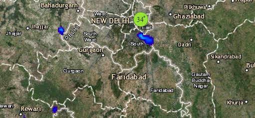
Click the image below to see the live lightning and thunderstorm across India
The South Peninsula will witness dry weather. Due to easterly winds over Andhra Pradesh, Telangana and Tamil Nadu, minimums are expected to rise marginally. Cold Wave conditions are expected over Kerala as well with minimums being below normal by three to five degrees.
Due to the effect of Cyclone Pabuk, light rains may commence over parts of Andaman and Nicobar Islands. However, there is no threat to the Indian Mainland because of this.
Any information taken from here should be credited to skymetweather.com
