The Western Disturbance is seen over North Pakistan and adjoining areas. The axis of Monsoon trough is also seen passing through Punjab, Haryana, West Uttar Pradesh, Central Madhya Pradesh, Chhattisgarh, Odisha and towards east central Bay of Bengal.
Therefore, due to inactive trough the weather over Punjab, Haryana, West Uttar Pradesh, West Rajasthan and many parts of Jammu and Kashmir is expected to remain mainly dry. Light rain may occur in few parts of Himachal Pradesh and Uttarakhand.
A cyclonic circulation can be marked over Southeast Bangladesh and adjoining Tripura. Hence, Nagaland, Manipur, Mizoram and Tripura will settle with good rains. However, the rainfall activities over remaining parts of northeastern states are expected to reduce marginally. Due to these weather systems, scattered light rains are possible over parts of Bihar, Jharkhand and Gangetic West Bengal. Meanwhile, Odisha may observe scattered light rains along with a few spells of moderate showers.
[yuzo_related]
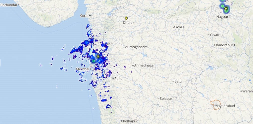
A cyclonic circulation is seen over South Madhya Pradesh and adjoining Vidarbha region. With this, light to moderate rains at some places are possible over Chhattisgarh, East and Southwest Madhya Pradesh. Whereas scattered light rains are expected over Vidarbha, North Madhya Maharashtra, Konkan and South Gujarat Coast.
Live status of Lightning and thunder

A cyclonic circulation is over North Karnataka Coast and Arabian Sea. A trough is also seen extending from South Gujarat up to Kerala. Due to this, scattered light to moderate rain are likely over Karnataka, Rayalaseema, Andhra Pradesh and Telangana.
Further, rains are expected to pick up pace over North Tamil Nadu Coast including Chennai and some parts of West Tamil Nadu.
Please Note: Any information picked from here should be attributed to skymetweather.com


