Presently, the rainfall activity is confined to Southern Peninsula in wake of multiple active weather systems on both sides.
The depression in east central Arabian Sea is likely to become a cyclone shortly now.This system is expected to move in west-northwesterly direction towards Oman Coast. From this system extends a trough up to Kerala and thus, Kerala and Coastal Karnataka would record light to moderate showers while Konkan & Goa and Madhya Maharashtra will see light rains.
Meanwhile the well-marked low over Southeast Bay of Bengal is likely to induce a depression soon. This system is expected to travel in northwesterly direction towards Odisha Coast giving moderate to heavy showers over Andaman & Nicobar Islands. From this system extends a trough up to Southwest Bay that would cause light to moderate showers over Tamil Nadu including Chennai.
Moving onto East/Northeast, the cyclonic circulation over Central Assam would cause scattered light rains over Assam, Meghalaya and Arunachal Pradesh. Meanwhile, the eastern states and the remaining Northeast India would remain dry.
Up North, the fresh Western Disturbance over North Pakistan and adjoining Jammu and Kashmir would give light rains over North Jammu and Kashmir and Himachal Pradesh. The higher reaches of Uttarakhand will too see some rains and snowfall.
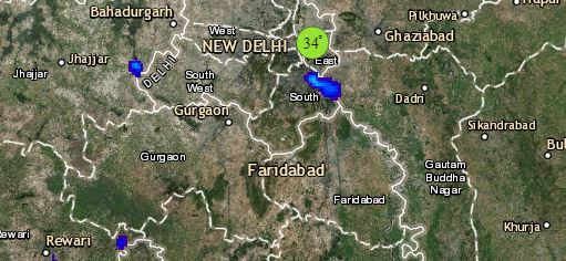
Click the image below to see the live lightning and thunderstorm across India
The induced cyclonic circulation lies over Central Pakistan and adjoining Rajasthan, due to which, North Rajasthan may witness dust storm and light rain in parts with strong winds.
Else, the weather over northwestern plains including Delhi would remain dry and warm.
Finally in Central India, the anti-cyclone over Madhya Pradesh and adjoining Rajasthan would keep the weather dry and warm over the entire region. Kutch and West Rajasthan will bear the most brunt with hot weather.
Any information taken from here should be credited to skymetweather.com


