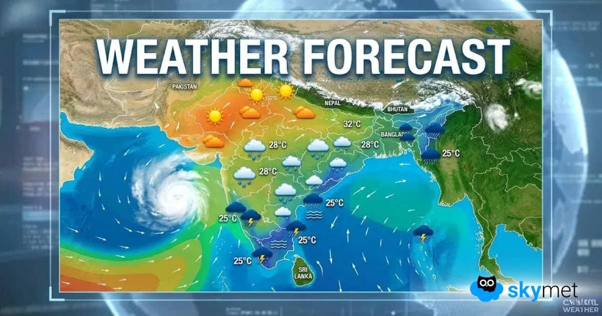
Beginning with North India, the persisting Western Disturbance over Jammu and Kashmir will continue to give scattered to isolated rain over the state along with Himachal Pradesh. Higher reaches may also witness some snowfall activity.
However, this system will not have any impact over northwestern plains and dry and hot winds will prevail over the region. As a result, temperatures will continue to settle significantly above normal by 3 to 5 degrees. These hot winds are also reaching up to Central India. Places such as Gujarat, Madhya Pradesh, Maharashtra and Telangana are reeling under heatwave conditions.
Moving onto East and Northeast India, a cyclonic circulation is over Northeast Bihar and adjoining West Bengal. A trough is also extending from this system up to Arunachal Pradesh. Another trough is seen extending from North Bihar up to North Coastal Odisha across West Bengal.
In wake of these weather systems, isolated light rain and thunderstorms are likely over Northeast Bihar, adjoining Jharkhand and West Bengal. Lightning strikes may also occur. Meanwhile, northeastern states will continue with fairly widespread rain and thundershowers, with isolated heavy rains over Arunachal Pradesh, Meghalaya and East Assam.
Down South, a cyclonic circulation is marked over North Interior Karnataka and adjoining areas. A trough is extending from Coastal Kerala up to this system across Coastal Karnataka. These weather systems will give isolated rain activity over Kerala and Andaman and Nicobar Islands.
Rest of South India will continue with warm and dry weather.
Delhi and Lucknow will both witness day maximum around 38 degrees, while Patna will see maximum temperature of 35 degrees.
Ahmedabad will be quite hot with maximum temperatures around 42 degrees, while Mumbai and Chennai will settle with 35 degrees.
Please Note: Any information picked from here should be attributed to skymetweather.com


