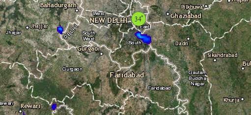
Beginning with North India, where a Western Disturbance is over Jammu and Kashmir. Its induced Cyclonic Circulation is over South Punjab. Widespread rains and snow are likely to continue over Jammu and Kashmir, Ladakh, Himachal Pradesh and Uttarakhand. Meanwhile, moderate to heavy rains are also excepted over northern districts Punjab, Haryana and West Uttar Pradesh. Meanwhile, Delhi NCR and North Rajasthan will remain mainly dry. Isolated thundery activity cannot be ruled out from here as well.
Talking about East and Northeast India, where a Trough is extending up to East Uttar Pradesh. A Confluence Zone is also seen over East and Central parts of the country. Therefore, rains will increase by the afternoon of March 13 over East Uttar Pradesh, Bihar and Jharkhand. Scattered rains are possible over West Bengal and Odisha. Strong winds and lightning strikes are also possible over Jharkhand and southern districts of Bihar. Isolated rains are possible over East Assam and Arunachal Pradesh. A warm humid day ahead for Kolkata.
Click the image below to see the live lightning and thunderstorm across India
Talking about Central India, where an anti-cyclone is over Northwest Bay of Bengal. A few moderate spells are possible over North Chhattisgarh and adjoining parts of East Madhya Pradesh. One or two places in Vidarbha will also see good rains. Weather of South Rajasthan, Gujarat, West Madhya Pradesh and rest parts of Maharashtra will remain dry. Mumbai will also see a warm and humid day.
Lastly in South India, where no significant weather activity is likely over South Peninsula. Isolated rains are possible over Kerala and Lakshadweep Islands. Weather of Andhra Pradesh, Telangana, Karnataka and Tamil Nadu will remain dry. Warm and humid weather is forecast for Chennai, Bengaluru and Hyderabad.
Any information taken from here should be credited to skymetweather.com
