The Western Disturbance is currently lying over Ladakh. Weather activities will now reduce in Jammu and Kashmir. Despite this, scattered rain and snow are expected in Jammu and Kashmir, Himachal Pradesh and Uttrakhand. The maximums will remain significantly below normal over the area. In the plains, the weather activities will also reduce. However, isolated activity towards morning and afternoon hours may occur in Punjab, Haryana and in parts of West Uttar Pradesh.
Coming to Central India due to the formation of a convergence zone which is moving across Maharashtra and Madhya Pradesh, we expect rain and thundershower at many places in East Madhya Pradesh, Chhattisgarh, and Vidarbha region in Maharashtra. While isolated rain and hailstorm with strong gusty winds are likely in West Madhya Pradesh and North Maharashtra. The weather of Gujarat will remain dry and warm.
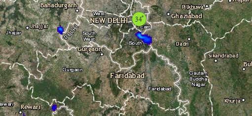
Click the image below to see the live lightning and thunderstorm across India
In the East and Northeast India where a Cyclonic Circulation is over the central parts of Bihar. While another Cyclonic Circulation is over the southern parts of Northeastern states. Due to this, we expect rains and hailstorm at many places in Bihar, Jharkhand, Gangetic West Bengal, and Odisha. In the Northeast, rains will intensity over Arunachal Pradesh, Assam, Nagaland, Manipur with a few moderate spells in East Assam and Arunachal Pradesh.
Down South a trough is extending from the Kerala coast up to the central parts of the country. In the wake of this system, we expect rain and thundershowers to continue at some places in Kerala, and Coastal and Interior Karnataka. Also, due to the presence of a convergence zone, the northern parts of Telangana will receive scattered rain and thundershowers. The weather of rest other parts of South India will remain dry.
Any information taken from here should be credited to skymetweather.com


